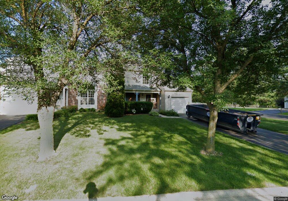
669 Sandwedge Place Gurnee, IL 60031
Estimated Value: $308,000 - $327,000
3
Beds
2
Baths
1,510
Sq Ft
$210/Sq Ft
Est. Value
About This Home
This home is located at 669 Sandwedge Place, Gurnee, IL 60031 and is currently estimated at $316,905, approximately $209 per square foot. 669 Sandwedge Place is a home located in Lake County with nearby schools including Woodland Primary School, Woodland Elementary School, and Woodland Intermediate School.
Ownership History
Date
Name
Owned For
Owner Type
Purchase Details
Closed on
Jul 29, 2011
Sold by
Mcdonald Catherine and Smith Catherine
Bought by
Rosso Christopher J and Rosso Elizabeth
Current Estimated Value
Home Financials for this Owner
Home Financials are based on the most recent Mortgage that was taken out on this home.
Original Mortgage
$167,639
Outstanding Balance
$115,855
Interest Rate
4.53%
Mortgage Type
FHA
Estimated Equity
$201,050
Purchase Details
Closed on
Feb 18, 2005
Sold by
Mcconnell Carol R
Bought by
Smith Catherine
Home Financials for this Owner
Home Financials are based on the most recent Mortgage that was taken out on this home.
Original Mortgage
$100,000
Interest Rate
5.8%
Mortgage Type
Unknown
Purchase Details
Closed on
Jul 21, 2004
Sold by
Leibfried Scott and Liebfried Christina
Bought by
Carol R Mcconnell Revocable Trust
Purchase Details
Closed on
May 23, 2002
Sold by
Pomerantz Jon and Pomerantz April
Bought by
Leibfried Scott and Leibfried Christina
Home Financials for this Owner
Home Financials are based on the most recent Mortgage that was taken out on this home.
Original Mortgage
$136,400
Interest Rate
6.62%
Purchase Details
Closed on
Feb 17, 1999
Sold by
Lomauro Charles A and Mcadoo Christine
Bought by
Pomerantz Jon and Pomerantz April
Home Financials for this Owner
Home Financials are based on the most recent Mortgage that was taken out on this home.
Original Mortgage
$130,800
Interest Rate
6.92%
Purchase Details
Closed on
Jun 30, 1997
Sold by
Flynn Timothy J and Flynn Mary Ro S
Bought by
Lomauro Charles A and Mcadoo Christine
Home Financials for this Owner
Home Financials are based on the most recent Mortgage that was taken out on this home.
Original Mortgage
$122,670
Interest Rate
5.5%
Purchase Details
Closed on
Mar 26, 1996
Sold by
Napiorkowski John E and Napiorkowski Pamela A
Bought by
Flynn Timothy J and Flynn Maryro S
Home Financials for this Owner
Home Financials are based on the most recent Mortgage that was taken out on this home.
Original Mortgage
$119,400
Interest Rate
6.98%
Mortgage Type
Balloon
Create a Home Valuation Report for This Property
The Home Valuation Report is an in-depth analysis detailing your home's value as well as a comparison with similar homes in the area
Home Values in the Area
Average Home Value in this Area
Purchase History
| Date | Buyer | Sale Price | Title Company |
|---|---|---|---|
| Rosso Christopher J | $172,000 | First American Title | |
| Smith Catherine | $199,000 | First American Title | |
| Carol R Mcconnell Revocable Trust | $199,000 | -- | |
| Leibfried Scott | $170,500 | -- | |
| Pomerantz Jon | $138,000 | Chicago Title Insurance Co | |
| Lomauro Charles A | $136,500 | Chicago Title Insurance Co | |
| Flynn Timothy J | $133,000 | -- |
Source: Public Records
Mortgage History
| Date | Status | Borrower | Loan Amount |
|---|---|---|---|
| Open | Rosso Christopher J | $167,639 | |
| Previous Owner | Smith Catherine | $100,000 | |
| Previous Owner | Leibfried Scott | $136,400 | |
| Previous Owner | Pomerantz Jon | $130,800 | |
| Previous Owner | Lomauro Charles A | $122,670 | |
| Previous Owner | Flynn Timothy J | $119,400 | |
| Closed | Leibfried Scott | $25,500 |
Source: Public Records
Tax History Compared to Growth
Tax History
| Year | Tax Paid | Tax Assessment Tax Assessment Total Assessment is a certain percentage of the fair market value that is determined by local assessors to be the total taxable value of land and additions on the property. | Land | Improvement |
|---|---|---|---|---|
| 2024 | $6,889 | $84,119 | $12,470 | $71,649 |
| 2023 | $6,420 | $78,097 | $11,577 | $66,520 |
| 2022 | $6,420 | $71,861 | $12,390 | $59,471 |
| 2021 | $5,379 | $64,465 | $11,115 | $53,350 |
| 2020 | $5,199 | $62,881 | $10,842 | $52,039 |
| 2019 | $5,047 | $61,055 | $10,527 | $50,528 |
| 2018 | $5,025 | $61,582 | $12,995 | $48,587 |
| 2017 | $4,968 | $59,818 | $12,623 | $47,195 |
| 2016 | $4,917 | $57,155 | $12,061 | $45,094 |
| 2015 | $4,775 | $54,206 | $11,439 | $42,767 |
| 2014 | $4,532 | $52,056 | $11,279 | $40,777 |
| 2012 | $4,304 | $52,454 | $11,365 | $41,089 |
Source: Public Records
Map
Nearby Homes
- 6121 Brookstone Place
- 6296 Doral Dr
- 6141 Crossland Blvd
- 6359 Doral Dr
- 690 Chandler Rd Unit 207
- 690 Chandler Rd Unit 305
- 650 Whitney Ct Unit 203
- 776 Chandler Rd
- 6161 Oakmont Ln
- 6191 Oakmont Ln
- 917 Vose Dr Unit 304
- 920 Vose Dr Unit 304
- 920 Vose Dr Unit 106
- 920 Vose Dr Unit 105
- 741 Colby Ct Unit U42
- 6402 Barn Swallow Ct
- 914 Vose Dr
- 651 White Ct
- 17119 W Prairieview Ln
- 638 Dordan Ct
- 663 Sandwedge Place
- 657 Sandwedge Place
- 6300 Eagle Ridge Dr
- 651 Sandwedge Place
- 6295 Eagle Ridge Dr
- 6298 Eagle Ridge Dr
- 645 Sandwedge Place
- 6296 Eagle Ridge Dr
- 676 Rolling Green St
- 650 Sandwedge Place
- 670 Rolling Green St
- 682 Rolling Green St
- 6291 Eagle Ridge Dr
- 664 Rolling Green St
- 688 Rolling Green St
- 6294 Eagle Ridge Dr
- 644 Sandwedge Place
- 639 Sandwedge Place
- 694 Rolling Green St
- 658 Rolling Green St