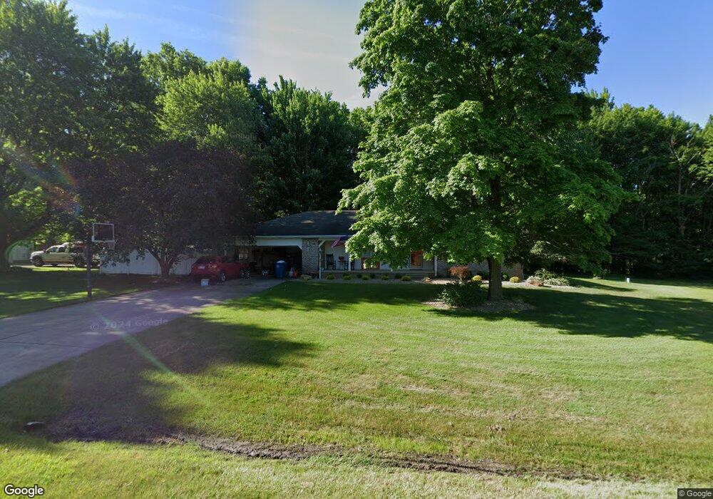
6699 Killdeer Dr Canfield, OH 44406
Estimated Value: $242,661 - $305,000
3
Beds
2
Baths
1,657
Sq Ft
$160/Sq Ft
Est. Value
About This Home
This home is located at 6699 Killdeer Dr, Canfield, OH 44406 and is currently estimated at $264,415, approximately $159 per square foot. 6699 Killdeer Dr is a home located in Mahoning County with nearby schools including Canfield Village Middle School and Canfield High School.
Ownership History
Date
Name
Owned For
Owner Type
Purchase Details
Closed on
May 12, 2021
Sold by
Buente Lynan P and Popio Lynan B
Bought by
Buente Adam V and The Buente Family Trust
Current Estimated Value
Purchase Details
Closed on
Apr 9, 2008
Sold by
Ivany Robin S and Ivany Thomas R
Bought by
Buente Lynan P
Purchase Details
Closed on
May 26, 2004
Sold by
Buchenic Mark J and Buchenic Carla M
Bought by
Patrick David E and Krivan Stephanie A
Home Financials for this Owner
Home Financials are based on the most recent Mortgage that was taken out on this home.
Original Mortgage
$144,400
Interest Rate
5.91%
Mortgage Type
Purchase Money Mortgage
Purchase Details
Closed on
Sep 9, 1997
Sold by
Oneill Paul
Bought by
Buchenic Mark J and Buchenic Carla M
Purchase Details
Closed on
May 1, 1987
Bought by
Neill Paul O and Neill Catherine
Create a Home Valuation Report for This Property
The Home Valuation Report is an in-depth analysis detailing your home's value as well as a comparison with similar homes in the area
Home Values in the Area
Average Home Value in this Area
Purchase History
| Date | Buyer | Sale Price | Title Company |
|---|---|---|---|
| Buente Adam V | -- | None Available | |
| Buente Lynan P | -- | Hunter Stevens Land Title Ag | |
| Patrick David E | $152,000 | -- | |
| Buchenic Mark J | $132,000 | -- | |
| Neill Paul O | $81,000 | -- |
Source: Public Records
Mortgage History
| Date | Status | Borrower | Loan Amount |
|---|---|---|---|
| Previous Owner | Patrick David E | $144,400 | |
| Closed | Buchenic Mark J | $0 |
Source: Public Records
Tax History
| Year | Tax Paid | Tax Assessment Tax Assessment Total Assessment is a certain percentage of the fair market value that is determined by local assessors to be the total taxable value of land and additions on the property. | Land | Improvement |
|---|---|---|---|---|
| 2025 | $2,445 | $69,630 | $17,500 | $52,130 |
| 2024 | $2,460 | $69,630 | $17,500 | $52,130 |
| 2023 | $2,809 | $69,630 | $17,500 | $52,130 |
| 2022 | $2,997 | $59,400 | $17,500 | $41,900 |
| 2021 | $2,903 | $59,400 | $17,500 | $41,900 |
| 2020 | $2,916 | $59,400 | $17,500 | $41,900 |
| 2019 | $2,951 | $53,940 | $17,500 | $36,440 |
| 2018 | $2,838 | $53,940 | $17,500 | $36,440 |
| 2017 | $2,835 | $53,940 | $17,500 | $36,440 |
| 2016 | $2,924 | $52,970 | $17,500 | $35,470 |
| 2015 | $2,859 | $52,970 | $17,500 | $35,470 |
| 2014 | $2,871 | $52,970 | $17,500 | $35,470 |
| 2013 | $2,766 | $52,970 | $17,500 | $35,470 |
Source: Public Records
Map
Nearby Homes
- 6605 Covington Cove
- 8015 Briarwood Ct Unit 6
- 24 Hunters Woods Blvd Unit D
- 8131 Leffingwell Rd
- 18 Hunters Woods Blvd Unit C
- 6020 (LOT #39) Century Blvd
- 7120 (LOT #32) S Palmyra Rd
- 7060 (LOT #29) S Palmyra Rd
- 6080 (LOT 44) Century Blvd
- 7040 (LOT #28) S Palmyra Rd
- 6090 Century Blvd
- 6025 (LOT #54) Century Blvd
- 6135 (LOT #65) Century Blvd
- 8099 W Western Reserve Rd
- 124 Wadsworth St
- 315 W Main St
- 223 Fairview Ave
- 30 Newton Square Dr Unit 3
- 30 Newton Square Dr Unit 1
- 8075 S Raccoon Rd
- 6735 Killdeer Dr
- 6700 Killdeer Dr
- 6655 Killdeer Dr
- 8240 Blue Heron Ln
- 8240 Blue Heron Ln
- 6660 Killdeer Dr
- 6750 Killdeer Dr
- 6625 Killdeer Dr
- 6624 Killdeer Dr
- 6805 Killdeer Dr
- 6804 Killdeer Dr
- 8121 Blue Heron Ln
- 6777 Killdeer Dr
- 8040 Blue Heron Ln
- 8091 Blue Heron Ln
- 8171 Blue Heron Ln
- 6901 Killdeer Dr
- 8059 Blue Heron Ln
- 6860 Killdeer Dr
- 8220 Blue Heron Ln
Your Personal Tour Guide
Ask me questions while you tour the home.