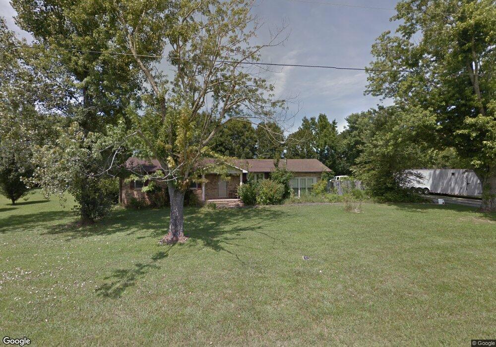
67 Baker Ln Manchester, TN 37355
Estimated Value: $226,149 - $316,000
--
Bed
2
Baths
1,650
Sq Ft
$163/Sq Ft
Est. Value
About This Home
This home is located at 67 Baker Ln, Manchester, TN 37355 and is currently estimated at $269,287, approximately $163 per square foot. 67 Baker Ln is a home located in Coffee County with nearby schools including East Coffee Elementary School, Coffee County Middle School, and Coffee County Central High School.
Ownership History
Date
Name
Owned For
Owner Type
Purchase Details
Closed on
Oct 8, 2018
Sold by
Parsley Matthew and Estate Of Michael J Parsley
Bought by
Parsley Matthew
Current Estimated Value
Purchase Details
Closed on
Feb 16, 2016
Sold by
Parsley Michael
Bought by
Smith Josephine Marie
Purchase Details
Closed on
Jul 13, 2012
Sold by
Baker Norma J
Bought by
Parsley Michael
Purchase Details
Closed on
Sep 25, 1986
Bought by
Parsley Michael J and Parsley Pamela
Create a Home Valuation Report for This Property
The Home Valuation Report is an in-depth analysis detailing your home's value as well as a comparison with similar homes in the area
Home Values in the Area
Average Home Value in this Area
Purchase History
| Date | Buyer | Sale Price | Title Company |
|---|---|---|---|
| Parsley Matthew | -- | None Available | |
| Smith Josephine Marie | $4,200 | -- | |
| Parsley Michael | $2,000 | -- | |
| Parsley Michael J | $61,000 | -- |
Source: Public Records
Tax History Compared to Growth
Tax History
| Year | Tax Paid | Tax Assessment Tax Assessment Total Assessment is a certain percentage of the fair market value that is determined by local assessors to be the total taxable value of land and additions on the property. | Land | Improvement |
|---|---|---|---|---|
| 2024 | $761 | $32,650 | $4,425 | $28,225 |
| 2023 | $761 | $32,650 | $0 | $0 |
| 2022 | $761 | $32,650 | $4,425 | $28,225 |
| 2021 | $781 | $26,625 | $4,575 | $22,050 |
| 2020 | $781 | $26,625 | $4,575 | $22,050 |
| 2019 | $781 | $26,625 | $4,575 | $22,050 |
| 2018 | $781 | $26,625 | $4,575 | $22,050 |
| 2017 | $795 | $24,375 | $5,175 | $19,200 |
| 2016 | $795 | $24,375 | $5,175 | $19,200 |
| 2015 | $822 | $25,200 | $6,000 | $19,200 |
| 2014 | $822 | $25,183 | $0 | $0 |
Source: Public Records
Map
Nearby Homes
- 670 Old McMinnville Hwy
- 1270 Taylor Rd
- 4282 McMinnville Hwy Unit 4270
- 781 Circle Dr
- 837 Circle Dr
- 3313 McMinnville Hwy
- 2635 Pete Sain Rd
- 300 Willow Brook Dr
- 499 Ridgewood Dr
- 363 Willow Brook Dr
- 2315 Ragsdale Rd
- 106 Grandview Dr
- 74 Grandview Dr
- 38 Falcon Dr
- 166 Keele Rd
- 667 Pete Sain Rd
- 0 Pete Sain Rd
- 2987 New Bushy Branch Rd
- 304 W Lynn Dr
- 0 Hickerson Rd
- 825 New Hope Rd
- 785 New Hope Rd
- 767 New Hope Rd
- 845 New Hope Rd
- 92 Baker Ln
- 889 New Hope Rd
- 818 New Hope Rd
- 776 New Hope Rd
- 721 New Hope Rd
- 830 New Hope Rd
- 705 New Hope Rd
- 665 New Hope Rd
- 196 Baker Ln
- 999 New Hope Rd
- 970 New Hope Rd
- 630 New Hope Rd
- 553 New Hope Rd
- 562 New Hope Rd
- 1133 New Hope Rd
- 404 New Hope Rd