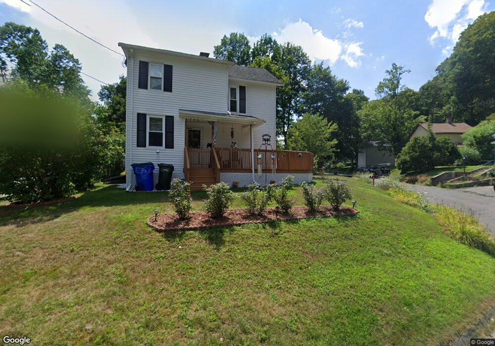
67 Bank St Winsted, CT 06098
Estimated Value: $179,000 - $247,000
2
Beds
1
Bath
1,118
Sq Ft
$201/Sq Ft
Est. Value
About This Home
This home is located at 67 Bank St, Winsted, CT 06098 and is currently estimated at $224,414, approximately $200 per square foot. 67 Bank St is a home located in Litchfield County with nearby schools including Explorations Charter School, St Anthony School, and The Gilbert School.
Create a Home Valuation Report for This Property
The Home Valuation Report is an in-depth analysis detailing your home's value as well as a comparison with similar homes in the area
Home Values in the Area
Average Home Value in this Area
Tax History Compared to Growth
Tax History
| Year | Tax Paid | Tax Assessment Tax Assessment Total Assessment is a certain percentage of the fair market value that is determined by local assessors to be the total taxable value of land and additions on the property. | Land | Improvement |
|---|---|---|---|---|
| 2025 | $3,002 | $102,900 | $28,000 | $74,900 |
| 2024 | $2,803 | $102,900 | $28,000 | $74,900 |
| 2023 | $2,716 | $102,900 | $28,000 | $74,900 |
| 2022 | $2,547 | $75,950 | $20,300 | $55,650 |
| 2021 | $2,547 | $75,950 | $20,300 | $55,650 |
| 2020 | $2,547 | $75,950 | $20,300 | $55,650 |
| 2019 | $2,547 | $75,950 | $20,300 | $55,650 |
| 2018 | $2,547 | $75,950 | $20,300 | $55,650 |
| 2017 | $2,423 | $72,240 | $20,300 | $51,940 |
| 2016 | $2,423 | $72,240 | $20,300 | $51,940 |
| 2015 | $2,362 | $72,240 | $20,300 | $51,940 |
| 2014 | $2,305 | $72,240 | $20,300 | $51,940 |
Source: Public Records
Map
Nearby Homes