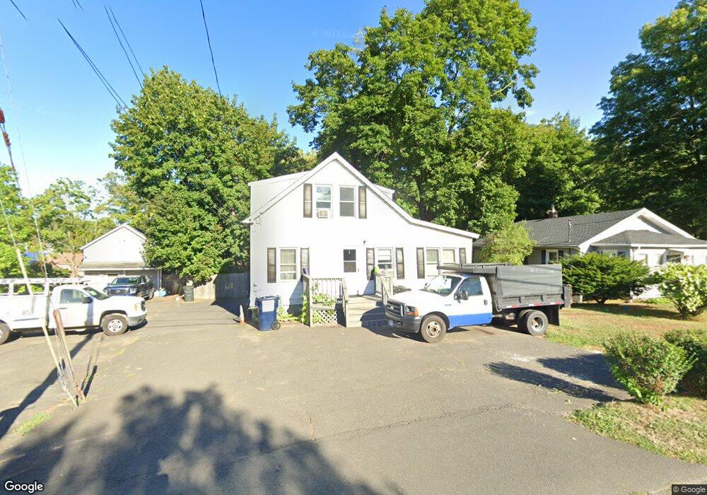
67 Beaver Brook Rd Danbury, CT 06810
Estimated Value: $369,000 - $443,000
3
Beds
1
Bath
1,220
Sq Ft
$331/Sq Ft
Est. Value
About This Home
This home is located at 67 Beaver Brook Rd, Danbury, CT 06810 and is currently estimated at $403,939, approximately $331 per square foot. 67 Beaver Brook Rd is a home located in Fairfield County with nearby schools including Stadley Rough School, Broadview Middle School, and Danbury High School.
Ownership History
Date
Name
Owned For
Owner Type
Purchase Details
Closed on
Aug 16, 1990
Sold by
Patti David
Bought by
Lostocco Ralph
Current Estimated Value
Home Financials for this Owner
Home Financials are based on the most recent Mortgage that was taken out on this home.
Original Mortgage
$100,000
Interest Rate
9.96%
Create a Home Valuation Report for This Property
The Home Valuation Report is an in-depth analysis detailing your home's value as well as a comparison with similar homes in the area
Home Values in the Area
Average Home Value in this Area
Purchase History
| Date | Buyer | Sale Price | Title Company |
|---|---|---|---|
| Lostocco Ralph | $150,000 | -- |
Source: Public Records
Mortgage History
| Date | Status | Borrower | Loan Amount |
|---|---|---|---|
| Closed | Lostocco Ralph | $100,000 |
Source: Public Records
Tax History
| Year | Tax Paid | Tax Assessment Tax Assessment Total Assessment is a certain percentage of the fair market value that is determined by local assessors to be the total taxable value of land and additions on the property. | Land | Improvement |
|---|---|---|---|---|
| 2025 | $4,363 | $174,580 | $59,010 | $115,570 |
| 2024 | $4,267 | $174,580 | $59,010 | $115,570 |
| 2023 | $4,073 | $174,580 | $59,010 | $115,570 |
| 2022 | $3,310 | $117,300 | $61,000 | $56,300 |
| 2021 | $3,237 | $117,300 | $61,000 | $56,300 |
| 2020 | $3,237 | $117,300 | $61,000 | $56,300 |
| 2019 | $3,237 | $117,300 | $61,000 | $56,300 |
| 2018 | $3,237 | $117,300 | $61,000 | $56,300 |
| 2017 | $3,019 | $104,300 | $58,200 | $46,100 |
| 2016 | $2,991 | $104,300 | $58,200 | $46,100 |
| 2015 | $2,948 | $104,300 | $58,200 | $46,100 |
| 2014 | $2,879 | $104,300 | $58,200 | $46,100 |
Source: Public Records
Map
Nearby Homes
- 16 Springside Ave
- 14 Newtown Rd Unit B6
- 14 Newtown Rd Unit A5
- 24 Valley View Dr
- 20 Oak Ridge Gate
- 18 James St
- 902 Sienna Dr Unit 902
- 1206 Eaton Ct Unit 1206
- 304 Sienna Dr Unit 304
- 166 Old Brookfield Rd Unit 7-5
- 53 Faith Ln
- 37 Faith Ln Unit 37
- 126 Triangle St Unit B43
- 126 Triangle St Unit B10
- 51 Wildman St Unit 305
- 31 Wildman St Unit 33
- 21 Crestview Ln
- 35 Taylor St
- 37 Taylor St
- 68 Virginia Ave Unit 11
- 65 Beaver Brook Rd
- 69 Beaver Brook Rd
- 71 Beaver Brook Rd
- 71 Beaver Brook Rd Unit 1
- 71 Beaver Brook Rd Unit 2
- 2 Augusta Dr
- 50 Beaver Brook Rd Unit 1
- 50 Beaver Brook Rd Unit 3
- 50 Beaver Brook Rd Unit 5
- 50 Beaver Brook Rd Unit 2
- 50 Beaver Brook Rd Unit 4
- 54 Beaver Brook Rd
- 43B Beaver Brook Rd
- 75 Beaver Brook Rd
- 73 Beaver Brook Rd
- 56 Beaver Brook Rd
- 2 Old Newtown Rd
- 42 Beaver Brook Rd Unit 52
- 81 Beaver Brook Rd
- 3 Old Newtown Rd
Your Personal Tour Guide
Ask me questions while you tour the home.