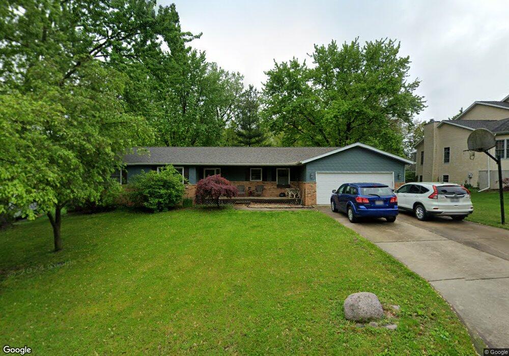
67 Covered Bridge Acres Unit 1 Glenarm, IL 62536
Estimated Value: $261,000 - $322,000
4
Beds
2
Baths
2,460
Sq Ft
$118/Sq Ft
Est. Value
About This Home
This home is located at 67 Covered Bridge Acres Unit 1, Glenarm, IL 62536 and is currently estimated at $289,989, approximately $117 per square foot. 67 Covered Bridge Acres Unit 1 is a home located in Sangamon County with nearby schools including Ball Elementary School, Glenwood Middle School, and Glenwood Intermediate School.
Ownership History
Date
Name
Owned For
Owner Type
Purchase Details
Closed on
Apr 20, 2007
Current Estimated Value
Purchase Details
Closed on
Jan 10, 2007
Purchase Details
Closed on
Sep 29, 2006
Purchase Details
Closed on
Dec 6, 2005
Purchase Details
Closed on
Aug 29, 2003
Purchase Details
Closed on
Apr 30, 2003
Purchase Details
Closed on
Sep 19, 2002
Purchase Details
Closed on
May 17, 1996
Create a Home Valuation Report for This Property
The Home Valuation Report is an in-depth analysis detailing your home's value as well as a comparison with similar homes in the area
Home Values in the Area
Average Home Value in this Area
Purchase History
| Date | Buyer | Sale Price | Title Company |
|---|---|---|---|
| -- | $169,900 | -- | |
| -- | $126,400 | -- | |
| -- | -- | -- | |
| -- | -- | -- | |
| -- | $155,000 | -- | |
| -- | $149,000 | -- | |
| -- | -- | -- | |
| -- | $140,000 | -- |
Source: Public Records
Tax History Compared to Growth
Tax History
| Year | Tax Paid | Tax Assessment Tax Assessment Total Assessment is a certain percentage of the fair market value that is determined by local assessors to be the total taxable value of land and additions on the property. | Land | Improvement |
|---|---|---|---|---|
| 2024 | $4,925 | $80,822 | $9,014 | $71,808 |
| 2023 | $4,636 | $73,242 | $8,169 | $65,073 |
| 2022 | $4,389 | $68,322 | $7,620 | $60,702 |
| 2021 | $4,186 | $64,883 | $7,236 | $57,647 |
| 2020 | $4,088 | $63,654 | $7,099 | $56,555 |
| 2019 | $3,933 | $62,455 | $6,965 | $55,490 |
| 2018 | $3,858 | $62,474 | $6,967 | $55,507 |
| 2017 | $3,820 | $62,474 | $6,967 | $55,507 |
| 2016 | $3,765 | $61,789 | $6,891 | $54,898 |
| 2015 | $3,693 | $59,966 | $6,688 | $53,278 |
| 2014 | $3,585 | $58,095 | $6,479 | $51,616 |
| 2013 | $3,454 | $56,375 | $6,287 | $50,088 |
Source: Public Records
Map
Nearby Homes
- 2214 Hopwood Dr
- 10553 S Main St Unit 1
- 404 Sundown Ln
- 203 Huntington Rd
- 248 Prairie Grass Rd
- 108 Kodiak Dr
- 337 Keystone Dr
- 327 Aspen Dr
- 1600 E Spruce St
- 315 Aspen Dr
- 121 Ramblewood Rd
- 104 Northwoods Ct
- 318 Ramblewood Rd
- 400 Ramblewood Rd
- 405 Ramblewood Rd
- 401 Ramblewood Rd
- 448 Wintergreen Dr
- 911 Mesa Dr
- 802 E Locust St
- 309 Dewberry Trail
- 68 Covered Bridge Acres
- 66 Covered Bridge Acres Unit 1
- 65 Covered Bridge Acres
- 65 Covered Bridge Acres
- 61 Covered Bridge Acres Unit 1
- 69 Covered Bridge Acres Unit 1
- 60 Covered Bridge Acres
- 0 Lot 60 Covered Bridg
- 64 Covered Bridge Acres Unit 1
- 70 Covered Bridge Acres Unit 1
- 57 Covered Bridge Acres
- 63 Covered Bridge Acres Unit 1
- 59 Covered Bridge Acres
- 71 Covered Bridge Acres
- 71 Covered Bridge Acres Unit 1
- 56 Covered Bridge Acres Unit 1
- 56 Covered Bridge
- 11578 Wayside Meadows Rd Unit 1
- 62 Covered Bridge Acres Unit 1
- 55 Covered Bridge Acres Unit 1