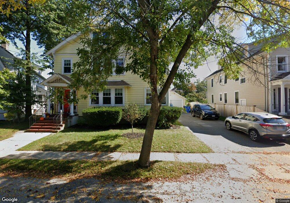
67 Dalton Rd Unit 2 Belmont, MA 02478
Cushing Square NeighborhoodEstimated Value: $1,108,000 - $1,606,057
3
Beds
1
Bath
1,600
Sq Ft
$880/Sq Ft
Est. Value
About This Home
This home is located at 67 Dalton Rd Unit 2, Belmont, MA 02478 and is currently estimated at $1,408,264, approximately $880 per square foot. 67 Dalton Rd Unit 2 is a home located in Middlesex County with nearby schools including Mary Lee Burbank Elementary School, Winthrop L Chenery Middle School, and Belmont High School.
Ownership History
Date
Name
Owned For
Owner Type
Purchase Details
Closed on
Apr 12, 2021
Sold by
Traniello Angelo W
Bought by
Kane Laura W and Kane Matthew R
Current Estimated Value
Home Financials for this Owner
Home Financials are based on the most recent Mortgage that was taken out on this home.
Original Mortgage
$764,400
Outstanding Balance
$689,047
Interest Rate
2.9%
Mortgage Type
Purchase Money Mortgage
Estimated Equity
$719,217
Purchase Details
Closed on
Nov 28, 2016
Sold by
Traniello Angelo W and Traniello Sarah D
Bought by
Traniello Angelo W
Home Financials for this Owner
Home Financials are based on the most recent Mortgage that was taken out on this home.
Original Mortgage
$500,000
Interest Rate
3.47%
Mortgage Type
New Conventional
Purchase Details
Closed on
Nov 1, 1972
Bought by
Traniello Angelo and Traniello Sarah D
Create a Home Valuation Report for This Property
The Home Valuation Report is an in-depth analysis detailing your home's value as well as a comparison with similar homes in the area
Home Values in the Area
Average Home Value in this Area
Purchase History
| Date | Buyer | Sale Price | Title Company |
|---|---|---|---|
| Kane Laura W | $1,274,000 | None Available | |
| Traniello Angelo W | $850,000 | -- | |
| Traniello Angelo | -- | -- |
Source: Public Records
Mortgage History
| Date | Status | Borrower | Loan Amount |
|---|---|---|---|
| Open | Kane Laura W | $764,400 | |
| Previous Owner | Traniello Angelo W | $500,000 |
Source: Public Records
Tax History Compared to Growth
Tax History
| Year | Tax Paid | Tax Assessment Tax Assessment Total Assessment is a certain percentage of the fair market value that is determined by local assessors to be the total taxable value of land and additions on the property. | Land | Improvement |
|---|---|---|---|---|
| 2025 | $14,112 | $1,239,000 | $873,000 | $366,000 |
| 2024 | $13,295 | $1,259,000 | $1,012,000 | $247,000 |
| 2023 | $13,387 | $1,191,000 | $955,000 | $236,000 |
| 2022 | $14,265 | $1,234,000 | $874,000 | $360,000 |
| 2021 | $13,836 | $1,199,000 | $865,000 | $334,000 |
| 2020 | $14,102 | $1,282,000 | $888,000 | $394,000 |
| 2019 | $10,515 | $901,000 | $616,000 | $285,000 |
| 2018 | $10,267 | $845,000 | $560,000 | $285,000 |
| 2017 | $11,370 | $896,000 | $513,000 | $383,000 |
| 2016 | $11,204 | $892,000 | $513,000 | $379,000 |
| 2015 | $9,391 | $728,000 | $404,000 | $324,000 |
Source: Public Records
Map
Nearby Homes
- 73 Foster Rd Unit 2
- 30 Unity Ave Unit 30
- 10 Marlboro St Unit 1
- 276 Belmont St Unit 1
- 147 Langdon Ave Unit 149
- 163 Belmont St
- 161 Cushing St
- 133 Hillside Rd
- 16 Ericsson St
- 56-58 Edgecliff Rd
- 87 Templeton Pkwy Unit 3
- 95 Cushing St
- 105 Watson Rd
- 81 Winsor Ave
- 25 Francis St Unit 2
- 25 Francis St Unit 1
- 87 Holworthy St Unit 2
- 87 Holworthy St Unit 3
- 36 Madison St
- 66 Holworthy St
- 67 Dalton Rd Unit 69
- 120 Elm St Unit 2
- 120 Elm St Unit 1
- 61 Dalton Rd
- 106 Elm St
- 55 Dalton Rd
- 55 Dalton Rd Unit 1
- 55 Dalton Rd Unit 2
- 68 Dalton Rd Unit 1
- 66 Dalton Rd Unit 68
- 17-19 Foster Rd
- 125 Elm St Unit 127
- 60 Dalton Rd Unit 62
- 62 Dalton Rd Unit 2
- 62 Dalton Rd
- 11 Foster Rd Unit 13
- 17 Foster Rd Unit 19
- 128 Elm St
- 128 Elm St Unit 2
- 128 Elm St Unit 1