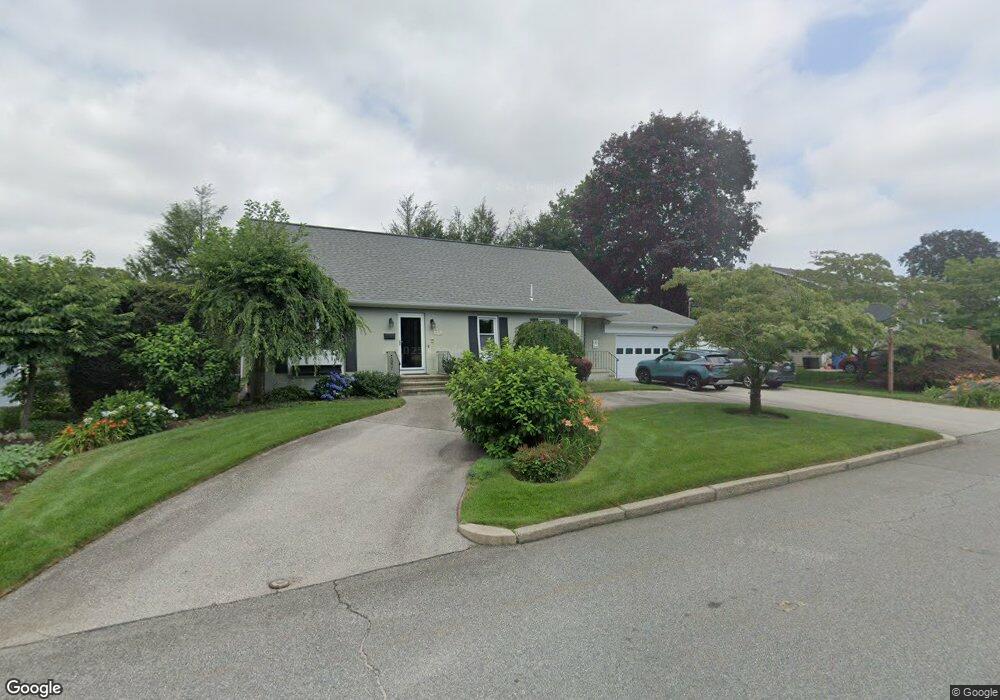
67 E Bel Air Rd Cranston, RI 02920
Meshanticut NeighborhoodEstimated Value: $676,438 - $758,000
3
Beds
2
Baths
3,080
Sq Ft
$228/Sq Ft
Est. Value
About This Home
This home is located at 67 E Bel Air Rd, Cranston, RI 02920 and is currently estimated at $701,360, approximately $227 per square foot. 67 E Bel Air Rd is a home located in Providence County with nearby schools including Glen Hills School, Western Hills Middle School, and Cranston High School West.
Ownership History
Date
Name
Owned For
Owner Type
Purchase Details
Closed on
Aug 21, 2012
Sold by
Swerdlow Mark B and Priestley Laurie A
Bought by
Swerdlow Mark B and Swerdlow Laurie A
Current Estimated Value
Home Financials for this Owner
Home Financials are based on the most recent Mortgage that was taken out on this home.
Original Mortgage
$229,500
Outstanding Balance
$94,696
Interest Rate
3.67%
Estimated Equity
$606,664
Purchase Details
Closed on
May 3, 2004
Sold by
Rawcliffe Anni
Bought by
Priestley Laurie and Swerdlow Mark
Home Financials for this Owner
Home Financials are based on the most recent Mortgage that was taken out on this home.
Original Mortgage
$255,200
Interest Rate
5.36%
Mortgage Type
Purchase Money Mortgage
Create a Home Valuation Report for This Property
The Home Valuation Report is an in-depth analysis detailing your home's value as well as a comparison with similar homes in the area
Home Values in the Area
Average Home Value in this Area
Purchase History
We collect this data history from publicly available records. To have your information removed, we recommend requesting removal directly through your county’s website.
| Date | Buyer | Sale Price | Title Company |
|---|---|---|---|
| Swerdlow Mark B | -- | -- | |
| Priestley Laurie | $319,000 | -- |
Source: Public Records
Mortgage History
We collect this data history from publicly available records. To have your information removed, we recommend requesting removal directly through your county’s website.
| Date | Status | Borrower | Loan Amount |
|---|---|---|---|
| Open | Priestley Laurie | $52,000 | |
| Open | Swerdlow Mark B | $229,500 | |
| Previous Owner | Priestley Laurie | $66,200 | |
| Previous Owner | Priestley Laurie | $255,200 | |
| Previous Owner | Priestley Laurie | $42,682 |
Source: Public Records
Tax History
| Year | Tax Paid | Tax Assessment Tax Assessment Total Assessment is a certain percentage of the fair market value that is determined by local assessors to be the total taxable value of land and additions on the property. | Land | Improvement |
|---|---|---|---|---|
| 2025 | $8,453 | $609,000 | $140,800 | $468,200 |
| 2024 | $8,288 | $609,000 | $140,800 | $468,200 |
| 2023 | $8,055 | $426,200 | $100,700 | $325,500 |
| 2022 | $7,889 | $426,200 | $100,700 | $325,500 |
| 2021 | $7,672 | $426,200 | $100,700 | $325,500 |
| 2020 | $7,346 | $353,700 | $104,300 | $249,400 |
| 2019 | $7,346 | $353,700 | $104,300 | $249,400 |
| 2018 | $7,177 | $353,700 | $104,300 | $249,400 |
| 2017 | $7,027 | $306,300 | $97,100 | $209,200 |
| 2016 | $6,876 | $306,300 | $97,100 | $209,200 |
| 2015 | $6,876 | $306,300 | $97,100 | $209,200 |
| 2014 | $6,724 | $294,400 | $104,300 | $190,100 |
Source: Public Records
Map
Nearby Homes
- 51 E Bel Air Rd
- 145 E Hill Dr
- 132 Hoffman Ave Unit 202
- 175 Hoffman Ave Unit 309
- 7 White Birch Rd
- 60 Coldbrook Dr
- 7 Oak Tree Ln
- 28 S Hill Dr
- 203 Dean Ridge Ct
- 1000 Chapel View Blvd Unit 306
- 1000 Chapel View Blvd Unit 312
- 39 Greening Ln
- 9 Williston St
- 141 Glen Ridge Rd
- 64 Long Ct
- 120 Bretton Woods Dr
- 135 Meshanticut Valley Pkwy
- 29 Sweetbriar Dr
- 60 North St
- 46 Eden Crest Dr
- 527 Lauren Hill Ave
- 59 E Bel Air Rd
- 73 E Bel Air Rd
- 42 Blue Ridge Rd
- 50 Blue Ridge Rd
- 34 Blue Ridge Rd
- 74 E Bel Air Rd
- 60 E Bel Air Rd
- 34 Hamden Rd
- 28 Blue Ridge Rd
- 58 Blue Ridge Rd
- 80 E Bel Air Rd
- 50 E Bel Air Rd
- 43 Park Forest Rd
- 41 Blue Ridge Rd
- 51 Park Forest Rd
- 37 Park Forest Rd
- 45 E Bel Air Rd
- 49 Blue Ridge Rd
- 33 Blue Ridge Rd
Your Personal Tour Guide
Ask me questions while you tour the home.