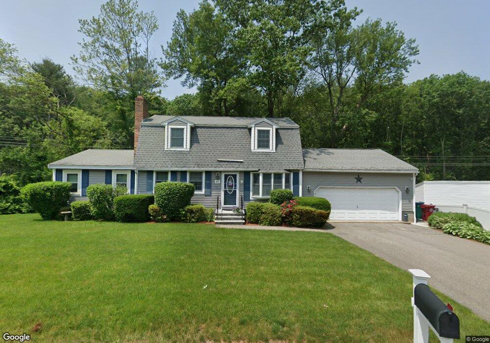
67 Gagnon Rd Lowell, MA 01854
Pawtucketville NeighborhoodEstimated Value: $643,000 - $691,000
4
Beds
2
Baths
1,920
Sq Ft
$344/Sq Ft
Est. Value
About This Home
This home is located at 67 Gagnon Rd, Lowell, MA 01854 and is currently estimated at $659,746, approximately $343 per square foot. 67 Gagnon Rd is a home located in Middlesex County with nearby schools including Joseph McAvinnue Elementary School, Charlotte M. Murkland Elementary School, and Charles W. Morey Elementary School.
Ownership History
Date
Name
Owned For
Owner Type
Purchase Details
Closed on
Nov 7, 2025
Sold by
Beilen Judith A
Bought by
Metros Nicholas P and Metros Kaitlyn S
Current Estimated Value
Home Financials for this Owner
Home Financials are based on the most recent Mortgage that was taken out on this home.
Original Mortgage
$491,250
Outstanding Balance
$489,858
Interest Rate
6.3%
Mortgage Type
New Conventional
Estimated Equity
$169,888
Purchase Details
Closed on
May 12, 2006
Sold by
Mills James C and Mills Linda M
Bought by
Beilen Judith A and Georgeou Paul
Home Financials for this Owner
Home Financials are based on the most recent Mortgage that was taken out on this home.
Original Mortgage
$165,000
Interest Rate
6.4%
Mortgage Type
Purchase Money Mortgage
Create a Home Valuation Report for This Property
The Home Valuation Report is an in-depth analysis detailing your home's value as well as a comparison with similar homes in the area
Home Values in the Area
Average Home Value in this Area
Purchase History
| Date | Buyer | Sale Price | Title Company |
|---|---|---|---|
| Metros Nicholas P | $655,000 | -- | |
| Beilen Judith A | $365,000 | -- | |
| Beilen Judith A | $365,000 | -- | |
| Beilen Judith A | $365,000 | -- |
Source: Public Records
Mortgage History
| Date | Status | Borrower | Loan Amount |
|---|---|---|---|
| Open | Metros Nicholas P | $491,250 | |
| Previous Owner | Beilen Judith A | $460,500 | |
| Previous Owner | Beilen Judith A | $163,500 | |
| Previous Owner | Beilen Judith A | $25,000 | |
| Previous Owner | Beilen Judith A | $165,000 |
Source: Public Records
Tax History
| Year | Tax Paid | Tax Assessment Tax Assessment Total Assessment is a certain percentage of the fair market value that is determined by local assessors to be the total taxable value of land and additions on the property. | Land | Improvement |
|---|---|---|---|---|
| 2025 | $6,754 | $588,300 | $183,100 | $405,200 |
| 2024 | $6,866 | $576,500 | $171,200 | $405,300 |
| 2023 | $6,498 | $523,200 | $148,800 | $374,400 |
| 2022 | $5,955 | $469,300 | $135,300 | $334,000 |
| 2021 | $5,571 | $413,900 | $117,600 | $296,300 |
| 2020 | $5,487 | $410,700 | $120,000 | $290,700 |
| 2019 | $5,448 | $388,000 | $105,700 | $282,300 |
| 2018 | $5,415 | $376,300 | $100,700 | $275,600 |
| 2017 | $5,170 | $346,500 | $91,500 | $255,000 |
| 2016 | $5,160 | $340,400 | $85,400 | $255,000 |
| 2015 | $4,915 | $317,500 | $83,600 | $233,900 |
| 2013 | $4,682 | $311,900 | $105,100 | $206,800 |
Source: Public Records
Map
Nearby Homes
- 1400 Skyline Dr Unit 6
- 2300 Skyline Dr Unit 3
- 248 Acropolis Rd
- 15 Barbara St
- 15 Robin Ln
- 591 Varnum Ave
- 187 Varnum Ave
- 307 Pawtucket Blvd Unit 24
- 311 Pawtucket Blvd Unit 9
- 311 Pawtucket Blvd Unit 3
- 351 Pawtucket Blvd Unit 3
- 351 Pawtucket Blvd Unit 29
- 30 4th Ave
- 295 Pawtucket Blvd Unit 7
- 339 Pawtucket Blvd Unit 19
- 89 Mammoth Rd
- 527 Pawtucket Blvd Unit 207
- 67 Glennon Ave
- 109 Navy Yard Rd
- 3 Louis Farm Rd Unit 3
Your Personal Tour Guide
Ask me questions while you tour the home.