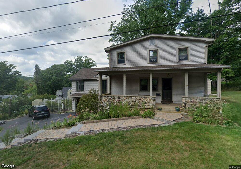
67 Glendale Ave Winsted, CT 06098
Estimated Value: $290,000 - $311,815
4
Beds
3
Baths
1,993
Sq Ft
$152/Sq Ft
Est. Value
About This Home
This home is located at 67 Glendale Ave, Winsted, CT 06098 and is currently estimated at $302,954, approximately $152 per square foot. 67 Glendale Ave is a home located in Litchfield County with nearby schools including St Anthony School.
Ownership History
Date
Name
Owned For
Owner Type
Purchase Details
Closed on
Jun 7, 2023
Sold by
Donovan William D and Donovan Maureen E
Bought by
William D Donovan Jr T D and William Donovan
Current Estimated Value
Purchase Details
Closed on
Oct 1, 1978
Bought by
Donovan William and Donovan Maureen E
Create a Home Valuation Report for This Property
The Home Valuation Report is an in-depth analysis detailing your home's value as well as a comparison with similar homes in the area
Home Values in the Area
Average Home Value in this Area
Purchase History
| Date | Buyer | Sale Price | Title Company |
|---|---|---|---|
| William D Donovan Jr T D | -- | None Available | |
| William D Donovan Jr T D | -- | None Available | |
| Donovan William | -- | -- |
Source: Public Records
Mortgage History
| Date | Status | Borrower | Loan Amount |
|---|---|---|---|
| Previous Owner | Donovan William | $40,000 | |
| Previous Owner | Donovan William | $12,000 | |
| Previous Owner | Donovan William | $85,000 | |
| Previous Owner | Donovan William | $80,000 |
Source: Public Records
Tax History Compared to Growth
Tax History
| Year | Tax Paid | Tax Assessment Tax Assessment Total Assessment is a certain percentage of the fair market value that is determined by local assessors to be the total taxable value of land and additions on the property. | Land | Improvement |
|---|---|---|---|---|
| 2025 | $4,468 | $153,160 | $33,040 | $120,120 |
| 2024 | $4,172 | $153,160 | $33,040 | $120,120 |
| 2023 | $4,042 | $153,160 | $33,040 | $120,120 |
| 2022 | $3,764 | $112,210 | $24,010 | $88,200 |
| 2021 | $3,764 | $112,210 | $24,010 | $88,200 |
| 2020 | $3,764 | $112,210 | $24,010 | $88,200 |
| 2019 | $3,764 | $112,210 | $24,010 | $88,200 |
| 2018 | $3,764 | $112,210 | $24,010 | $88,200 |
| 2017 | $3,573 | $106,540 | $24,010 | $82,530 |
| 2016 | $3,573 | $106,540 | $24,010 | $82,530 |
| 2015 | $3,484 | $106,540 | $24,010 | $82,530 |
| 2014 | $3,400 | $106,540 | $24,010 | $82,530 |
Source: Public Records
Map
Nearby Homes