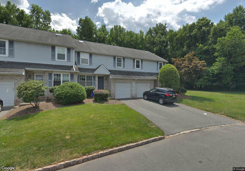
67 Hawthorn Dr Edison, NJ 08820
Estimated Value: $598,047 - $703,000
3
Beds
--
Bath
1,547
Sq Ft
$427/Sq Ft
Est. Value
About This Home
This home is located at 67 Hawthorn Dr, Edison, NJ 08820 and is currently estimated at $661,012, approximately $427 per square foot. 67 Hawthorn Dr is a home located in Middlesex County with nearby schools including Martin Luther King Elementary School, John Adams Middle School, and J.P. Stevens High School.
Ownership History
Date
Name
Owned For
Owner Type
Purchase Details
Closed on
Jul 5, 2016
Sold by
Shah Sujata and Shah Trupti Shah
Bought by
Shah Ankur and Shah Yesha
Current Estimated Value
Home Financials for this Owner
Home Financials are based on the most recent Mortgage that was taken out on this home.
Interest Rate
3.48%
Purchase Details
Closed on
Feb 8, 2001
Sold by
Desal Anish
Bought by
Shah Sujata and Shah Truptt
Home Financials for this Owner
Home Financials are based on the most recent Mortgage that was taken out on this home.
Original Mortgage
$130,000
Interest Rate
6.89%
Purchase Details
Closed on
May 10, 1999
Sold by
Salkin Jeff
Bought by
Desai Anish and Desai Manjari
Home Financials for this Owner
Home Financials are based on the most recent Mortgage that was taken out on this home.
Original Mortgage
$120,000
Interest Rate
6.82%
Create a Home Valuation Report for This Property
The Home Valuation Report is an in-depth analysis detailing your home's value as well as a comparison with similar homes in the area
Home Values in the Area
Average Home Value in this Area
Purchase History
| Date | Buyer | Sale Price | Title Company |
|---|---|---|---|
| Shah Ankur | $439,500 | -- | |
| Shah Sujata | $180,000 | -- | |
| Desai Anish | $160,000 | -- |
Source: Public Records
Mortgage History
| Date | Status | Borrower | Loan Amount |
|---|---|---|---|
| Closed | Shah Ankur | -- | |
| Previous Owner | Shah Sujata | $130,000 | |
| Previous Owner | Desai Anish | $120,000 |
Source: Public Records
Tax History Compared to Growth
Tax History
| Year | Tax Paid | Tax Assessment Tax Assessment Total Assessment is a certain percentage of the fair market value that is determined by local assessors to be the total taxable value of land and additions on the property. | Land | Improvement |
|---|---|---|---|---|
| 2025 | $10,049 | $168,800 | $80,000 | $88,800 |
| 2024 | $9,995 | $168,800 | $80,000 | $88,800 |
| 2023 | $9,995 | $168,800 | $80,000 | $88,800 |
| 2022 | $9,998 | $168,800 | $80,000 | $88,800 |
| 2021 | $9,593 | $168,800 | $80,000 | $88,800 |
| 2020 | $9,873 | $168,800 | $80,000 | $88,800 |
| 2019 | $9,129 | $168,800 | $80,000 | $88,800 |
| 2018 | $9,271 | $168,800 | $80,000 | $88,800 |
| 2017 | $9,075 | $168,800 | $80,000 | $88,800 |
| 2016 | $8,277 | $163,700 | $80,000 | $83,700 |
| 2015 | $7,962 | $163,700 | $80,000 | $83,700 |
| 2014 | $7,736 | $163,700 | $80,000 | $83,700 |
Source: Public Records
Map
Nearby Homes
- 28 Hawthorn Dr Unit 28
- 28 Hawthorn Dr
- 166 Hidden Hollow Ct
- 31 Hickory Hollow Ct
- 145 Maplewood Ct Unit 145D
- 3801 Cricket Cir
- 3 Old Hickory Ln
- 4 Hemlock Dr
- 11 Madaline Dr
- 1681 Woodland Ave
- 3 Anthony Ave
- 3606 Springbrook Dr
- 3606 Spring Brook Dr
- 4807 Stonehedge Rd
- 10 Milford Ct
- 302 Westgate Dr
- 404 Westgate Dr
- 338 Westgate Dr Unit 338
- 154 Westgate Dr
- 384 Westgate Dr
- 19 Hawthorn Dr
- 23 Hawthorn Dr
- 10 Snowflake Ln
- 35 Hawthorn Dr
- 35 Hawthorn Dr Unit 1235
- 14 Snowflake Ln
- 6 Snowflake Ln
- 63 Hawthorn Dr
- 33 Hawthorn Dr
- 17 Hawthorn Dr
- 17 Hawthorn Dr Unit 1317
- 41 Hawthorn Dr Unit 41
- 4 Snowflake Ln
- 8 Snowflake Ln
- 61 Hawthorn Dr
- 65 Hawthorn Dr
- 37 Hawthorn Dr Unit 37
- 5 Hawthorn Dr
- 51 Hawthorn Dr
- 51 Hawthorn Dr Unit 1051