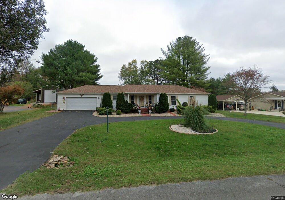
67 Lake Ln Winchester, TN 37398
Estimated Value: $320,000 - $437,000
3
Beds
2
Baths
1,886
Sq Ft
$201/Sq Ft
Est. Value
About This Home
This home is located at 67 Lake Ln, Winchester, TN 37398 and is currently estimated at $379,201, approximately $201 per square foot. 67 Lake Ln is a home located in Franklin County with nearby schools including North Middle School, Franklin County High School, and School of the Good Shepherd.
Ownership History
Date
Name
Owned For
Owner Type
Purchase Details
Closed on
Apr 1, 2015
Sold by
Devoe Raymond F
Bought by
Koenig Michael and Koenig Patricia
Current Estimated Value
Purchase Details
Closed on
Nov 24, 2014
Sold by
Forsythe Michael D
Bought by
Devoe Raymond F and Devoe Tracy L
Home Financials for this Owner
Home Financials are based on the most recent Mortgage that was taken out on this home.
Original Mortgage
$120,000
Interest Rate
3.95%
Mortgage Type
New Conventional
Purchase Details
Closed on
Nov 3, 1986
Bought by
Mason James L and Mason Rosemary
Purchase Details
Closed on
Feb 22, 1971
Create a Home Valuation Report for This Property
The Home Valuation Report is an in-depth analysis detailing your home's value as well as a comparison with similar homes in the area
Home Values in the Area
Average Home Value in this Area
Purchase History
| Date | Buyer | Sale Price | Title Company |
|---|---|---|---|
| Koenig Michael | $152,000 | -- | |
| Devoe Raymond F | $150,000 | -- | |
| Mason James L | $7,000 | -- | |
| -- | -- | -- |
Source: Public Records
Mortgage History
| Date | Status | Borrower | Loan Amount |
|---|---|---|---|
| Previous Owner | Devoe Raymond F | $120,000 |
Source: Public Records
Tax History Compared to Growth
Tax History
| Year | Tax Paid | Tax Assessment Tax Assessment Total Assessment is a certain percentage of the fair market value that is determined by local assessors to be the total taxable value of land and additions on the property. | Land | Improvement |
|---|---|---|---|---|
| 2024 | $1,783 | $69,350 | $13,750 | $55,600 |
| 2023 | $1,783 | $69,350 | $13,750 | $55,600 |
| 2022 | $1,748 | $69,350 | $13,750 | $55,600 |
| 2021 | $1,074 | $69,350 | $13,750 | $55,600 |
| 2020 | $1,482 | $41,925 | $5,025 | $36,900 |
| 2019 | $1,482 | $41,925 | $5,025 | $36,900 |
| 2018 | $1,396 | $41,925 | $5,025 | $36,900 |
| 2017 | $1,396 | $41,925 | $5,025 | $36,900 |
| 2016 | $1,297 | $38,975 | $5,025 | $33,950 |
| 2015 | $1,274 | $38,975 | $5,025 | $33,950 |
| 2014 | $1,274 | $38,981 | $0 | $0 |
Source: Public Records
Map
Nearby Homes
- 0 Sharp Springs Rd Unit RTC2980057
- 60 Sharp Cir
- 66 Edgefield Ct
- 67 Summerset Dr
- 67 Edgefield Ct
- 53 Summerset Dr
- 201 Lookout Dr
- 348 Lookout Dr
- 249 Lookout Dr
- 0 Lookout Dr Unit RTC3015909
- 0 Lookout Dr Unit RTC3015905
- 0 Lookout Dr Unit RTC3000162
- 0 Lookout Dr Unit RTC2976836
- 1336 Sharp Springs Rd
- 307 Mary Sharp Dr
- 136 Bel Aire Dr
- 505 Kindel Dr
- 0 Mary Sharp Dr
- 120 Dogwood Ln
- 208 Tammy Dr
- 41 Lake Ln
- 93 Lake Ln
- 1079 Sharp Springs Rd
- 66 Lake Ln
- 1061 Sharp Springs Rd
- 1105 Sharp Springs Rd
- 115 Lake Ln
- 75 Chattin St
- 90 Lake Ln
- 28 Lake Ln
- 127 Chattin St
- 35 Chattin St
- 985 Sharp Springs Rd
- 130 Lake Ln
- 2 Sharp Springs Rd
- 1 Sharp Springs Rd
- 1132 Sharp Springs Rd
- 1156 Sharp Springs Rd
- 51 Sharp Cir
- 86 Chattin St