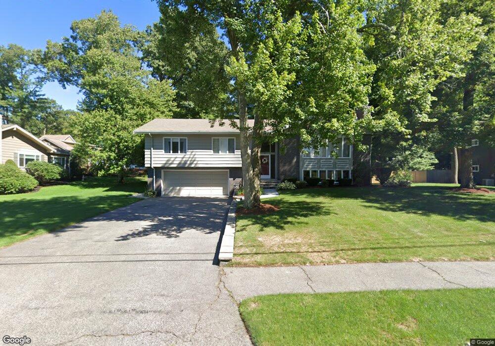
67 Ledge Rd Waltham, MA 02452
Piety Corner NeighborhoodEstimated Value: $1,052,266 - $1,380,000
3
Beds
3
Baths
2,122
Sq Ft
$576/Sq Ft
Est. Value
About This Home
This home is located at 67 Ledge Rd, Waltham, MA 02452 and is currently estimated at $1,222,817, approximately $576 per square foot. 67 Ledge Rd is a home located in Middlesex County with nearby schools including Northeast Elementary School, John F Kennedy Middle School, and Waltham Sr High School.
Ownership History
Date
Name
Owned For
Owner Type
Purchase Details
Closed on
Aug 22, 2012
Sold by
Papachristos James
Bought by
Campagna Anthony C
Current Estimated Value
Home Financials for this Owner
Home Financials are based on the most recent Mortgage that was taken out on this home.
Original Mortgage
$537,000
Outstanding Balance
$360,087
Interest Rate
3%
Mortgage Type
Purchase Money Mortgage
Estimated Equity
$862,730
Create a Home Valuation Report for This Property
The Home Valuation Report is an in-depth analysis detailing your home's value as well as a comparison with similar homes in the area
Home Values in the Area
Average Home Value in this Area
Purchase History
| Date | Buyer | Sale Price | Title Company |
|---|---|---|---|
| Campagna Anthony C | $632,000 | -- |
Source: Public Records
Mortgage History
| Date | Status | Borrower | Loan Amount |
|---|---|---|---|
| Open | Campagna Anthony C | $537,000 |
Source: Public Records
Tax History Compared to Growth
Tax History
| Year | Tax Paid | Tax Assessment Tax Assessment Total Assessment is a certain percentage of the fair market value that is determined by local assessors to be the total taxable value of land and additions on the property. | Land | Improvement |
|---|---|---|---|---|
| 2025 | $9,358 | $953,000 | $570,400 | $382,600 |
| 2024 | $8,872 | $920,300 | $543,800 | $376,500 |
| 2023 | $8,782 | $851,000 | $494,300 | $356,700 |
| 2022 | $8,884 | $797,500 | $454,800 | $342,700 |
| 2021 | $8,583 | $758,200 | $435,000 | $323,200 |
| 2020 | $8,256 | $690,900 | $405,300 | $285,600 |
| 2019 | $8,554 | $675,700 | $400,400 | $275,300 |
| 2018 | $7,444 | $590,300 | $370,700 | $219,600 |
| 2017 | $6,980 | $555,700 | $336,100 | $219,600 |
| 2016 | $6,561 | $536,000 | $316,400 | $219,600 |
| 2015 | $6,809 | $518,600 | $311,400 | $207,200 |
Source: Public Records
Map
Nearby Homes
- 70 Rosewood Dr
- 116 Raffaele Dr
- 511 Lexington St
- 28 College Farm Rd Unit 2
- 34 Cedar Hill Ln
- 266 Linden St
- 155 Marguerite Ave
- 49 Lincoln St
- 55 Circle Dr
- 44 Sachem St
- 326 Bacon St
- 214 Church St
- 158 Church St
- 14 Piedmont Ave
- 16 Winter St Unit 26C
- 750 Trapelo Rd
- 23 Wight St
- 65 Montclair Ave
- 59 Farnum Rd
- 45 Chase Rd