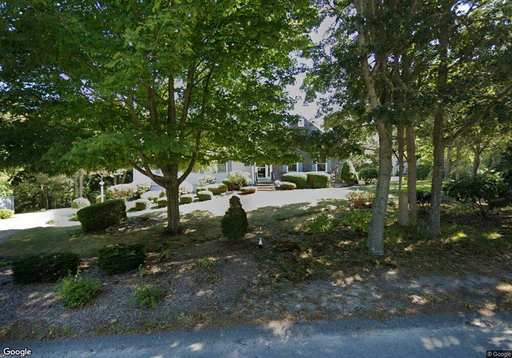
67 Leland Rd Brewster, MA 02631
Estimated Value: $610,782
3
Beds
3
Baths
1,501
Sq Ft
$407/Sq Ft
Est. Value
About This Home
This home is located at 67 Leland Rd, Brewster, MA 02631 and is currently estimated at $610,782, approximately $406 per square foot. 67 Leland Rd is a home located in Barnstable County with nearby schools including Stony Brook Elementary School, Eddy Elementary School, and Nauset Regional Middle School.
Ownership History
Date
Name
Owned For
Owner Type
Purchase Details
Closed on
Nov 21, 2016
Sold by
Beach Katherine
Bought by
Northside United Meth
Current Estimated Value
Home Financials for this Owner
Home Financials are based on the most recent Mortgage that was taken out on this home.
Original Mortgage
$305,000
Outstanding Balance
$240,885
Interest Rate
3.42%
Mortgage Type
New Conventional
Estimated Equity
$369,897
Purchase Details
Closed on
Sep 8, 2016
Sold by
Katherine G Beach Lt and Beach
Bought by
Beach Katherine
Purchase Details
Closed on
Jul 25, 2007
Sold by
Beach Katherine
Bought by
Katherine G Beach Lt and Willey
Purchase Details
Closed on
Jul 30, 1996
Sold by
Russ Daniel
Bought by
Beach Katherine and Beach Edward G
Home Financials for this Owner
Home Financials are based on the most recent Mortgage that was taken out on this home.
Original Mortgage
$100,000
Interest Rate
8.37%
Mortgage Type
Purchase Money Mortgage
Purchase Details
Closed on
Oct 4, 1995
Sold by
Crane John
Bought by
Russ Daniel
Create a Home Valuation Report for This Property
The Home Valuation Report is an in-depth analysis detailing your home's value as well as a comparison with similar homes in the area
Home Values in the Area
Average Home Value in this Area
Purchase History
| Date | Buyer | Sale Price | Title Company |
|---|---|---|---|
| Northside United Meth | $305,000 | -- | |
| Beach Katherine | -- | -- | |
| Katherine G Beach Lt | -- | -- | |
| Beach Katherine | $160,000 | -- | |
| Russ Daniel | $33,500 | -- |
Source: Public Records
Mortgage History
| Date | Status | Borrower | Loan Amount |
|---|---|---|---|
| Open | Northside United Meth | $305,000 | |
| Previous Owner | Russ Daniel | $75,000 | |
| Previous Owner | Russ Daniel | $35,000 | |
| Previous Owner | Russ Daniel | $100,000 |
Source: Public Records
Tax History
| Year | Tax Paid | Tax Assessment Tax Assessment Total Assessment is a certain percentage of the fair market value that is determined by local assessors to be the total taxable value of land and additions on the property. | Land | Improvement |
|---|---|---|---|---|
| 2025 | $3,137 | $708,400 | $226,500 | $481,900 |
| 2024 | $3,137 | $674,600 | $213,700 | $460,900 |
| 2023 | $3,137 | $603,400 | $190,700 | $412,700 |
| 2022 | $3,137 | $508,900 | $158,900 | $350,000 |
| 2021 | $0 | $444,000 | $138,100 | $305,900 |
| 2020 | $0 | $433,300 | $138,100 | $295,200 |
| 2019 | $4,586 | $417,700 | $132,900 | $284,800 |
| 2018 | $4,321 | $409,600 | $132,900 | $276,700 |
| 2017 | $3,137 | $373,900 | $132,900 | $241,000 |
| 2016 | $3,117 | $369,800 | $130,300 | $239,500 |
| 2015 | $2,987 | $361,600 | $127,700 | $233,900 |
Source: Public Records
Map
Nearby Homes
- 98 Leland Rd
- 0 Canoe Pond Dr
- 186 Canoe Pond Dr
- 80 Abby Rd
- 117 A p Newcomb Rd
- 0 Ridgewood Dr
- 309 Great Fields Rd
- 53 Brier Ln
- 20 Spring Ln
- 102 Wildwood Rd
- 46 Trout Pond Ln
- 92 Whiffletree Ave
- 31 Hazel Ln
- 279 Alden Dr
- 36 Island St
- 1580 Main St
- 240 Robbins Hill Rd
- 34 Pleasant St Unit 3
- 360 Airline Rd
- 149 Greenland Cir
Your Personal Tour Guide
Ask me questions while you tour the home.