
Seller's Agent in 2025
Claire Lavin
Charron Real Estate & Associates
(800) 564-7566
4 in this area
9 Total Sales
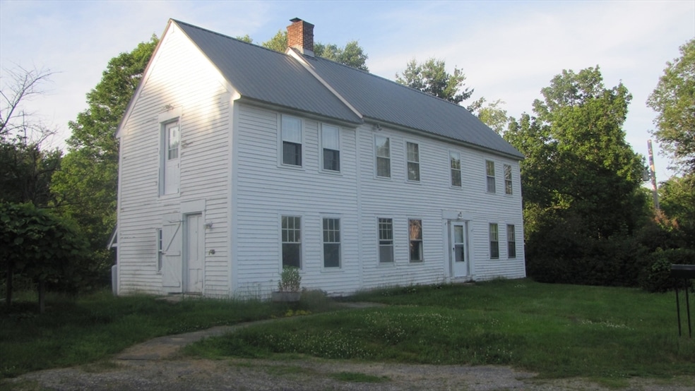
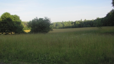
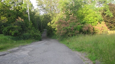
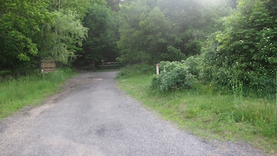
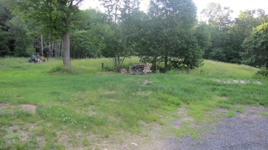
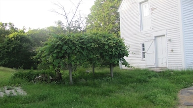
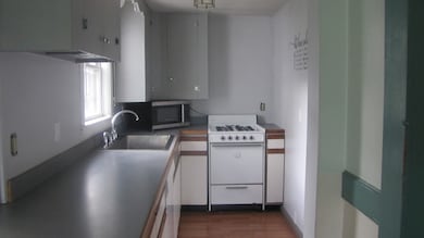
This colonial sits in a bucolic setting that can't be matched! Abutting conservation land (Blood Hill) and across the road from acres of town owned land, you can enjoy nature all year round. Newer kitchen and bath along with the charm of antique features make this home special. Pellet stove in the kitchen adds cozy warmth. Plenty of land for a garden and for playing. Ready for you to add your own personal decor and touches to make it stunning!
| Date | Type | Sale Price | Title Company |
|---|---|---|---|
| Quit Claim Deed | $340,000 | -- | |
| Deed | $340,000 | -- | |
| Warranty Deed | -- | None Available | |
| Quit Claim Deed | $5,000 | -- | |
| Quit Claim Deed | $5,000 | -- | |
| Deed | $151,055 | -- | |
| Deed | $151,055 | -- | |
| Deed | $691,000 | -- |
| Date | Status | Loan Amount | Loan Type |
|---|---|---|---|
| Previous Owner | $50,000 | No Value Available |
| Date | Event | Price | List to Sale | Price per Sq Ft |
|---|---|---|---|---|
| 08/19/2025 08/19/25 | Sold | $340,000 | -2.9% | $221 / Sq Ft |
| 07/02/2025 07/02/25 | Pending | -- | -- | -- |
| 06/24/2025 06/24/25 | For Sale | $350,000 | -- | $228 / Sq Ft |
| Year | Tax Paid | Tax Assessment Tax Assessment Total Assessment is a certain percentage of the fair market value that is determined by local assessors to be the total taxable value of land and additions on the property. | Land | Improvement |
|---|---|---|---|---|
| 2025 | $3,719 | $244,200 | $72,200 | $172,000 |
| 2024 | $3,463 | $223,000 | $69,800 | $153,200 |
| 2023 | $3,314 | $201,800 | $65,000 | $136,800 |
| 2022 | $3,253 | $183,900 | $74,600 | $109,300 |
| 2021 | $3,120 | $168,200 | $74,600 | $93,600 |
| 2020 | $3,018 | $160,300 | $73,800 | $86,500 |
| 2019 | $5,275 | $154,900 | $73,800 | $81,100 |
| 2018 | $6,996 | $146,300 | $59,700 | $86,600 |
| 2017 | $3,006 | $144,300 | $55,700 | $88,600 |
| 2016 | $2,900 | $144,300 | $55,700 | $88,600 |
| 2015 | $2,840 | $144,300 | $55,700 | $88,600 |
| 2014 | $2,802 | $146,700 | $55,700 | $91,000 |
Seller's Agent in 2025
Claire Lavin
Charron Real Estate & Associates
(800) 564-7566
4 in this area
9 Total Sales
Source: MLS Property Information Network (MLS PIN)
MLS Number: 73395961
APN: ASHB-000008-000031
Disclaimer: Certain information contained herein is derived from information provided by parties other than Homes.com. All information provided is deemed reliable, but is not guaranteed to be accurate and should be independently verified.
![]() The property listing data and information, or the Images, set forth herein were provided to MLS Property Information Network, Inc. from third party sources, including sellers, lessors and public records, and were compiled by MLS Property Information Network, Inc. The property listing data and information, and the Images, are for the personal, non-commercial use of consumers having a good faith interest in purchasing or leasing listed properties of the type displayed to them and may not be used for any purpose other than to identify prospective properties which such consumers may have a good faith interest in purchasing or leasing. MLS Property Information Network, Inc. and its subscribers disclaim any and all representations and warranties as to the accuracy of the property listing data and information, or as to the accuracy of any of the Images, set forth herein.
The property listing data and information, or the Images, set forth herein were provided to MLS Property Information Network, Inc. from third party sources, including sellers, lessors and public records, and were compiled by MLS Property Information Network, Inc. The property listing data and information, and the Images, are for the personal, non-commercial use of consumers having a good faith interest in purchasing or leasing listed properties of the type displayed to them and may not be used for any purpose other than to identify prospective properties which such consumers may have a good faith interest in purchasing or leasing. MLS Property Information Network, Inc. and its subscribers disclaim any and all representations and warranties as to the accuracy of the property listing data and information, or as to the accuracy of any of the Images, set forth herein.
Ask me questions while you tour the home.