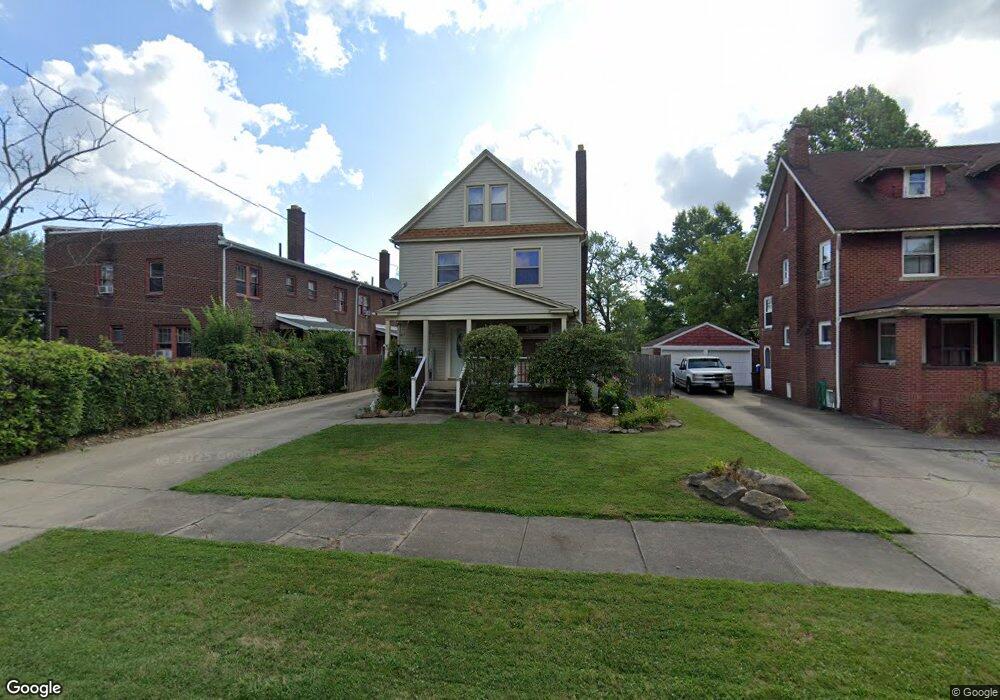
67 N Brockway Ave Youngstown, OH 44509
Belle Vista NeighborhoodEstimated Value: $94,000 - $103,000
3
Beds
1
Bath
1,240
Sq Ft
$79/Sq Ft
Est. Value
About This Home
This home is located at 67 N Brockway Ave, Youngstown, OH 44509 and is currently estimated at $98,566, approximately $79 per square foot. 67 N Brockway Ave is a home located in Mahoning County with nearby schools including Volney Rogers Elementary School, Chaney High School, and Summit Academy - Youngstown.
Ownership History
Date
Name
Owned For
Owner Type
Purchase Details
Closed on
Mar 3, 2025
Sold by
Navarro Angela Cavucci and Navarro Jeffrey
Bought by
Cavucci Angelo J and Cavucci Geraldine E
Current Estimated Value
Purchase Details
Closed on
Jul 14, 2023
Sold by
Navarro Angela Cavucci and Cavucci Nicholas
Bought by
Navarro Angela Cavucci
Purchase Details
Closed on
Dec 12, 2022
Sold by
Cavucci Angelo J and Cavucci Geraldine E
Bought by
Cavucci Nicholas and Navarro Angela Cavucci
Purchase Details
Closed on
Aug 21, 1979
Bought by
Cavucci Angelo J and G E
Create a Home Valuation Report for This Property
The Home Valuation Report is an in-depth analysis detailing your home's value as well as a comparison with similar homes in the area
Home Values in the Area
Average Home Value in this Area
Purchase History
| Date | Buyer | Sale Price | Title Company |
|---|---|---|---|
| Cavucci Angelo J | -- | None Listed On Document | |
| Cavucci Angelo J | -- | None Listed On Document | |
| Navarro Angela Cavucci | -- | None Listed On Document | |
| Navarro Angela Cavucci | -- | None Listed On Document | |
| Cavucci Nicholas | -- | None Listed On Document | |
| Cavucci Nicholas | -- | None Listed On Document | |
| Cavucci Angelo J | -- | -- |
Source: Public Records
Tax History Compared to Growth
Tax History
| Year | Tax Paid | Tax Assessment Tax Assessment Total Assessment is a certain percentage of the fair market value that is determined by local assessors to be the total taxable value of land and additions on the property. | Land | Improvement |
|---|---|---|---|---|
| 2024 | $1,002 | $21,020 | $1,480 | $19,540 |
| 2023 | $1,021 | $21,020 | $1,480 | $19,540 |
| 2022 | $268 | $13,080 | $1,460 | $11,620 |
| 2021 | $268 | $13,080 | $1,460 | $11,620 |
| 2020 | $270 | $13,080 | $1,460 | $11,620 |
| 2019 | $193 | $11,480 | $1,280 | $10,200 |
| 2018 | $195 | $11,480 | $1,280 | $10,200 |
| 2017 | $192 | $11,480 | $1,280 | $10,200 |
| 2016 | $399 | $14,910 | $1,980 | $12,930 |
| 2015 | $391 | $14,910 | $1,980 | $12,930 |
| 2014 | $388 | $14,910 | $1,980 | $12,930 |
| 2013 | $383 | $14,910 | $1,980 | $12,930 |
Source: Public Records
Map
Nearby Homes
- 107 N Hartford Ave
- 115 N Richview Ave
- 175 N Hartford Ave
- 28 N Hartford Ave
- 134 Millet Ave
- 50 Manchester Ave
- 23 Manchester Ave
- 40 Manchester Ave
- 2113 Manhattan Ave
- 425 Manchester Ave
- 77 Fernwood Ave
- 1947 Manhattan Ave
- 43 N Schenley Ave
- 61 S Hartford Ave
- 219 N Maryland Ave
- 26 N Glenellen Ave
- 446 N Schenley Ave
- 626 Leadville Ave
- 6 S Glenellen Ave
- 635 N Hazelwood Ave
- 59 N Brockway Ave
- 53 N Brockway Ave
- 103 N Brockway Ave Unit 105
- 2218 Oakwood Ave
- 72 N Richview Ave
- 2209 Oakwood Ave Unit 2213
- 2209 Oakwood Ave
- 60 N Richview Ave
- 107 N Brockway Ave
- 68 N Brockway Ave
- 49 N Brockway Ave
- 74 N Brockway Ave
- 104 N Richview Ave
- 54 N Richview Ave Unit 56
- 66 N Brockway Ave
- 111 N Brockway Ave
- 56 N Brockway Ave Unit 58
- 106 N Brockway Ave
- 108 N Richview Ave
- 45 N Brockway Ave Unit 47