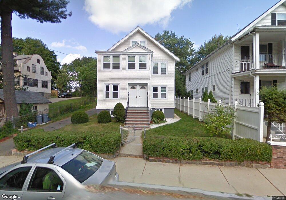
67 Oakland St Brighton, MA 02135
Brighton NeighborhoodEstimated Value: $1,084,000 - $1,176,000
4
Beds
2
Baths
2,421
Sq Ft
$472/Sq Ft
Est. Value
About This Home
This home is located at 67 Oakland St, Brighton, MA 02135 and is currently estimated at $1,143,319, approximately $472 per square foot. 67 Oakland St is a home located in Suffolk County with nearby schools including St Columbkille Partnership School, Shaloh House Jewish Day School, and Mesivta High School of Greater Boston.
Ownership History
Date
Name
Owned For
Owner Type
Purchase Details
Closed on
May 1, 2024
Sold by
Wu Jose
Bought by
Wu Ft Of 2024 and Wu
Current Estimated Value
Purchase Details
Closed on
Aug 26, 2010
Sold by
Tanaka Cecilia W and Wu Clement
Bought by
Wu Jose L and Wu King C
Purchase Details
Closed on
Oct 8, 2009
Sold by
Wu Jose L and Wu King C
Bought by
Tanaka Cecilia W and Wu Clement
Create a Home Valuation Report for This Property
The Home Valuation Report is an in-depth analysis detailing your home's value as well as a comparison with similar homes in the area
Home Values in the Area
Average Home Value in this Area
Purchase History
| Date | Buyer | Sale Price | Title Company |
|---|---|---|---|
| Wu Ft Of 2024 | -- | None Available | |
| Wu Ft Of 2024 | -- | None Available | |
| Wu Jose L | -- | -- | |
| Wu Jose L | -- | -- | |
| Tanaka Cecilia W | -- | -- | |
| Tanaka Cecilia W | -- | -- |
Source: Public Records
Mortgage History
| Date | Status | Borrower | Loan Amount |
|---|---|---|---|
| Previous Owner | Tanaka Cecilia W | $73,000 |
Source: Public Records
Tax History Compared to Growth
Tax History
| Year | Tax Paid | Tax Assessment Tax Assessment Total Assessment is a certain percentage of the fair market value that is determined by local assessors to be the total taxable value of land and additions on the property. | Land | Improvement |
|---|---|---|---|---|
| 2025 | $11,249 | $971,400 | $374,300 | $597,100 |
| 2024 | $10,752 | $986,400 | $336,500 | $649,900 |
| 2023 | $9,806 | $913,000 | $311,500 | $601,500 |
| 2022 | $9,284 | $853,300 | $291,100 | $562,200 |
| 2021 | $9,105 | $853,300 | $291,100 | $562,200 |
| 2020 | $8,933 | $845,900 | $257,500 | $588,400 |
| 2019 | $8,483 | $804,800 | $212,400 | $592,400 |
| 2018 | $7,954 | $759,000 | $212,400 | $546,600 |
| 2017 | $7,882 | $744,300 | $212,400 | $531,900 |
| 2016 | $7,311 | $664,600 | $212,400 | $452,200 |
| 2015 | $7,373 | $608,800 | $203,800 | $405,000 |
| 2014 | $6,529 | $519,000 | $203,800 | $315,200 |
Source: Public Records
Map
Nearby Homes
- 77 Bennett St Unit 2
- 83-85 Surrey St
- 461 Washington St Unit 301
- 30 Dighton St Unit 3
- 30 Dighton St
- 21 Upcrest Rd
- 71 Brooks St
- 21 Glenmont Rd
- 10 Waldo Terrace
- 59 Riverview Rd
- 12 Mina Way
- 10 Mina Way
- 2 Westminster Terrace
- 22 Bigelow St
- 18 Breck Ave Unit 18
- 427-435 Faneuil St Unit R4
- 11 Faneuil St
- 39 Champney St
- 34 Larch St Unit 34
- 32 Larch St Unit 34
- 67 Oakland St
- 67 Oakland St Unit 2
- 67 Oakland St Unit 1
- 65 Oakland St
- 65 Oakland St
- 65 Oakland St Unit B
- 65 Oakland St Unit 2
- 65 Oakland St Unit 1
- 63 Oakland St Unit 2
- 63 Oakland St Unit 1
- 63 Oakland St
- 63 Oakland St Unit B
- 71 Oakland St
- 66 Oakland St Unit 68
- 66 Oakland St Unit 2
- 106 Bennett St Unit 1
- 106 Bennett St Unit 2
- 106 Bennett St
- 106 Bennett St
- 62 Oakland St Unit 64