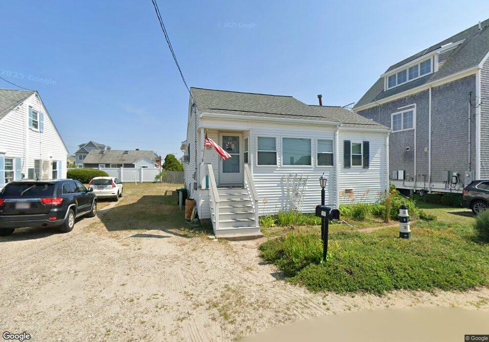
67 Parker St Marshfield, MA 02050
Ocean Bluff-Brant Rock NeighborhoodEstimated Value: $642,836 - $747,000
2
Beds
1
Bath
1,176
Sq Ft
$579/Sq Ft
Est. Value
About This Home
This home is located at 67 Parker St, Marshfield, MA 02050 and is currently estimated at $680,959, approximately $579 per square foot. 67 Parker St is a home located in Plymouth County with nearby schools including Daniel Webster, Furnace Brook Middle School, and Marshfield High School.
Create a Home Valuation Report for This Property
The Home Valuation Report is an in-depth analysis detailing your home's value as well as a comparison with similar homes in the area
Home Values in the Area
Average Home Value in this Area
Tax History
| Year | Tax Paid | Tax Assessment Tax Assessment Total Assessment is a certain percentage of the fair market value that is determined by local assessors to be the total taxable value of land and additions on the property. | Land | Improvement |
|---|---|---|---|---|
| 2025 | $5,566 | $562,200 | $317,600 | $244,600 |
| 2024 | $5,412 | $520,900 | $297,800 | $223,100 |
| 2023 | $5,078 | $462,000 | $268,000 | $194,000 |
| 2022 | $5,078 | $392,100 | $228,300 | $163,800 |
| 2021 | $4,792 | $363,300 | $218,400 | $144,900 |
| 2020 | $4,446 | $333,500 | $188,600 | $144,900 |
| 2019 | $4,326 | $323,300 | $188,600 | $134,700 |
| 2018 | $4,225 | $316,000 | $188,600 | $127,400 |
| 2017 | $3,954 | $288,200 | $178,700 | $109,500 |
| 2016 | $3,780 | $272,300 | $168,700 | $103,600 |
| 2015 | $3,619 | $272,300 | $168,700 | $103,600 |
| 2014 | $3,523 | $265,100 | $168,700 | $96,400 |
Source: Public Records
Map
Nearby Homes
- 255 Ridge Rd
- 1192 S River St
- 85 Constitution Rd
- 155 Quincy Ave
- 86 Telegraph Hill Rd
- 16 Schooner Way
- 566 Holly Rd
- 29 Spyglass Landing Dr
- 39 High Beacon Way
- 30 Chandler Dr
- 32 Gratto Rd
- 4 Summer St
- 3 Summer St
- 92 Salt Meadow Waye
- 7 Pierce Rd
- 42 Carr Rd
- 290 S River St
- 122 June St
- 78 Tower Ave
- 14 Ferry St
Your Personal Tour Guide
Ask me questions while you tour the home.