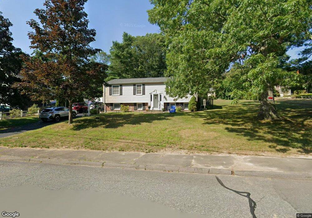
67 Peterson Path Marshfield, MA 02050
Estimated Value: $652,249 - $761,000
2
Beds
1
Bath
1,008
Sq Ft
$712/Sq Ft
Est. Value
About This Home
This home is located at 67 Peterson Path, Marshfield, MA 02050 and is currently estimated at $717,562, approximately $711 per square foot. 67 Peterson Path is a home located in Plymouth County with nearby schools including Governor Edward Winslow School, Furnace Brook Middle School, and Marshfield High School.
Ownership History
Date
Name
Owned For
Owner Type
Purchase Details
Closed on
Nov 20, 2024
Sold by
Omalley Catherine A
Bought by
Catherine O Malley Ft and Omalley
Current Estimated Value
Purchase Details
Closed on
Nov 26, 2002
Sold by
Pulsifer Erik C and Pulsifer Traci L
Bought by
Omalley Catherine A
Home Financials for this Owner
Home Financials are based on the most recent Mortgage that was taken out on this home.
Original Mortgage
$190,000
Interest Rate
6.07%
Mortgage Type
Purchase Money Mortgage
Purchase Details
Closed on
Jul 30, 1996
Sold by
Card Richard L and Card Marion D
Bought by
Pulsifer Erik C and Millett Traci L
Create a Home Valuation Report for This Property
The Home Valuation Report is an in-depth analysis detailing your home's value as well as a comparison with similar homes in the area
Home Values in the Area
Average Home Value in this Area
Purchase History
| Date | Buyer | Sale Price | Title Company |
|---|---|---|---|
| Catherine O Malley Ft | -- | None Available | |
| Catherine O Malley Ft | -- | None Available | |
| Omalley Catherine A | $358,000 | -- | |
| Omalley Catherine A | $358,000 | -- | |
| Pulsifer Erik C | $135,000 | -- |
Source: Public Records
Mortgage History
| Date | Status | Borrower | Loan Amount |
|---|---|---|---|
| Previous Owner | Pulsifer Erik C | $20,000 | |
| Previous Owner | Omalley Catherine A | $190,000 | |
| Previous Owner | Pulsifer Erik C | $166,000 |
Source: Public Records
Tax History
| Year | Tax Paid | Tax Assessment Tax Assessment Total Assessment is a certain percentage of the fair market value that is determined by local assessors to be the total taxable value of land and additions on the property. | Land | Improvement |
|---|---|---|---|---|
| 2025 | $5,734 | $579,200 | $302,900 | $276,300 |
| 2024 | $5,609 | $539,800 | $288,500 | $251,300 |
| 2023 | $5,080 | $475,600 | $257,600 | $218,000 |
| 2022 | $5,080 | $392,300 | $216,400 | $175,900 |
| 2021 | $4,999 | $379,000 | $216,400 | $162,600 |
| 2020 | $4,733 | $355,100 | $195,800 | $159,300 |
| 2019 | $4,625 | $345,700 | $195,800 | $149,900 |
| 2018 | $4,724 | $353,300 | $195,800 | $157,500 |
| 2017 | $4,570 | $333,100 | $195,800 | $137,300 |
| 2016 | $4,519 | $325,600 | $195,800 | $129,800 |
| 2015 | $4,327 | $325,600 | $195,800 | $129,800 |
| 2014 | $4,092 | $307,900 | $195,800 | $112,100 |
Source: Public Records
Map
Nearby Homes
- 86 Barouche Dr
- 116 Outlook Rd
- 184 King Phillips Pathe
- 431 Moraine St
- 242 Enterprise St
- 42 Carr Rd
- 7 Pierce Rd
- 32 Gratto Rd
- 30 Chandler Dr
- 6 Maple Ln
- 152 Acorn St
- 129 Franklin St
- 4 Rachael's Ln
- 92 Salt Meadow Waye
- 12 Rachael Ln
- 290 S River St
- 106 Careswell St
- 122 June St
- 74 Teakettle Ln
- 62 Teakettle Ln
- 110 Blackmount Dr
- 57 Peterson Path
- 114 Barouche Dr
- 70 Peterson Path
- 128 Barouche Dr
- 60 Peterson Path
- 74 Blackmount
- 104 Barouche Dr
- 45 Peterson Path
- 109 Blackmount Dr
- 80 Peterson Path
- 52 Peterson Path
- 95 Blackmount Dr
- 94 Barouche Dr
- 35 Peterson Path
- 13 Travelers Ln
- 82 Blackmount Dr
- 115 Barouche Dr
- 95 Peterson Path
- 92 Peterson Path
Your Personal Tour Guide
Ask me questions while you tour the home.