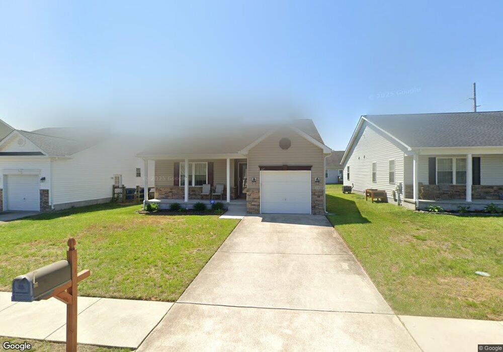
67 Red Chestnut Dr Unit 7 Camden Wyoming, DE 19934
Estimated Value: $312,978 - $329,000
3
Beds
2
Baths
1,520
Sq Ft
$212/Sq Ft
Est. Value
About This Home
This home is located at 67 Red Chestnut Dr Unit 7, Camden Wyoming, DE 19934 and is currently estimated at $322,245, approximately $212 per square foot. 67 Red Chestnut Dr Unit 7 is a home located in Kent County with nearby schools including W.B. Simpson Elementary School, Fred Fifer Middle School, and Caesar Rodney High School.
Ownership History
Date
Name
Owned For
Owner Type
Purchase Details
Closed on
Jun 20, 2019
Sold by
Gzym Roger L
Bought by
Deo Nancy L
Current Estimated Value
Home Financials for this Owner
Home Financials are based on the most recent Mortgage that was taken out on this home.
Original Mortgage
$56,000
Outstanding Balance
$49,238
Interest Rate
4.1%
Mortgage Type
New Conventional
Estimated Equity
$273,007
Purchase Details
Closed on
Feb 24, 2012
Sold by
Prime Developers Llc
Bought by
Gzym Roger L
Home Financials for this Owner
Home Financials are based on the most recent Mortgage that was taken out on this home.
Original Mortgage
$49,900
Interest Rate
3.88%
Mortgage Type
New Conventional
Purchase Details
Closed on
Aug 18, 2011
Sold by
The Greens At Wyoming Llc
Bought by
Prime Developers Llc
Create a Home Valuation Report for This Property
The Home Valuation Report is an in-depth analysis detailing your home's value as well as a comparison with similar homes in the area
Home Values in the Area
Average Home Value in this Area
Purchase History
| Date | Buyer | Sale Price | Title Company |
|---|---|---|---|
| Deo Nancy L | $189,900 | None Available | |
| Gzym Roger L | $149,900 | None Available | |
| Prime Developers Llc | -- | None Available |
Source: Public Records
Mortgage History
| Date | Status | Borrower | Loan Amount |
|---|---|---|---|
| Open | Deo Nancy L | $56,000 | |
| Previous Owner | Gzym Roger L | $49,900 |
Source: Public Records
Tax History Compared to Growth
Tax History
| Year | Tax Paid | Tax Assessment Tax Assessment Total Assessment is a certain percentage of the fair market value that is determined by local assessors to be the total taxable value of land and additions on the property. | Land | Improvement |
|---|---|---|---|---|
| 2025 | $720 | $291,500 | $64,200 | $227,300 |
| 2024 | $720 | $291,500 | $64,200 | $227,300 |
| 2023 | $611 | $38,800 | $3,200 | $35,600 |
| 2022 | $572 | $38,800 | $3,200 | $35,600 |
| 2021 | $568 | $38,800 | $3,200 | $35,600 |
| 2020 | $560 | $38,800 | $3,200 | $35,600 |
| 2019 | $354 | $38,800 | $3,200 | $35,600 |
| 2018 | $526 | $38,800 | $3,200 | $35,600 |
| 2017 | $514 | $38,800 | $0 | $0 |
| 2016 | $504 | $38,800 | $0 | $0 |
| 2015 | $677 | $38,800 | $0 | $0 |
| 2014 | $597 | $34,200 | $0 | $0 |
Source: Public Records
Map
Nearby Homes
- 162 Downey Oak Cir
- 58 Downey Oak Cir
- 111 Downey Oak Cir
- 54 Silver Fir Dr
- 49 Citrus Dr
- 118 Broad St
- 110 W Camden Wyoming Ave
- 0 Willow Grove Rd
- 12191 Willow Grove Rd
- 11939 Willow Grove Rd
- 109 Wesley St
- 15 Wesley St
- 68 Carey Ln Unit 15
- 12 Catts Ln Unit 21
- 24 S Stetson Ln Unit 210
- 21 Catts Ln Unit 27
- 705 Millet Ln
- 35 N Jerman Ln Unit 271
- 11 N Kimmer Ln Unit 265
- 107 S Hairgrove Ln Unit 86
- 67 Red Chestnut Dr
- 57 Red Chestnut Dr Unit 8
- 57 Red Chestnut Dr
- 47 Red Chestnut Dr
- 46 Buckthorn Dr
- 40 Buckthorn Dr
- 37 Red Chestnut Dr
- 32 Buckthorn Dr Unit 12
- 32 Buckthorn Dr
- 62 Red Chestnut Dr
- 52 Red Chestnut Dr
- 24 Buckthorn Dr
- 22 Buckthorn Dr
- 72 Red Chestnut Dr Unit 5
- 72 Red Chestnut Dr
- 42 Red Chestnut Dr
- 54 Buckthorn Dr
- 32 Red Chestnut Dr Unit 1
- 32 Red Chestnut Dr
- 33 Buckthorn Dr