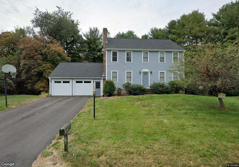
67 Robin Rd Leominster, MA 01453
Estimated Value: $585,000 - $638,000
3
Beds
3
Baths
1,972
Sq Ft
$309/Sq Ft
Est. Value
About This Home
This home is located at 67 Robin Rd, Leominster, MA 01453 and is currently estimated at $610,033, approximately $309 per square foot. 67 Robin Rd is a home located in Worcester County with nearby schools including Leominster High School, St. Anna Catholic School, and St. Leo School.
Ownership History
Date
Name
Owned For
Owner Type
Purchase Details
Closed on
Oct 28, 2022
Sold by
Stull Corey W and Stull Noreen R
Bought by
Stull Lt
Current Estimated Value
Purchase Details
Closed on
Sep 20, 2006
Sold by
Charlesworth Joanne E and Keleher Joanne E
Bought by
Stull Corey and Armstrong Noreen
Home Financials for this Owner
Home Financials are based on the most recent Mortgage that was taken out on this home.
Original Mortgage
$302,000
Interest Rate
6.59%
Mortgage Type
Purchase Money Mortgage
Purchase Details
Closed on
Jun 21, 1996
Sold by
Morrilly John T and Morrilly Beverly
Bought by
Charlesworth Stuart K and Keleher Joanne
Purchase Details
Closed on
May 26, 1994
Sold by
Brassard Frederick H and Brassard Maryann
Bought by
Morrilly John T and Morrilly Beverly
Create a Home Valuation Report for This Property
The Home Valuation Report is an in-depth analysis detailing your home's value as well as a comparison with similar homes in the area
Home Values in the Area
Average Home Value in this Area
Purchase History
| Date | Buyer | Sale Price | Title Company |
|---|---|---|---|
| Stull Lt | -- | None Available | |
| Stull Corey | $377,500 | -- | |
| Charlesworth Stuart K | $169,900 | -- | |
| Morrilly John T | $164,000 | -- |
Source: Public Records
Mortgage History
| Date | Status | Borrower | Loan Amount |
|---|---|---|---|
| Previous Owner | Morrilly John T | $299,000 | |
| Previous Owner | Stull Corey | $302,000 | |
| Previous Owner | Stull Corey | $15,500 | |
| Previous Owner | Morrilly John T | $129,000 |
Source: Public Records
Tax History Compared to Growth
Tax History
| Year | Tax Paid | Tax Assessment Tax Assessment Total Assessment is a certain percentage of the fair market value that is determined by local assessors to be the total taxable value of land and additions on the property. | Land | Improvement |
|---|---|---|---|---|
| 2025 | $7,002 | $499,100 | $155,200 | $343,900 |
| 2024 | $6,891 | $474,900 | $147,800 | $327,100 |
| 2023 | $6,528 | $420,100 | $128,600 | $291,500 |
| 2022 | $6,228 | $376,100 | $111,900 | $264,200 |
| 2021 | $5,963 | $328,900 | $87,000 | $241,900 |
| 2020 | $5,710 | $317,600 | $87,000 | $230,600 |
| 2019 | $5,597 | $301,900 | $82,700 | $219,200 |
| 2018 | $5,559 | $287,600 | $80,300 | $207,300 |
| 2017 | $5,382 | $272,800 | $75,000 | $197,800 |
| 2016 | $5,341 | $272,800 | $75,000 | $197,800 |
| 2015 | $4,922 | $253,200 | $75,000 | $178,200 |
| 2014 | $4,819 | $255,100 | $82,400 | $172,700 |
Source: Public Records
Map
Nearby Homes
- 15 Peach Tree Ln
- 35 Hill St
- 41 Hill St
- 871 Pleasant St
- 12 Walden Ct
- 46 Eugene St
- 47 Carolyn St
- 25 Crimson Ct
- 28 Dupont Cir
- 22 Naples St
- 24 Starling Way
- 98 Sylvan Ave
- 74 Crisci St
- 102 Chapman Place Unit 102
- 112 Overlook Dr
- 6 Argentine St
- 197 Chapman Place Unit 197
- 45 Tisdale St
- 76 Jamestown Rd
- 556 Central St Unit 4