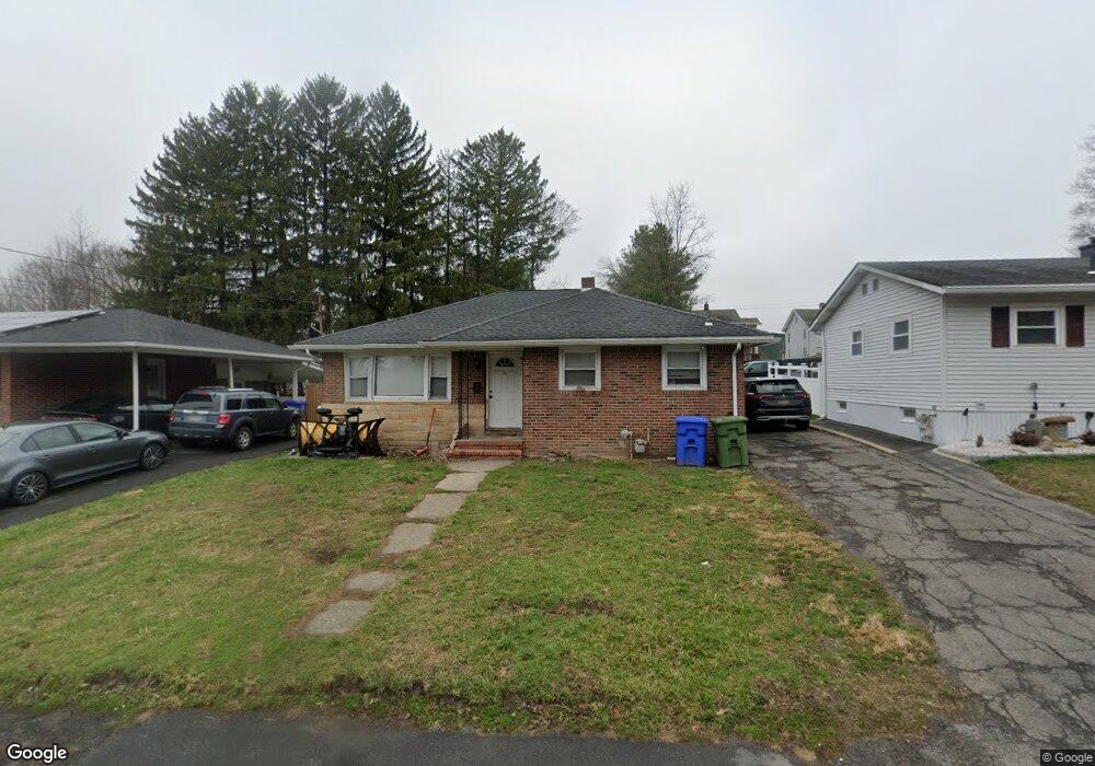
67 Sproat St Middletown, NY 10940
Estimated Value: $312,000 - $349,000
3
Beds
1
Bath
1,080
Sq Ft
$308/Sq Ft
Est. Value
About This Home
This home is located at 67 Sproat St, Middletown, NY 10940 and is currently estimated at $332,664, approximately $308 per square foot. 67 Sproat St is a home located in Orange County with nearby schools including Presidential Park Elementary School, Middletown Twin Towers Middle School, and Monhagen Middle School.
Ownership History
Date
Name
Owned For
Owner Type
Purchase Details
Closed on
Dec 13, 2021
Sold by
Deserio Dominick and Deserio Renate
Bought by
Scholl Steven
Current Estimated Value
Home Financials for this Owner
Home Financials are based on the most recent Mortgage that was taken out on this home.
Original Mortgage
$230,000
Outstanding Balance
$211,540
Interest Rate
3.11%
Mortgage Type
Stand Alone Refi Refinance Of Original Loan
Estimated Equity
$121,124
Purchase Details
Closed on
Jan 6, 2005
Sold by
William Fotino As Exec Of The Estate Of
Bought by
Huslinger Robert W
Create a Home Valuation Report for This Property
The Home Valuation Report is an in-depth analysis detailing your home's value as well as a comparison with similar homes in the area
Home Values in the Area
Average Home Value in this Area
Purchase History
| Date | Buyer | Sale Price | Title Company |
|---|---|---|---|
| Scholl Steven | $440,000 | None Available | |
| Huslinger Robert W | $190,600 | Patrica Cocchia |
Source: Public Records
Mortgage History
| Date | Status | Borrower | Loan Amount |
|---|---|---|---|
| Open | Scholl Steven | $230,000 |
Source: Public Records
Tax History Compared to Growth
Tax History
| Year | Tax Paid | Tax Assessment Tax Assessment Total Assessment is a certain percentage of the fair market value that is determined by local assessors to be the total taxable value of land and additions on the property. | Land | Improvement |
|---|---|---|---|---|
| 2024 | $6,836 | $24,900 | $6,100 | $18,800 |
| 2023 | $6,836 | $24,900 | $6,100 | $18,800 |
| 2022 | $6,695 | $24,900 | $6,100 | $18,800 |
| 2021 | $7,043 | $24,900 | $6,100 | $18,800 |
| 2020 | $2,884 | $24,900 | $6,100 | $18,800 |
| 2019 | $2,637 | $24,900 | $6,100 | $18,800 |
| 2018 | $5,420 | $23,400 | $6,100 | $17,300 |
| 2017 | $5,246 | $23,400 | $6,100 | $17,300 |
| 2016 | $5,279 | $23,400 | $6,100 | $17,300 |
| 2015 | -- | $23,400 | $6,100 | $17,300 |
| 2014 | -- | $23,400 | $6,100 | $17,300 |
Source: Public Records
Map
Nearby Homes
- 80 Beattie Ave
- 105 Sheffield Dr
- 39 Harrison St
- 9 Albert St
- 115 Vincent Dr
- 30 Royce Ave
- 38 Sheffield Dr
- 37 Wisner Ave Unit 39
- 1 Polly Kay Dr
- 3 Chappell Pkwy
- 203 Highland Ave
- 127 Watkins Ave Unit 129
- 47 Prince St
- 13 Smith St
- 92 Linden Ave
- 31 Beattie Ave
- 71 Watkins Ave
- 55 Prince St
- 7 Roosevelt Ave
- 71 Commonwealth Ave
- 69 Sproat St
- 204 Cottage St
- 63 Sproat St
- 65 Sproat St
- 71 Sproat St
- 206 Cottage St
- 61 Sproat St Unit 63
- 210 Cottage St
- 73 Sproat St Unit 75
- 212 Cottage St
- 92 Sproat St
- 76 Sproat St Unit 78
- 214 Cottage St Unit 216
- 59 Sproat St
- 200 Cottage St
- 68 Sproat St
- 218 Cottage St
- 57 Sproat St
- 196 Cottage St
- 70 Sproat St