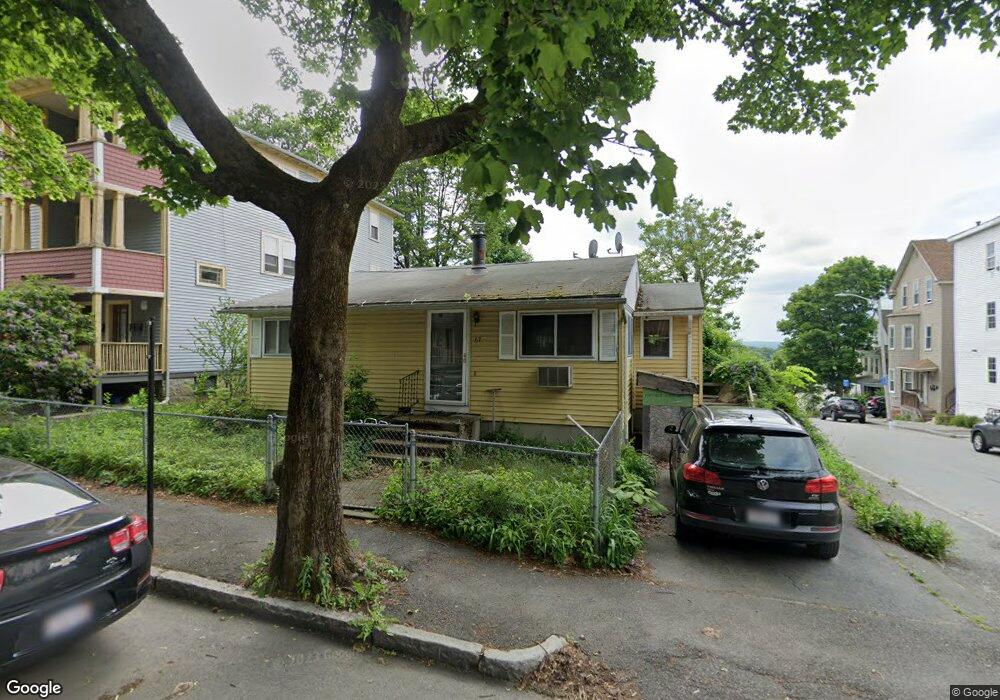
67 Stanton St Worcester, MA 01605
Bell Hill NeighborhoodEstimated Value: $241,000 - $310,000
2
Beds
1
Bath
720
Sq Ft
$403/Sq Ft
Est. Value
About This Home
This home is located at 67 Stanton St, Worcester, MA 01605 and is currently estimated at $290,464, approximately $403 per square foot. 67 Stanton St is a home located in Worcester County with nearby schools including Jacob Hiatt Magnet School, Chandler Magnet, and Worcester East Middle School.
Ownership History
Date
Name
Owned For
Owner Type
Purchase Details
Closed on
May 27, 1994
Sold by
Fhlmc
Bought by
Cameron Robert O
Current Estimated Value
Home Financials for this Owner
Home Financials are based on the most recent Mortgage that was taken out on this home.
Original Mortgage
$27,000
Interest Rate
8.22%
Mortgage Type
Purchase Money Mortgage
Purchase Details
Closed on
Apr 2, 1993
Sold by
Dutile Dinae M and Federal Home Loan Mortgage Cor
Bought by
Fhlmc
Purchase Details
Closed on
Nov 2, 1987
Sold by
Hunter Audrey J
Bought by
Bloksberg Wm R
Home Financials for this Owner
Home Financials are based on the most recent Mortgage that was taken out on this home.
Original Mortgage
$95,900
Interest Rate
10.97%
Mortgage Type
Purchase Money Mortgage
Create a Home Valuation Report for This Property
The Home Valuation Report is an in-depth analysis detailing your home's value as well as a comparison with similar homes in the area
Home Values in the Area
Average Home Value in this Area
Purchase History
| Date | Buyer | Sale Price | Title Company |
|---|---|---|---|
| Cameron Robert O | $47,000 | -- | |
| Fhlmc | $108,177 | -- | |
| Bloksberg Wm R | $101,000 | -- |
Source: Public Records
Mortgage History
| Date | Status | Borrower | Loan Amount |
|---|---|---|---|
| Closed | Bloksberg Wm R | $27,000 | |
| Previous Owner | Bloksberg Wm R | $95,900 |
Source: Public Records
Tax History
| Year | Tax Paid | Tax Assessment Tax Assessment Total Assessment is a certain percentage of the fair market value that is determined by local assessors to be the total taxable value of land and additions on the property. | Land | Improvement |
|---|---|---|---|---|
| 2025 | $3,418 | $259,100 | $81,200 | $177,900 |
| 2024 | $3,347 | $243,400 | $81,200 | $162,200 |
| 2023 | $3,237 | $225,700 | $70,600 | $155,100 |
| 2022 | $2,872 | $188,800 | $56,500 | $132,300 |
| 2021 | $2,701 | $165,900 | $45,200 | $120,700 |
| 2020 | $2,640 | $155,300 | $44,900 | $110,400 |
| 2019 | $2,462 | $136,800 | $39,200 | $97,600 |
| 2018 | $2,390 | $126,400 | $39,200 | $87,200 |
| 2017 | $2,383 | $124,000 | $39,200 | $84,800 |
| 2016 | $2,321 | $112,600 | $28,300 | $84,300 |
| 2015 | $2,260 | $112,600 | $28,300 | $84,300 |
| 2014 | $2,200 | $112,600 | $28,300 | $84,300 |
Source: Public Records
Map
Nearby Homes
- 67 Rodney St
- 109 Merrifield St
- 38 Johnson St
- Lot 2 Ararat
- 256 Belmont St
- 25 Johnson St
- 24 Catharine St
- 107 Eastern Ave
- 29 Chilmark St
- 26 Orne St
- 28 Adams St Unit 304
- 21 Kendall St
- 82 Green Hill Pkwy
- 1 Verdi Rd
- 78 Green Hill Pkwy
- 74 Green Hill Pkwy
- 78 Gage St
- 47 Laurel St
- 247 Shrewsbury St
- 3 Perkins St
- 61 Stanton St
- 59 Stanton St
- 71 Stanton St
- 19 Vinson St
- 19 Vinson St Unit 2
- 19 Vinson St Unit 1
- 19 Vinson St Unit 3
- 19 Vinson St Unit Varies
- 50 Everard St
- 50 Everard St Unit 1
- 50 Everard St Unit 2
- 50 Everard St Unit 3
- 48 Everard St
- 26 Vinson St Unit 3
- 26 Vinson St Unit 2
- 26 Vinson St Unit 1
- 26 Vinson St
- 55 Stanton St
- 55 Stanton St Unit 1
- 46 Everard St
Your Personal Tour Guide
Ask me questions while you tour the home.