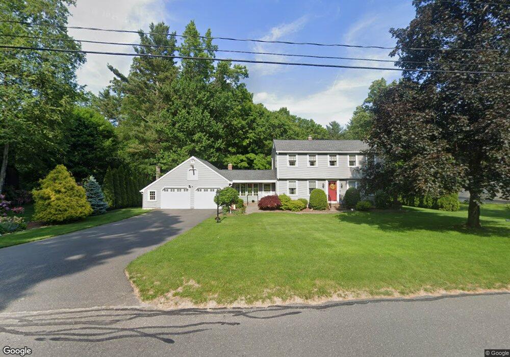
67 Strong Rd Southampton, MA 01073
Estimated Value: $462,000 - $558,000
4
Beds
2
Baths
2,092
Sq Ft
$238/Sq Ft
Est. Value
About This Home
This home is located at 67 Strong Rd, Southampton, MA 01073 and is currently estimated at $497,685, approximately $237 per square foot. 67 Strong Rd is a home located in Hampshire County with nearby schools including William E Norris School, White Oak School, and Westfield Christian Academy.
Ownership History
Date
Name
Owned For
Owner Type
Purchase Details
Closed on
May 28, 2010
Sold by
Benware John T and Benware Joanne A
Bought by
Benware Tr John T and Benware Joanne A
Current Estimated Value
Purchase Details
Closed on
Oct 9, 1979
Bought by
Benware John T
Create a Home Valuation Report for This Property
The Home Valuation Report is an in-depth analysis detailing your home's value as well as a comparison with similar homes in the area
Home Values in the Area
Average Home Value in this Area
Purchase History
| Date | Buyer | Sale Price | Title Company |
|---|---|---|---|
| Benware Tr John T | -- | -- | |
| Benware John T | -- | -- |
Source: Public Records
Mortgage History
| Date | Status | Borrower | Loan Amount |
|---|---|---|---|
| Previous Owner | Benware John T | $60,000 | |
| Previous Owner | Benware John T | $120,000 | |
| Previous Owner | Benware John T | $20,000 |
Source: Public Records
Tax History
| Year | Tax Paid | Tax Assessment Tax Assessment Total Assessment is a certain percentage of the fair market value that is determined by local assessors to be the total taxable value of land and additions on the property. | Land | Improvement |
|---|---|---|---|---|
| 2025 | $5,334 | $376,400 | $95,100 | $281,300 |
| 2024 | $5,178 | $363,400 | $95,100 | $268,300 |
| 2023 | $4,813 | $335,900 | $95,100 | $240,800 |
| 2022 | $4,590 | $304,600 | $85,900 | $218,700 |
| 2021 | $4,302 | $269,400 | $78,800 | $190,600 |
| 2020 | $4,262 | $269,400 | $78,800 | $190,600 |
| 2019 | $4,135 | $253,500 | $78,800 | $174,700 |
| 2018 | $3,907 | $233,700 | $70,800 | $162,900 |
| 2017 | $3,814 | $233,700 | $70,800 | $162,900 |
| 2015 | $3,585 | $228,200 | $64,300 | $163,900 |
Source: Public Records
Map
Nearby Homes
- Lot 92-00 White Loaf Rd
- 119 Brickyard Rd
- Lot 5 Brickyard Rd
- Lot 5 Gil Farm Rd
- Lot 6 Gil Farm Rd
- 36 County Rd
- 21 Old County Rd
- 150 Middle Rd
- 94 Pequot Rd (Rear)
- 45 Jaeger Dr
- 19 Cottage Ave
- 48 Gunn Rd
- 36 Line St
- 95 Gunn Rd
- 1 Plain St
- Lot 3 Mountain Rd
- 37 Sun Valley Rd
- 178 Falcon Dr
- 38 College Hwy
- 7 Western View Rd
Your Personal Tour Guide
Ask me questions while you tour the home.