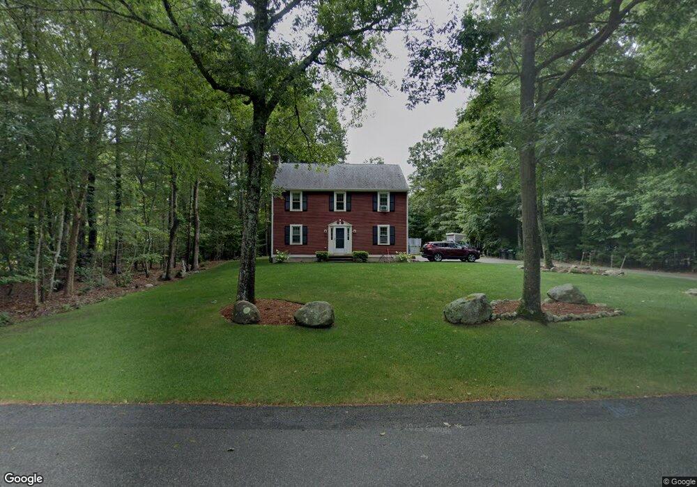
67 Woodbrook Ln Hanson, MA 02341
Estimated Value: $568,000 - $661,000
3
Beds
3
Baths
1,700
Sq Ft
$358/Sq Ft
Est. Value
About This Home
This home is located at 67 Woodbrook Ln, Hanson, MA 02341 and is currently estimated at $608,128, approximately $357 per square foot. 67 Woodbrook Ln is a home located in Plymouth County.
Ownership History
Date
Name
Owned For
Owner Type
Purchase Details
Closed on
May 29, 2019
Sold by
Mcdonough Paul F and Mcdonough Bernadette
Bought by
Mcdonough Ft and Taylor
Current Estimated Value
Purchase Details
Closed on
Jun 21, 1995
Sold by
Gamsby Joanne E
Bought by
Mcdonough Paul F and Mcdonough Bernadette
Home Financials for this Owner
Home Financials are based on the most recent Mortgage that was taken out on this home.
Original Mortgage
$132,400
Interest Rate
7.82%
Mortgage Type
Purchase Money Mortgage
Create a Home Valuation Report for This Property
The Home Valuation Report is an in-depth analysis detailing your home's value as well as a comparison with similar homes in the area
Home Values in the Area
Average Home Value in this Area
Purchase History
| Date | Buyer | Sale Price | Title Company |
|---|---|---|---|
| Mcdonough Ft | -- | -- | |
| Mcdonough Ft | -- | -- | |
| Mcdonough Paul F | $165,500 | -- | |
| Mcdonough Paul F | $165,500 | -- |
Source: Public Records
Mortgage History
| Date | Status | Borrower | Loan Amount |
|---|---|---|---|
| Previous Owner | Mcdonough Paul F | $10,000 | |
| Previous Owner | Mcdonough Paul F | $142,500 | |
| Previous Owner | Mcdonough Paul F | $20,000 | |
| Previous Owner | Mcdonough Paul F | $132,400 |
Source: Public Records
Tax History Compared to Growth
Tax History
| Year | Tax Paid | Tax Assessment Tax Assessment Total Assessment is a certain percentage of the fair market value that is determined by local assessors to be the total taxable value of land and additions on the property. | Land | Improvement |
|---|---|---|---|---|
| 2025 | $6,746 | $504,200 | $182,400 | $321,800 |
| 2024 | $6,606 | $493,700 | $177,100 | $316,600 |
| 2023 | $6,426 | $453,200 | $177,100 | $276,100 |
| 2022 | $6,270 | $415,500 | $161,000 | $254,500 |
| 2021 | $5,614 | $371,800 | $154,800 | $217,000 |
| 2020 | $5,531 | $362,200 | $149,600 | $212,600 |
| 2019 | $5,540 | $356,700 | $160,600 | $196,100 |
| 2018 | $5,471 | $345,600 | $154,500 | $191,100 |
| 2017 | $5,299 | $331,600 | $147,100 | $184,500 |
| 2016 | $5,394 | $325,900 | $147,100 | $178,800 |
| 2015 | $4,997 | $313,900 | $147,100 | $166,800 |
Source: Public Records
Map
Nearby Homes
- 168 Spring St
- 248 E Washington St
- 418 E Washington St
- 13 Hayford Trail Unit 15
- 12 Hayford Trail Unit 17
- 5 Hayford Trail Unit 11
- 7 Hayford Trail Unit 12
- 22 Howland Trail Unit 34
- 33 Tavern Way
- Lot 5 Princeton Way
- 842 Whitman St
- 57 Liberty St
- 417 Birchbark Dr
- 1057 Whitman St
- 37 Brook St
- 842 E Washington St
- 55 Plymouth St Unit A5
- 154 Winter St
- 131 Holly Ridge Dr
- 41 Gail Rd
- 95 Woodbrook Ln
- 55 Woodbrook Ln
- 47 Woodbrook Ln
- 76 Woodbrook Ln
- 64 Woodbrook Ln
- 52 Woodbrook Ln
- 136 Woodbrook Ln
- 88 Woodbrook Ln
- 100 Woodbrook Ln
- 124 Woodbrook Ln
- 112 Woodbrook Ln
- 9 Woodbrook Ln
- 12 Commons Ln
- 40 Woodbrook Ln
- 31 Woodbrook Ln
- 7 Commons Ln
- 500 Whitman St
- 11 Commons Ln
- 28 Woodbrook Ln
- 28 Commons Ln