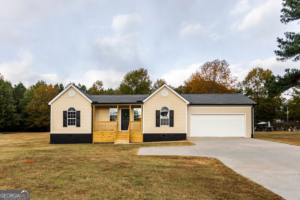
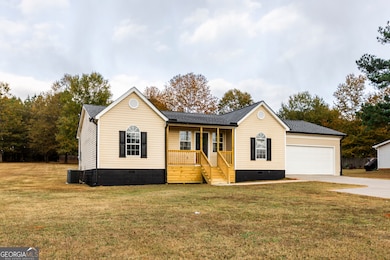
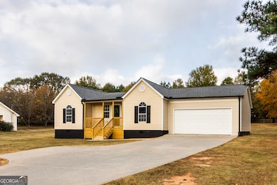
670 E Hightower Trail Social Circle, GA 30025
Estimated payment $1,697/month
Highlights
- Hot Property
- Traditional Architecture
- Laundry in Mud Room
- Deck
- No HOA
- Cooling Available
About This Home
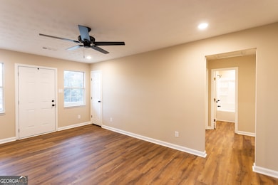
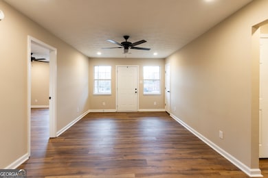
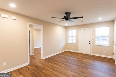
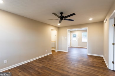
This home has been recently renovated and ready for a brand new owner! The home features LVP flooring throughout the home, NO carpet. From the front porch, you will be welcome into the living room that leads into a large kitchen/dining room. Kitchen features painted cabinetry, quartz countertops, stainless steel appliances and tile backsplash. Huge laundry room with tons of storage room. Spacious master bedroom with walk in closet, full ensuite bathroom with full tile shower. Two additional bedrooms and a full bathroom on the left side of the home. Deck on the back porch overlooks a LARGE backyard! Come see this one today.
Home Details
Home Type
- Single Family
Est. Annual Taxes
- $3,015
Year Built
- Built in 1997 | Remodeled
Lot Details
- 0.78 Acre Lot
- Level Lot
Home Design
- Traditional Architecture
- Composition Roof
- Vinyl Siding
Interior Spaces
- 1,467 Sq Ft Home
- 1-Story Property
- Laminate Flooring
- Crawl Space
Kitchen
- Oven or Range
- Dishwasher
Bedrooms and Bathrooms
- 3 Main Level Bedrooms
- Split Bedroom Floorplan
- 2 Full Bathrooms
Laundry
- Laundry in Mud Room
- Laundry Room
Outdoor Features
- Deck
Schools
- Social Circle Primary/Elementa Elementary School
- Social Circle Middle School
- Social Circle High School
Utilities
- Cooling Available
- Heating Available
- Electric Water Heater
- High Speed Internet
Community Details
- No Home Owners Association
Map
Home Values in the Area
Average Home Value in this Area
Tax History
| Year | Tax Paid | Tax Assessment Tax Assessment Total Assessment is a certain percentage of the fair market value that is determined by local assessors to be the total taxable value of land and additions on the property. | Land | Improvement |
|---|---|---|---|---|
| 2024 | $3,015 | $84,760 | $17,600 | $67,160 |
| 2023 | $2,862 | $79,160 | $15,840 | $63,320 |
| 2022 | $724 | $69,480 | $14,080 | $55,400 |
| 2021 | $599 | $57,520 | $9,680 | $47,840 |
| 2020 | $571 | $53,480 | $7,480 | $46,000 |
| 2019 | $535 | $45,640 | $7,480 | $38,160 |
| 2018 | $498 | $45,640 | $7,480 | $38,160 |
| 2017 | $1,690 | $40,440 | $5,720 | $34,720 |
| 2016 | $395 | $34,920 | $5,720 | $29,200 |
| 2015 | $344 | $30,560 | $5,720 | $24,840 |
| 2014 | $310 | $26,120 | $5,720 | $20,400 |
Property History
| Date | Event | Price | List to Sale | Price per Sq Ft |
|---|---|---|---|---|
| 11/12/2025 11/12/25 | For Sale | $274,900 | -- | $187 / Sq Ft |
Purchase History
| Date | Type | Sale Price | Title Company |
|---|---|---|---|
| Deed | $87,900 | -- |
Mortgage History
| Date | Status | Loan Amount | Loan Type |
|---|---|---|---|
| Open | $87,900 | New Conventional |
Source: Georgia MLS
MLS Number: 10641857
APN: SC16000000011C00
Disclaimer: Certain information contained herein is derived from information provided by parties other than Homes.com. All information provided is deemed reliable, but is not guaranteed to be accurate and should be independently verified.
![]() The data relating to real estate for sale on this web site comes in part from the Broker Reciprocity Program of Georgia MLS. Real estate listings held by brokerage firms other than Redfin are marked with the Broker Reciprocity logo and detailed information about them includes the name of the listing brokers. Information deemed reliable but not guaranteed. Copyright 2025 Georgia MLS. All rights reserved.
The data relating to real estate for sale on this web site comes in part from the Broker Reciprocity Program of Georgia MLS. Real estate listings held by brokerage firms other than Redfin are marked with the Broker Reciprocity logo and detailed information about them includes the name of the listing brokers. Information deemed reliable but not guaranteed. Copyright 2025 Georgia MLS. All rights reserved.
- 133 Dove Landing
- 0 Thurman Baccus Rd Unit 10438526
- 278 Woodfin
- 339 Woodfin Way
- 345 Woodfin Way
- 232 Orwell Dr Unit 99
- 232 Orwell Dr
- 246 Orwell Dr
- 218 Orwell Dr Unit 100
- 218 Orwell Dr
- 204 Orwell Dr
- 330 Orwell Dr
- 341 Boxwood St
- 178 Orwell Dr
- 231 Orwell Dr
- 432 Chestnut St
- 257 Orwell Dr Unit 48
- 245 Orwell Dr
- 217 Orwell Dr
- 303 Dove Point
- 764 Dove Tree Ln
- 111 Elder Dr
- 1020 Joseph Ln
- 253 Marco Dr
- 685 Meadows Ln
- 1540 Lipscomb Rd
- 20 Willow Woods Rd
- 21 Willow Woods Rd
- 150 Kay Cir
- 175 E Main St Unit B
- 220 Alcovy Way
- 170 Mandy Ln
- 130 Mandy Ln
- 225 Riverbend Dr
- 30 Pratt Dr
- 110 Otelia Ln
- 10196 Waterford Rd NE
- 10235 Waterford Rd NE
- 10144 Henderson Dr
