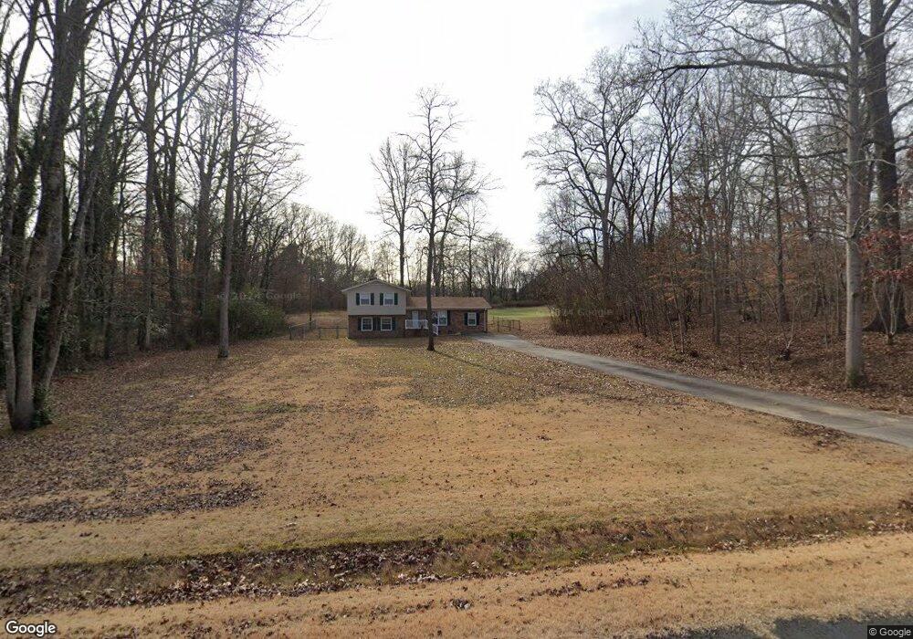
670 Independence Dr Roebuck, SC 29376
Estimated Value: $257,575 - $299,000
3
Beds
2
Baths
1,713
Sq Ft
$162/Sq Ft
Est. Value
About This Home
This home is located at 670 Independence Dr, Roebuck, SC 29376 and is currently estimated at $277,394, approximately $161 per square foot. 670 Independence Dr is a home located in Spartanburg County with nearby schools including Dorman High School Freshman Campus and Dorman High School.
Ownership History
Date
Name
Owned For
Owner Type
Purchase Details
Closed on
Dec 14, 2024
Sold by
Johnson Donna G
Bought by
Johnson Roger P
Current Estimated Value
Purchase Details
Closed on
Mar 19, 2024
Sold by
Johnson Roger P
Bought by
Johnson Roger P and Vaughn George India
Purchase Details
Closed on
Mar 12, 2024
Sold by
Johnson Roger P
Bought by
Johnson Roger P
Create a Home Valuation Report for This Property
The Home Valuation Report is an in-depth analysis detailing your home's value as well as a comparison with similar homes in the area
Home Values in the Area
Average Home Value in this Area
Purchase History
| Date | Buyer | Sale Price | Title Company |
|---|---|---|---|
| Johnson Roger P | -- | None Listed On Document | |
| Johnson Roger P | -- | None Listed On Document | |
| Johnson Roger P | -- | None Listed On Document | |
| Johnson Roger P | -- | None Listed On Document |
Source: Public Records
Tax History Compared to Growth
Tax History
| Year | Tax Paid | Tax Assessment Tax Assessment Total Assessment is a certain percentage of the fair market value that is determined by local assessors to be the total taxable value of land and additions on the property. | Land | Improvement |
|---|---|---|---|---|
| 2025 | $805 | $6,046 | $1,096 | $4,950 |
| 2024 | $805 | $6,046 | $1,096 | $4,950 |
| 2023 | $805 | $6,046 | $1,096 | $4,950 |
| 2022 | $674 | $5,258 | $1,053 | $4,205 |
| 2021 | $667 | $5,258 | $1,053 | $4,205 |
| 2020 | $648 | $5,258 | $1,053 | $4,205 |
| 2019 | $632 | $5,258 | $1,053 | $4,205 |
| 2018 | $634 | $5,258 | $1,053 | $4,205 |
| 2017 | $506 | $4,572 | $1,000 | $3,572 |
| 2016 | $517 | $4,572 | $1,000 | $3,572 |
| 2015 | $495 | $4,520 | $1,000 | $3,520 |
| 2014 | $819 | $4,520 | $1,000 | $3,520 |
Source: Public Records
Map
Nearby Homes
- 0 Independence Ct
- 365 Guernsey Ln
- 0 Stone Station Rd
- 583 Chattooga Rd
- 120 State Road S-42-9962
- 310 Templeton Dr
- 707 Tallulah Ct
- 409 Balfour Rd
- 379 Lawtonwood Ln
- 408 Congaree Rd
- 511 Chattooga Rd
- 387 Congaree Rd
- 129 John Lancaster Rd
- 375 N Timm Creek Ave
- 100 Caroline Dr
- 811 S Edisto River Dr
- 635 Mcabee Rd
- 212 Reedy River Ct
- 215 Reedy River Ct
- 161 Caroline Dr
- 650 Independence Dr
- 680 Independence Dr
- 665 Independence Dr
- 681 Independence Dr
- 640 Independence Dr
- 639 Independence Dr
- 3159 Stone Station Rd
- 699 Independence Dr
- 3149 Stone Station Rd
- 625 Independence Dr
- 150 Patriot Rd
- 3139 Stone Station Rd
- 3119 Stone Station Rd
- 3179 Stone Station Rd
- 115 Otts Shoals Rd (Lot 1)
- 115 Otts Shoals Rd
- 199 Patriot Rd
- 125 Otts Shoals Rd
- 125 Otts Shoals Rd (Lot 2)
- 599 Independence Dr