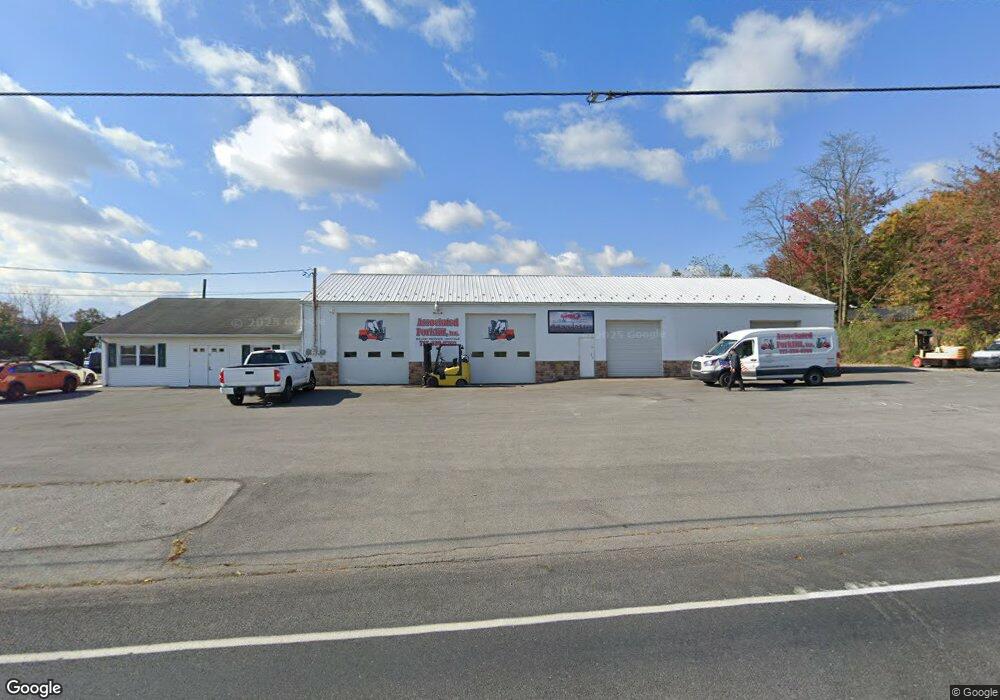
670 Longs Gap Rd Carlisle, PA 17013
Estimated Value: $566,571
--
Bed
--
Bath
6,960
Sq Ft
$81/Sq Ft
Est. Value
About This Home
This home is located at 670 Longs Gap Rd, Carlisle, PA 17013 and is currently estimated at $566,571, approximately $81 per square foot. 670 Longs Gap Rd is a home located in Cumberland County with nearby schools including Crestview Elementary School, Wilson Middle School, and Carlisle Area High School.
Ownership History
Date
Name
Owned For
Owner Type
Purchase Details
Closed on
Apr 24, 2024
Sold by
Carr Theresa A
Bought by
Carr James L
Current Estimated Value
Purchase Details
Closed on
Jun 1, 2018
Sold by
Fob Properties Llc A Pennsylvania Limite
Bought by
Carr James L and Carr Theresa Ann
Purchase Details
Closed on
Dec 21, 2012
Sold by
M & J Explosives Inc
Bought by
Fob Properties Llc
Home Financials for this Owner
Home Financials are based on the most recent Mortgage that was taken out on this home.
Original Mortgage
$180,000
Interest Rate
3.35%
Mortgage Type
Construction
Purchase Details
Closed on
Sep 26, 2003
Sold by
Garman Earl P
Bought by
M And J Explosives Inc
Create a Home Valuation Report for This Property
The Home Valuation Report is an in-depth analysis detailing your home's value as well as a comparison with similar homes in the area
Home Values in the Area
Average Home Value in this Area
Purchase History
| Date | Buyer | Sale Price | Title Company |
|---|---|---|---|
| Carr James L | -- | None Listed On Document | |
| Carr James L | $360,000 | None Available | |
| Fob Properties Llc | $225,000 | -- | |
| M And J Explosives Inc | $160,000 | -- |
Source: Public Records
Mortgage History
| Date | Status | Borrower | Loan Amount |
|---|---|---|---|
| Previous Owner | Fob Properties Llc | $180,000 |
Source: Public Records
Tax History Compared to Growth
Tax History
| Year | Tax Paid | Tax Assessment Tax Assessment Total Assessment is a certain percentage of the fair market value that is determined by local assessors to be the total taxable value of land and additions on the property. | Land | Improvement |
|---|---|---|---|---|
| 2025 | $5,238 | $250,000 | $90,900 | $159,100 |
| 2024 | $5,039 | $250,000 | $90,900 | $159,100 |
| 2023 | $4,856 | $250,000 | $90,900 | $159,100 |
| 2022 | $4,778 | $250,000 | $90,900 | $159,100 |
| 2021 | $4,701 | $250,000 | $90,900 | $159,100 |
| 2020 | $4,590 | $250,000 | $90,900 | $159,100 |
| 2019 | $4,481 | $250,000 | $90,900 | $159,100 |
| 2018 | $4,364 | $250,000 | $90,900 | $159,100 |
| 2017 | $4,265 | $250,000 | $90,900 | $159,100 |
| 2016 | -- | $250,000 | $90,900 | $159,100 |
| 2015 | -- | $250,000 | $90,900 | $159,100 |
| 2014 | -- | $250,000 | $90,900 | $159,100 |
Source: Public Records
Map
Nearby Homes
- 514 Longs Gap Rd
- 20 Stony Creek Ct
- 117 Pearl Dr
- 203 Cumberland Dr
- 125 Channel Dr
- 145 Long View
- 1312 Pheasant Dr S
- 1698 Douglas Dr
- 215 West View
- 145 Tower Cir
- 4 Over View
- 116 Blue Mountain Blvd
- 114 Blue Mountain Blvd
- 111 Blue Mountain Blvd
- 111 Lakeview Dr
- 00 S Mountain Dr
- 121 S Mountain Dr
- Magnolia Plan at Mountain View Estates
- Madison Plan at Mountain View Estates
- Charlotte Plan at Mountain View Estates