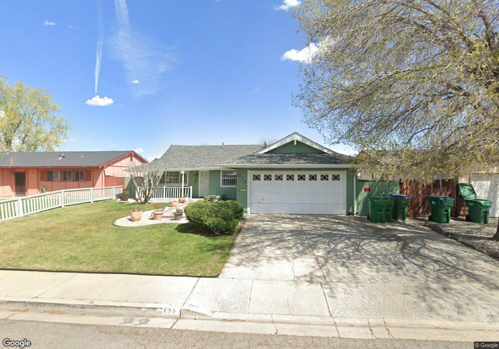
670 Teel St Sparks, NV 89431
McCarran Boulevard-Probasco NeighborhoodEstimated Value: $399,345 - $460,000
4
Beds
2
Baths
1,404
Sq Ft
$316/Sq Ft
Est. Value
About This Home
This home is located at 670 Teel St, Sparks, NV 89431 and is currently estimated at $443,336, approximately $315 per square foot. 670 Teel St is a home located in Washoe County with nearby schools including Lincoln Park Elementary School, George L Dilworth Middle School, and Sparks High School.
Ownership History
Date
Name
Owned For
Owner Type
Purchase Details
Closed on
Jun 19, 2012
Sold by
Garcia Tomas and Garcia Gloria
Bought by
Garcia Tomas and Garcia Gloria
Current Estimated Value
Purchase Details
Closed on
Nov 17, 1994
Sold by
Sosnowski Henry and Sosnowski Donna
Bought by
Garcia Tomas and Garcia Gloria
Home Financials for this Owner
Home Financials are based on the most recent Mortgage that was taken out on this home.
Original Mortgage
$84,750
Interest Rate
5.5%
Create a Home Valuation Report for This Property
The Home Valuation Report is an in-depth analysis detailing your home's value as well as a comparison with similar homes in the area
Home Values in the Area
Average Home Value in this Area
Purchase History
| Date | Buyer | Sale Price | Title Company |
|---|---|---|---|
| Garcia Tomas | -- | None Available | |
| Garcia Tomas | $113,000 | First Centennial Title Co |
Source: Public Records
Mortgage History
| Date | Status | Borrower | Loan Amount |
|---|---|---|---|
| Closed | Garcia Tomas | $84,750 |
Source: Public Records
Tax History Compared to Growth
Tax History
| Year | Tax Paid | Tax Assessment Tax Assessment Total Assessment is a certain percentage of the fair market value that is determined by local assessors to be the total taxable value of land and additions on the property. | Land | Improvement |
|---|---|---|---|---|
| 2025 | $882 | $54,897 | $33,565 | $21,332 |
| 2024 | $882 | $51,053 | $30,065 | $20,988 |
| 2023 | $0 | $50,771 | $31,325 | $19,446 |
| 2022 | $833 | $42,042 | $26,180 | $15,862 |
| 2021 | $809 | $33,401 | $17,955 | $15,446 |
| 2020 | $782 | $32,091 | $16,940 | $15,151 |
| 2019 | $759 | $30,380 | $15,890 | $14,490 |
| 2018 | $738 | $25,631 | $11,725 | $13,906 |
| 2017 | $717 | $24,071 | $10,395 | $13,676 |
| 2016 | $699 | $23,028 | $9,345 | $13,683 |
| 2015 | $178 | $21,110 | $7,700 | $13,410 |
| 2014 | $677 | $19,879 | $6,440 | $13,439 |
| 2013 | -- | $18,051 | $4,270 | $13,781 |
Source: Public Records
Map
Nearby Homes
- 10 Lincoln Way
- 360 E Lincoln Way
- 300 I St
- 385 Gleeson Way
- 345 H St
- 445 Pine Meadows Dr Unit E25
- 560 Nichols Blvd
- 601 Oakwood Dr Unit 4
- 370 O'Brien Way
- 611 Oakwood Dr Unit 1
- 604 Oakwood Dr Unit 1
- 644 Oakwood Dr Unit 2
- 400 4th St
- 684 Oakwood Dr Unit 3
- 402 5th St
- 8 E O St
- 848 Parkside Dr Unit 1
- 1703 1st St
- 324 Victorian Ave
- 801 Woodglen Dr Unit 2