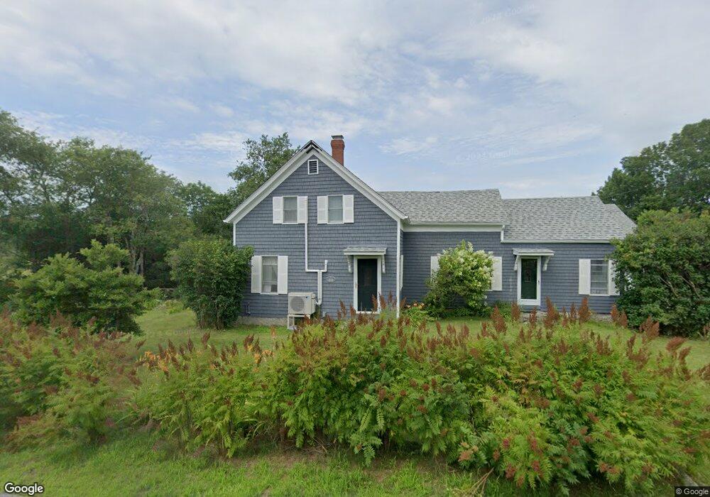
670 the Shore Rd Castine, ME 04421
Estimated Value: $321,120 - $518,000
--
Bed
--
Bath
--
Sq Ft
5.15
Acres
About This Home
This home is located at 670 the Shore Rd, Castine, ME 04421 and is currently estimated at $420,030. 670 the Shore Rd is a home located in Hancock County with nearby schools including Adams School.
Ownership History
Date
Name
Owned For
Owner Type
Purchase Details
Closed on
Jun 30, 2021
Sold by
Ackerman Jeffrey D
Bought by
Sawyer Mark Z and Sawyer Rachel M
Current Estimated Value
Home Financials for this Owner
Home Financials are based on the most recent Mortgage that was taken out on this home.
Original Mortgage
$206,100
Outstanding Balance
$186,191
Interest Rate
2.9%
Mortgage Type
Purchase Money Mortgage
Estimated Equity
$233,839
Purchase Details
Closed on
Jul 26, 2013
Sold by
Richards Jessie C Est
Bought by
Ackerman Jeffrey
Home Financials for this Owner
Home Financials are based on the most recent Mortgage that was taken out on this home.
Original Mortgage
$120,750
Interest Rate
3.97%
Mortgage Type
Commercial
Create a Home Valuation Report for This Property
The Home Valuation Report is an in-depth analysis detailing your home's value as well as a comparison with similar homes in the area
Home Values in the Area
Average Home Value in this Area
Purchase History
| Date | Buyer | Sale Price | Title Company |
|---|---|---|---|
| Sawyer Mark Z | -- | None Available | |
| Ackerman Jeffrey | -- | -- |
Source: Public Records
Mortgage History
| Date | Status | Borrower | Loan Amount |
|---|---|---|---|
| Open | Sawyer Mark Z | $206,100 | |
| Previous Owner | Ackerman Jeffrey | $120,750 |
Source: Public Records
Tax History Compared to Growth
Tax History
| Year | Tax Paid | Tax Assessment Tax Assessment Total Assessment is a certain percentage of the fair market value that is determined by local assessors to be the total taxable value of land and additions on the property. | Land | Improvement |
|---|---|---|---|---|
| 2025 | $2,548 | $235,900 | $80,400 | $155,500 |
| 2024 | $2,241 | $235,900 | $80,400 | $155,500 |
| 2023 | $2,111 | $178,900 | $60,900 | $118,000 |
| 2022 | $1,996 | $153,500 | $52,300 | $101,200 |
| 2021 | $1,750 | $153,500 | $52,300 | $101,200 |
| 2020 | $1,750 | $153,500 | $52,300 | $101,200 |
| 2019 | $1,750 | $153,500 | $52,300 | $101,200 |
| 2018 | $1,804 | $153,500 | $52,300 | $101,200 |
| 2017 | $1,804 | $153,500 | $52,300 | $101,200 |
| 2016 | $2,576 | $180,700 | $61,600 | $119,100 |
| 2015 | $1,726 | $180,700 | $61,600 | $119,100 |
| 2013 | $1,681 | $180,700 | $61,600 | $119,100 |
Source: Public Records
Map
Nearby Homes
- 684 the Shore Rd
- 581 the Shore Rd
- 1026 Castine Rd
- 1114 Castine Rd
- 00 Dunbar
- 15 Maine 166
- 113 Wardwell Point Rd
- 11 S Cape Shore Unit C11
- 118 Wescott Battery
- 64 New Homestead Rd
- 8 Clipper Ln
- 269 Wardwell Point Rd
- 40 Loon Landing
- 352 Bayview Rd
- Lot #7 Cape Jellison Rd
- 112 Rocky Point Rd
- 45 Harborview Dr
- 37 Water St
- 10 Green St
- MAP13LOT21 Maine 199
- 663 the Shore Rd
- 680 the Shore Rd
- 671 the Shore Rd
- 670 Shore Rd
- 681 the Shore Rd
- 657 the Shore Rd
- 639 the Shore Rd
- 633 the Shore Rd
- 705 the Shore Rd
- 0 Wilson Point Rd
- 20 Wilson Point Rd
- 625 the Shore Rd
- 722 the Shore Rd
- 722 the Shore Rd
- 21 Wilson Point Rd
- 47 Wilson Point Rd
- 600 the Shore Rd
- 232 Wilson Point Rd
- 590 the Shore Rd
- 24 Morse Cove Ln