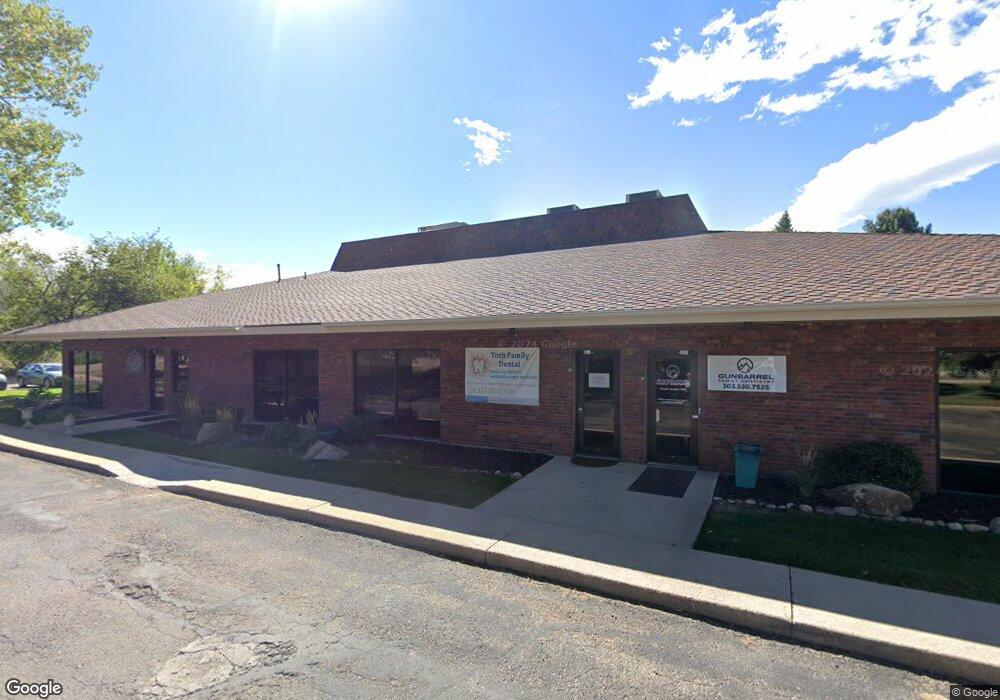
6700 Lookout Rd Boulder, CO 80301
Gunbarrel NeighborhoodEstimated Value: $1,113,226
--
Bed
--
Bath
8,320
Sq Ft
$134/Sq Ft
Est. Value
About This Home
This home is located at 6700 Lookout Rd, Boulder, CO 80301 and is currently estimated at $1,113,226, approximately $133 per square foot. 6700 Lookout Rd is a home located in Boulder County with nearby schools including Heatherwood Elementary School, Nevin Platt Middle School, and Boulder High School.
Ownership History
Date
Name
Owned For
Owner Type
Purchase Details
Closed on
Dec 31, 2001
Sold by
Investors Independent Trust Company
Bought by
George Williams Ltd Liability Ltd Prtnrs
Current Estimated Value
Purchase Details
Closed on
Aug 22, 1986
Bought by
Williams George C Lll Partnership
Purchase Details
Closed on
Apr 1, 1977
Bought by
Williams George C Lll Partnership
Create a Home Valuation Report for This Property
The Home Valuation Report is an in-depth analysis detailing your home's value as well as a comparison with similar homes in the area
Home Values in the Area
Average Home Value in this Area
Purchase History
| Date | Buyer | Sale Price | Title Company |
|---|---|---|---|
| George Williams Ltd Liability Ltd Prtnrs | $420,000 | -- | |
| Williams George C Lll Partnership | -- | -- | |
| Williams George C Lll Partnership | $8,420,000 | -- |
Source: Public Records
Tax History Compared to Growth
Tax History
| Year | Tax Paid | Tax Assessment Tax Assessment Total Assessment is a certain percentage of the fair market value that is determined by local assessors to be the total taxable value of land and additions on the property. | Land | Improvement |
|---|---|---|---|---|
| 2025 | $52,982 | $502,789 | $239,436 | $263,353 |
| 2024 | $52,982 | $502,789 | $239,436 | $263,353 |
| 2023 | $52,063 | $602,863 | $230,482 | $380,751 |
| 2022 | $35,360 | $380,770 | $141,230 | $239,540 |
| 2021 | $32,775 | $380,770 | $141,230 | $239,540 |
| 2020 | $31,049 | $356,700 | $141,230 | $215,470 |
| 2019 | $30,574 | $356,700 | $141,230 | $215,470 |
| 2018 | $28,993 | $334,402 | $91,324 | $243,078 |
| 2017 | $28,085 | $334,402 | $91,324 | $243,078 |
| 2016 | $27,569 | $318,478 | $81,664 | $236,814 |
| 2015 | $26,106 | $260,768 | $143,521 | $117,247 |
| 2014 | $21,926 | $260,768 | $143,521 | $117,247 |
Source: Public Records
Map
Nearby Homes
- 6809 Harvest Rd
- 6919 Hunter Place
- 6850 Frying Pan Rd
- 6972 Roaring Fork Trail
- 5110 Williams Fork Trail Unit 102
- 5102 Williams Fork Trail Unit 205
- 5120 Williams Fork Trail Unit 213
- 5120 Williams Fork Trail Unit 210
- 5122 Williams Fork Trail Unit 108
- 4985 Twin Lakes Rd Unit 94
- 5292 Sun Dial Place
- 4945 Twin Lakes Rd Unit 39
- 5302 Pinehurst Dr
- 7134 Cedarwood Cir
- 4872 Country Club Way
- 7240 Glacier View Rd
- 7088 Indian Peaks Trail
- 7261 Mount Meeker Rd
- 7126 Cedarwood Cir
- 7100 Cedarwood Cir
- 6688 Gunpark Dr
- 5340 Gunbarrel Center Ct
- 6655 Lookout Rd
- 6655 Lookout Rd
- 6672 Gunpark Dr
- 6755 Harvest Rd
- 5419 Indian Summer Ct
- 5468 Jewel Creek Ct
- 5435 Indian Summer Ct
- 5457 Jewel Creek Ct
- 5411 Indian Summer Ct
- 5385 Gunbarrel Center Ct
- 6666 Gunpark Dr Unit 200
- 6666 Gunpark Dr
- 6666 Gunpark Dr Unit 100 & 200
- 6666 Gunpark Dr Unit 100
- 5466 Lone Eagle Ct
- 5459 Indian Summer Ct
- 6781 Harvest Rd
- 5424 Indian Summer Ct