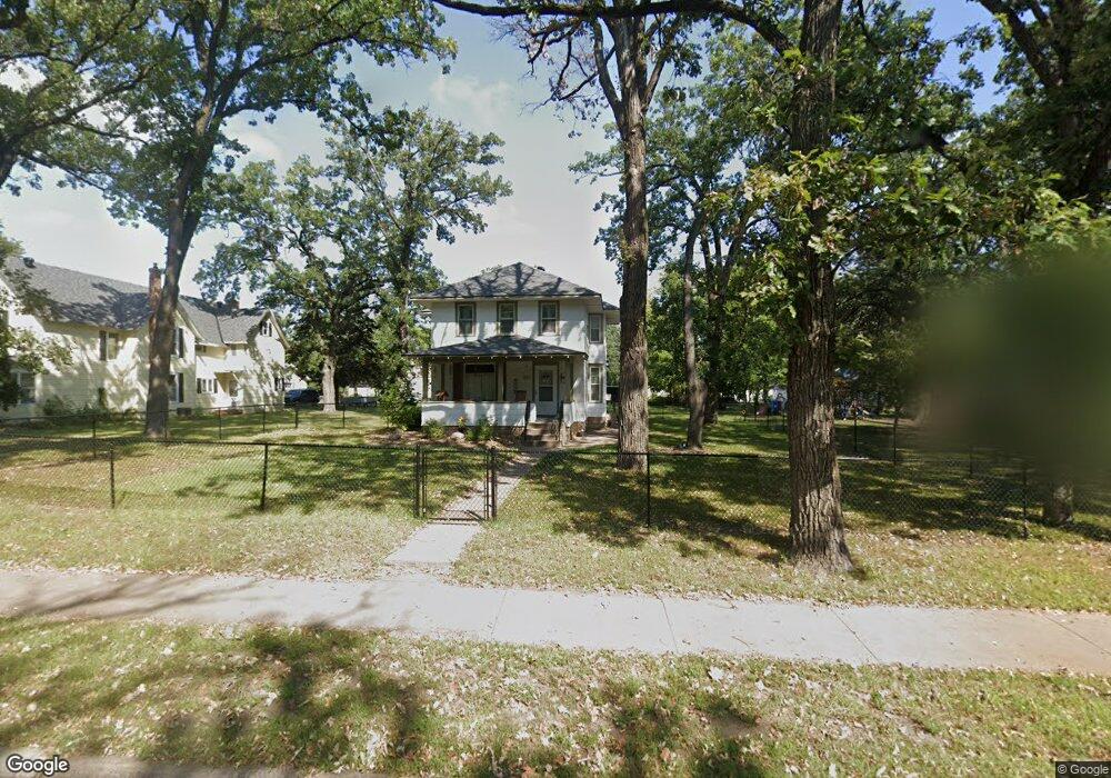
6700 Main St North Branch, MN 55056
Estimated Value: $276,000 - $294,000
3
Beds
2
Baths
2,302
Sq Ft
$124/Sq Ft
Est. Value
About This Home
This home is located at 6700 Main St, North Branch, MN 55056 and is currently estimated at $286,231, approximately $124 per square foot. 6700 Main St is a home located in Chisago County with nearby schools including North Branch Middle School, Sunrise River Elementary School, and North Branch Senior High School.
Ownership History
Date
Name
Owned For
Owner Type
Purchase Details
Closed on
Sep 10, 2021
Sold by
Becker Michael Michael
Bought by
Dinzl Chistine Chistine
Current Estimated Value
Home Financials for this Owner
Home Financials are based on the most recent Mortgage that was taken out on this home.
Original Mortgage
$213,660
Outstanding Balance
$193,804
Interest Rate
2.88%
Estimated Equity
$92,427
Purchase Details
Closed on
Feb 10, 1999
Sold by
Gordon Frank and Gordon Vonnie
Bought by
Melby David G and Melby Patricia J
Create a Home Valuation Report for This Property
The Home Valuation Report is an in-depth analysis detailing your home's value as well as a comparison with similar homes in the area
Home Values in the Area
Average Home Value in this Area
Purchase History
| Date | Buyer | Sale Price | Title Company |
|---|---|---|---|
| Dinzl Chistine Chistine | $237,400 | -- | |
| Melby David G | $132,500 | -- | |
| Dinzl Chistine Chistine | $237,400 | -- |
Source: Public Records
Mortgage History
| Date | Status | Borrower | Loan Amount |
|---|---|---|---|
| Open | Dinzl Chistine Chistine | $213,660 | |
| Closed | Dinzl Chistine Chistine | -- | |
| Closed | Dinzl Chistine Chistine | $213,660 |
Source: Public Records
Tax History Compared to Growth
Tax History
| Year | Tax Paid | Tax Assessment Tax Assessment Total Assessment is a certain percentage of the fair market value that is determined by local assessors to be the total taxable value of land and additions on the property. | Land | Improvement |
|---|---|---|---|---|
| 2024 | $2,464 | $186,900 | $0 | $0 |
| 2023 | $2,464 | $210,000 | $0 | $0 |
| 2022 | $2,560 | $191,900 | $0 | $0 |
| 2021 | $2,262 | $125,400 | $0 | $0 |
| 2020 | $2,246 | $143,600 | $40,000 | $103,600 |
| 2019 | $2,346 | $0 | $0 | $0 |
| 2018 | $2,230 | $0 | $0 | $0 |
| 2017 | $2,210 | $0 | $0 | $0 |
| 2016 | $2,118 | $0 | $0 | $0 |
| 2015 | $2,134 | $0 | $0 | $0 |
| 2014 | -- | $104,400 | $0 | $0 |
Source: Public Records
Map
Nearby Homes
- 38958 Elm Ct
- 38558 Grand Ave
- 38946 7th Ave
- XXXXX Maple St
- 39183 Grand Ave
- 36XXX Forest Blvd
- 38692 Hawthorne Ave
- 38578 Hawthorne Ave
- TBD Saint Croix Trail
- 7255 Hawthorne Ct
- 7222 Hawthorne Ct
- 7246 385th St
- 39590 Hemingway Ave
- 39xxx Hemingway Ave
- XXX Ash St
- 374xx-N40 Hemingway Ave
- 5244 391st St
- 6231 Red Fox Run
- 38470 Glacier Dr
- 7348 384th Ct