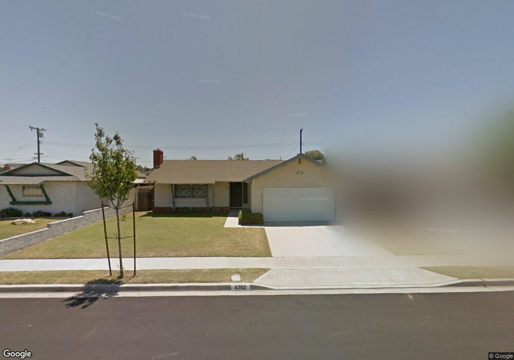
6702 Sambar Cir Cypress, CA 90630
Estimated Value: $958,916 - $1,160,000
4
Beds
2
Baths
1,420
Sq Ft
$768/Sq Ft
Est. Value
About This Home
This home is located at 6702 Sambar Cir, Cypress, CA 90630 and is currently estimated at $1,090,479, approximately $767 per square foot. 6702 Sambar Cir is a home located in Orange County with nearby schools including Patton Elementary School, Hilton D. Bell Intermediate School, and Pacifica High School.
Ownership History
Date
Name
Owned For
Owner Type
Purchase Details
Closed on
Jun 17, 2021
Sold by
Voorhees Michelle and Estate Of Gary Voorhees
Bought by
Voorhees Michelle
Current Estimated Value
Purchase Details
Closed on
Feb 23, 2009
Sold by
Voorhees Frances P
Bought by
Voorhees Frances P and Voorhees Garry T
Purchase Details
Closed on
Aug 14, 2001
Sold by
Voorhees Frances P
Bought by
Voorhees Frances P and Frances P Voorhees Trust
Create a Home Valuation Report for This Property
The Home Valuation Report is an in-depth analysis detailing your home's value as well as a comparison with similar homes in the area
Home Values in the Area
Average Home Value in this Area
Purchase History
| Date | Buyer | Sale Price | Title Company |
|---|---|---|---|
| Voorhees Michelle | -- | None Available | |
| Voorhees Frances P | -- | None Available | |
| Voorhees Frances P | -- | -- |
Source: Public Records
Tax History Compared to Growth
Tax History
| Year | Tax Paid | Tax Assessment Tax Assessment Total Assessment is a certain percentage of the fair market value that is determined by local assessors to be the total taxable value of land and additions on the property. | Land | Improvement |
|---|---|---|---|---|
| 2025 | $1,143 | $70,531 | $29,164 | $41,367 |
| 2024 | $1,143 | $69,149 | $28,593 | $40,556 |
| 2023 | $1,116 | $67,794 | $28,033 | $39,761 |
| 2022 | $1,095 | $66,465 | $27,483 | $38,982 |
| 2021 | $1,084 | $65,162 | $26,944 | $38,218 |
| 2020 | $1,071 | $64,494 | $26,667 | $37,827 |
| 2019 | $1,052 | $63,230 | $26,144 | $37,086 |
| 2018 | $7,341 | $635,000 | $569,875 | $65,125 |
| 2017 | $1,023 | $60,776 | $25,129 | $35,647 |
| 2016 | $988 | $59,585 | $24,636 | $34,949 |
| 2015 | $974 | $58,690 | $24,265 | $34,425 |
| 2014 | $944 | $57,541 | $23,790 | $33,751 |
Source: Public Records
Map
Nearby Homes
- 11474 Shippigan Way
- 11390 Nantucket Ct
- 6601 Chapman Ave
- 6837 Amelia Way
- 6212 Santa Rita Ave
- 6051 Santa Barbara Ave
- 11058 Grant Way
- 11219 Hood Way
- 6870 Via Kannela
- 11081 Robinson Dr
- 7271 Katella Ave Unit 58
- 7271 Katella Ave
- 7271 Katella Ave Unit 101
- 7271 Katella Ave Unit 9
- 7271 Katella Ave Unit 84
- 6971 Knollcrest Ln Unit 47
- 6925 Brightwood Ln Unit 108
- 10700 Knott Ave
- 10748 Knott Ave
- 10720 Knott Ave
- 6692 Sambar Cir
- 6712 Sambar Cir
- 6701 Timaru Cir
- 6711 Timaru Cir
- 6691 Timaru Cir
- 6682 Sambar Cir
- 6722 Sambar Cir
- 6701 Sambar Cir
- 6681 Timaru Cir
- 6691 Sambar Cir
- 6711 Sambar Cir
- 6721 Timaru Cir
- 6662 Sambar Cir
- 6681 Sambar Cir
- 6721 Sambar Cir
- 6661 Timaru Cir
- 11571 Halawa Ln
- 11563 Halawa Ln
- 11583 Halawa Ln
- 6661 Sambar Cir