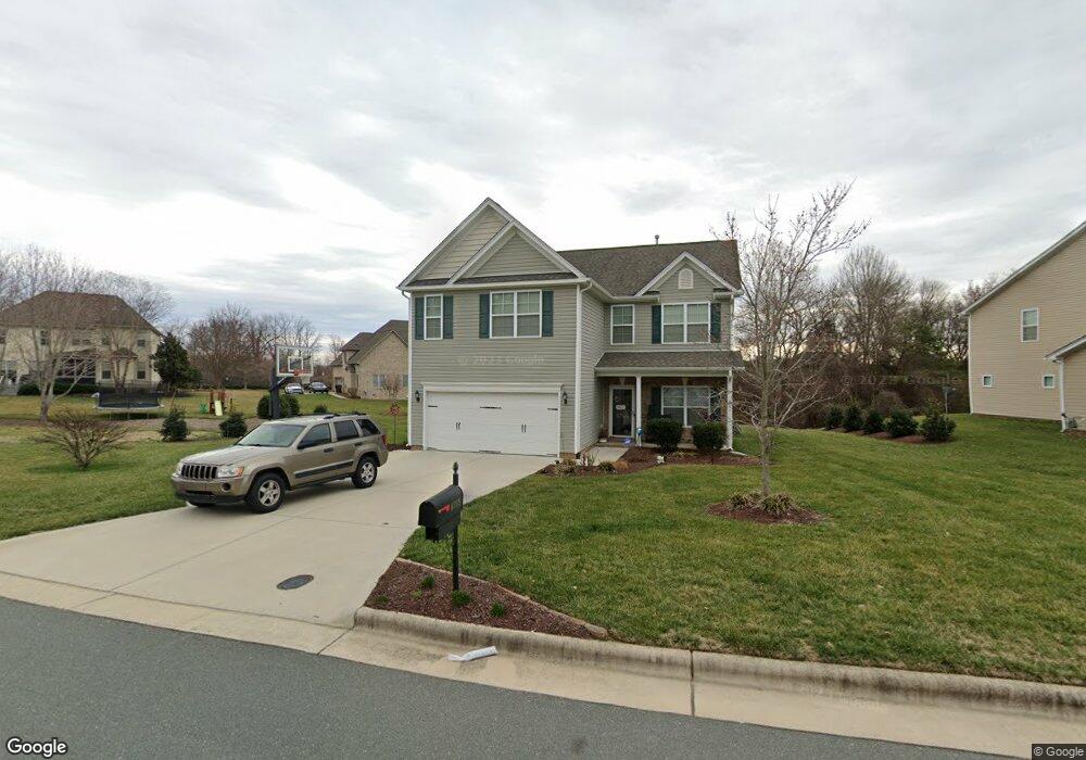
6705 Laurel Fork Dr Whitsett, NC 27377
Estimated Value: $325,894 - $381,000
4
Beds
3
Baths
2,196
Sq Ft
$164/Sq Ft
Est. Value
About This Home
This home is located at 6705 Laurel Fork Dr, Whitsett, NC 27377 and is currently estimated at $359,224, approximately $163 per square foot. 6705 Laurel Fork Dr is a home with nearby schools including Sedalia Elementary School, Eastern Guilford Middle School, and Eastern Guilford High School.
Ownership History
Date
Name
Owned For
Owner Type
Purchase Details
Closed on
Sep 10, 2014
Sold by
Keystone Group Inc
Bought by
Mason Share R
Current Estimated Value
Home Financials for this Owner
Home Financials are based on the most recent Mortgage that was taken out on this home.
Original Mortgage
$181,600
Outstanding Balance
$139,283
Interest Rate
4.19%
Mortgage Type
New Conventional
Estimated Equity
$219,941
Purchase Details
Closed on
Jul 1, 2011
Bought by
Keystone Group Inc
Create a Home Valuation Report for This Property
The Home Valuation Report is an in-depth analysis detailing your home's value as well as a comparison with similar homes in the area
Home Values in the Area
Average Home Value in this Area
Purchase History
| Date | Buyer | Sale Price | Title Company |
|---|---|---|---|
| Mason Share R | $178,500 | None Available | |
| Keystone Group Inc | -- | -- |
Source: Public Records
Mortgage History
| Date | Status | Borrower | Loan Amount |
|---|---|---|---|
| Open | Mason Share R | $181,600 |
Source: Public Records
Tax History Compared to Growth
Tax History
| Year | Tax Paid | Tax Assessment Tax Assessment Total Assessment is a certain percentage of the fair market value that is determined by local assessors to be the total taxable value of land and additions on the property. | Land | Improvement |
|---|---|---|---|---|
| 2025 | $1,823 | $224,900 | $48,000 | $176,900 |
| 2024 | $1,823 | $224,900 | $48,000 | $176,900 |
| 2023 | $1,823 | $224,900 | $48,000 | $176,900 |
| 2022 | $1,823 | $224,900 | $48,000 | $176,900 |
| 2021 | $1,483 | $183,000 | $35,000 | $148,000 |
| 2020 | $1,483 | $183,000 | $35,000 | $148,000 |
| 2019 | $1,483 | $183,000 | $0 | $0 |
| 2018 | $1,476 | $183,000 | $0 | $0 |
| 2017 | $1,483 | $183,000 | $0 | $0 |
| 2016 | $1,548 | $185,400 | $0 | $0 |
| 2015 | $1,557 | $185,400 | $0 | $0 |
| 2014 | $298 | $35,000 | $0 | $0 |
Source: Public Records
Map
Nearby Homes
- 1915 Wake Bridge Dr
- 2016 Heron Pointe Dr
- 1963 Whisper Lake Dr
- 1942 Whisper Lake Dr
- 1911 Whisper Lake Dr Unit A
- 6710 Breeze Pointe Dr
- 1903 Osterville Ct
- 6506 Donahue Dr
- 6717 Barton Creek Dr
- 6731 Barton Creek Dr
- 1904 Brant Pointe Ct
- 1431 Rock Creek Dairy Rd
- 1132 Brooksridge Way
- 1130 Brooksridge Way
- 1128 Brooksridge Way
- 1126 Brooksridge Way
- 1112 Brooksridge Way
- 1108 Brooksridge Way
- 1104 Brooksridge Way
- 6305 Hibiscus Ct
- 6707 Laurel Fork Dr
- 6709 Laurel Fork Dr
- 6708 Laurel Fork Dr
- 1904 Wake Bridge Dr
- 6706 Laurel Fork Dr
- 6710 Laurel Fork Dr
- 1902 Wake Bridge Dr
- 1906 Wake Bridge Dr
- 6704 Laurel Fork Dr
- 6712 Laurel Fork Dr
- 6711 Laurel Fork Dr
- 6714 Laurel Fork Dr
- 1908 Wake Bridge Dr
- 6716 Laurel Fork Dr
- 6713 Laurel Fork Dr
- 1910 Wake Bridge Dr
- 2004 Heron Pointe Dr
- 6715 Laurel Fork Dr
- 6718 Laurel Fork Dr
- 1912 Wake Bridge Dr