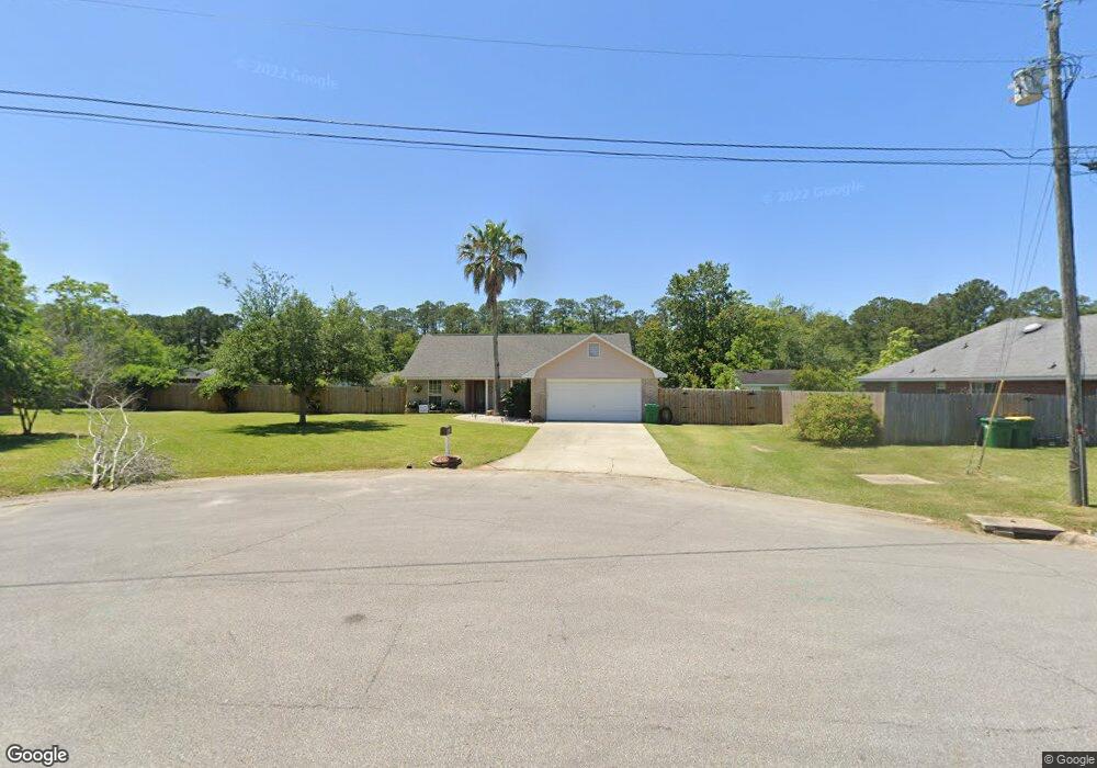
6705 Linden Place Ocean Springs, MS 39564
Estimated Value: $199,481 - $239,000
--
Bed
2
Baths
1,552
Sq Ft
$140/Sq Ft
Est. Value
About This Home
This home is located at 6705 Linden Place, Ocean Springs, MS 39564 and is currently estimated at $217,620, approximately $140 per square foot. 6705 Linden Place is a home located in Jackson County with nearby schools including St Martin East Elementary School, St Martin North Elementary School, and St Martin Upper Elementary School.
Ownership History
Date
Name
Owned For
Owner Type
Purchase Details
Closed on
May 13, 2013
Sold by
Snow Jay E
Bought by
Snow Mary Christina
Current Estimated Value
Home Financials for this Owner
Home Financials are based on the most recent Mortgage that was taken out on this home.
Original Mortgage
$71,337
Outstanding Balance
$50,459
Interest Rate
3.44%
Mortgage Type
Purchase Money Mortgage
Estimated Equity
$167,161
Create a Home Valuation Report for This Property
The Home Valuation Report is an in-depth analysis detailing your home's value as well as a comparison with similar homes in the area
Home Values in the Area
Average Home Value in this Area
Purchase History
| Date | Buyer | Sale Price | Title Company |
|---|---|---|---|
| Snow Mary Christina | -- | -- |
Source: Public Records
Mortgage History
| Date | Status | Borrower | Loan Amount |
|---|---|---|---|
| Open | Snow Mary Christina | $71,337 |
Source: Public Records
Tax History Compared to Growth
Tax History
| Year | Tax Paid | Tax Assessment Tax Assessment Total Assessment is a certain percentage of the fair market value that is determined by local assessors to be the total taxable value of land and additions on the property. | Land | Improvement |
|---|---|---|---|---|
| 2024 | $1,078 | $11,306 | $2,428 | $8,878 |
| 2023 | $1,078 | $11,306 | $2,428 | $8,878 |
| 2022 | $1,041 | $11,306 | $2,428 | $8,878 |
| 2021 | $1,049 | $11,372 | $2,428 | $8,944 |
| 2020 | $950 | $10,146 | $2,188 | $7,958 |
| 2019 | $937 | $10,146 | $2,188 | $7,958 |
| 2018 | $962 | $10,157 | $2,188 | $7,969 |
| 2017 | $983 | $10,157 | $2,188 | $7,969 |
| 2016 | $933 | $10,157 | $2,188 | $7,969 |
| 2015 | $884 | $96,980 | $21,880 | $75,100 |
| 2014 | $898 | $9,982 | $2,188 | $7,794 |
| 2013 | $859 | $9,982 | $2,188 | $7,794 |
Source: Public Records
Map
Nearby Homes
- 6701 Linden Place
- 0 Lake Geneva Dr
- 6704 Post Oak Dr
- 0 Big Oak & Lake Geneva Dr
- 12265 Savannah Cir
- 11458 Leann Ct
- 12213 Savannah Cir
- 12210 Savannah Cir
- 12281 Savannah Cir
- 11625 Talla Dr
- 0 Old Fort Bayou Rd
- 11584 Paige Cove
- Rodessa IV H Plan at Admiral Landing
- Sycamore IV G Plan at Admiral Landing
- Nolana Plan at Admiral Landing
- Trillium IV H Plan at Admiral Landing
- Oakstone V H Plan at Admiral Landing
- Roses V H Plan at Admiral Landing
- Comstock III H Plan at Admiral Landing
- Rodessa IV G Plan at Admiral Landing
- 11505 Wedgewood Ln
- 11536 Bayou Place
- 11540 Bayou Place
- 11532 Bayou Place
- 11544 Bayou Place
- 6644 Oakbrook Dr
- 6700 Linden Place
- 6640 Oakbrook Dr
- 6648 Oakbrook Dr
- 6704 Linden Place
- 6636 Oakbrook Dr
- 11425 Wedgewood Ln
- 11528 Bayou Place
- 6632 Oakbrook Dr
- 11504 Wedgewood Ln
- 11508 Wedgewood Ln
- 11512 Wedgewood Ln
- 11500 Wedgewood Ln
- 11537 Bayou Place
- 11533 Bayou Place