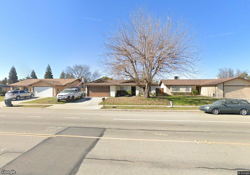
6705 Patton Way Bakersfield, CA 93308
Olive Drive Area NeighborhoodEstimated Value: $359,902 - $432,000
4
Beds
2
Baths
1,597
Sq Ft
$257/Sq Ft
Est. Value
About This Home
This home is located at 6705 Patton Way, Bakersfield, CA 93308 and is currently estimated at $409,976, approximately $256 per square foot. 6705 Patton Way is a home located in Kern County with nearby schools including Olive Drive Elementary School, Norris Middle School, and Centennial High School.
Ownership History
Date
Name
Owned For
Owner Type
Purchase Details
Closed on
Mar 22, 2011
Sold by
Kreutzer Delores Louise and Delores Louise Kreutzer Living
Bought by
Moseley Jason A and Moseley Danielle F
Current Estimated Value
Home Financials for this Owner
Home Financials are based on the most recent Mortgage that was taken out on this home.
Original Mortgage
$128,653
Outstanding Balance
$88,231
Interest Rate
4.75%
Mortgage Type
FHA
Estimated Equity
$321,745
Create a Home Valuation Report for This Property
The Home Valuation Report is an in-depth analysis detailing your home's value as well as a comparison with similar homes in the area
Home Values in the Area
Average Home Value in this Area
Purchase History
| Date | Buyer | Sale Price | Title Company |
|---|---|---|---|
| Moseley Jason A | $132,000 | Placer Title Company |
Source: Public Records
Mortgage History
| Date | Status | Borrower | Loan Amount |
|---|---|---|---|
| Open | Moseley Jason A | $128,653 |
Source: Public Records
Tax History
| Year | Tax Paid | Tax Assessment Tax Assessment Total Assessment is a certain percentage of the fair market value that is determined by local assessors to be the total taxable value of land and additions on the property. | Land | Improvement |
|---|---|---|---|---|
| 2025 | $2,481 | $169,101 | $44,833 | $124,268 |
| 2024 | $2,423 | $165,786 | $43,954 | $121,832 |
| 2023 | $2,423 | $162,537 | $43,093 | $119,444 |
| 2022 | $2,356 | $159,351 | $42,249 | $117,102 |
| 2021 | $2,274 | $156,227 | $41,421 | $114,806 |
| 2020 | $2,196 | $154,626 | $40,997 | $113,629 |
| 2019 | $2,163 | $154,626 | $40,997 | $113,629 |
| 2018 | $2,090 | $148,623 | $39,406 | $109,217 |
| 2017 | $2,094 | $145,710 | $38,634 | $107,076 |
| 2016 | $1,962 | $142,854 | $37,877 | $104,977 |
| 2015 | $1,931 | $140,710 | $37,309 | $103,401 |
| 2014 | $1,884 | $137,955 | $36,579 | $101,376 |
Source: Public Records
Map
Nearby Homes
- 6801 Mignonette St
- 6900 Jennifer St
- 6413 Gina Ct
- 7704 Jill Jean Ave
- 7605 Penny Marie Ave
- 6709 Cedarcrest Ave
- 6708 Cranbrook Ave
- 6300 Mignonette St
- 7009 Etter St
- 7908 Jill Jean Ave
- 7108 Luke Ave
- 7919 Scarlet Maple Ct
- 6712 Noah Ave
- 6710 Pinecone Ave
- 6600 Cedarcrest Ave
- 7200 Darrin Ave
- 7712 Jensen Ave
- 6505 Joe Ed Way
- 7221 Etter St
- 7207 Briar Ridge Ct
- 6701 Patton Way
- 6709 Patton Way
- 6713 Patton Way
- 6704 Randall St
- 6700 Randall St
- 6708 Randall St
- 6801 Patton Way
- 7216 Cedarcrest Ave
- 6712 Randall St
- 7305 Cedarcrest Ave
- 7301 Cedarcrest Ave
- 6805 Patton Way
- 6800 Randall St
- 7217 Cranbrook Ave
- 7212 Cedarcrest Ave
- 7313 Cedarcrest Ave
- 6804 Randall St
- 7213 Cranbrook Ave
- 7317 Cedarcrest Ave
- 6809 Patton Way
Your Personal Tour Guide
Ask me questions while you tour the home.