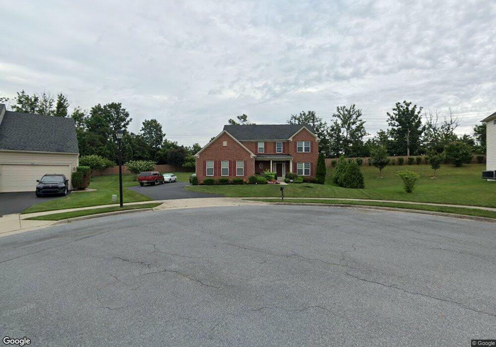
6705 Sandy View Ct Laurel, MD 20707
West Laurel NeighborhoodEstimated Value: $652,000 - $790,000
Studio
1
Bath
2,874
Sq Ft
$246/Sq Ft
Est. Value
About This Home
This home is located at 6705 Sandy View Ct, Laurel, MD 20707 and is currently estimated at $708,102, approximately $246 per square foot. 6705 Sandy View Ct is a home located in Prince George's County with nearby schools including Bond Mill Elementary, Martin Luther King Jr. Middle School, and Laurel High School.
Ownership History
Date
Name
Owned For
Owner Type
Purchase Details
Closed on
Feb 7, 2024
Sold by
Ali Kelvin H and Ali Ellina B
Bought by
Beal Nisha Ali and Agam Jennifer Lea
Current Estimated Value
Purchase Details
Closed on
May 12, 2010
Sold by
Nvr Inc
Bought by
Ali Kelvin H and Ali Ellina B
Home Financials for this Owner
Home Financials are based on the most recent Mortgage that was taken out on this home.
Original Mortgage
$390,000
Interest Rate
5.03%
Mortgage Type
New Conventional
Create a Home Valuation Report for This Property
The Home Valuation Report is an in-depth analysis detailing your home's value as well as a comparison with similar homes in the area
Home Values in the Area
Average Home Value in this Area
Purchase History
| Date | Buyer | Sale Price | Title Company |
|---|---|---|---|
| Beal Nisha Ali | -- | None Listed On Document | |
| Beal Nisha Ali | -- | None Listed On Document | |
| Ali Kelvin H | $515,065 | -- |
Source: Public Records
Mortgage History
| Date | Status | Borrower | Loan Amount |
|---|---|---|---|
| Previous Owner | Ali Kelvin H | $390,000 |
Source: Public Records
Tax History
| Year | Tax Paid | Tax Assessment Tax Assessment Total Assessment is a certain percentage of the fair market value that is determined by local assessors to be the total taxable value of land and additions on the property. | Land | Improvement |
|---|---|---|---|---|
| 2025 | $8,784 | $643,400 | $143,200 | $500,200 |
| 2024 | $8,784 | $618,600 | -- | -- |
| 2023 | $6,603 | $593,800 | $0 | $0 |
| 2022 | $8,138 | $569,000 | $103,200 | $465,800 |
| 2021 | $7,833 | $556,233 | $0 | $0 |
| 2020 | $7,727 | $543,467 | $0 | $0 |
| 2019 | $7,574 | $530,700 | $101,600 | $429,100 |
| 2018 | $7,345 | $510,700 | $0 | $0 |
| 2017 | $7,164 | $490,700 | $0 | $0 |
| 2016 | -- | $470,700 | $0 | $0 |
| 2015 | $6,064 | $459,333 | $0 | $0 |
| 2014 | $6,064 | $447,967 | $0 | $0 |
Source: Public Records
Map
Nearby Homes
- 6918 Scotch Dr
- 7002 Scotch Dr
- 7004 Fitzpatrick Dr
- 7019 Fitzpatrick Dr
- 7019 Redmiles Rd
- 15712 Dorset Rd Unit 104
- 15708 Dorset Rd Unit 202
- 15706 Dorset Rd Unit 102
- 15603 Dorset Rd Unit 101
- 6003 Windham Rd
- 16140 Kenny Rd
- 14717 Exbury Ln
- 15046 Cherrywood Dr
- 15020 Cherrywood Dr
- 1027 Overlook Way
- 1012 Flester Ln
- 1016 Flester Ln
- 1023 Flester Ln
- 1024 Flester Ln
- 1106 Overlook Way
- 6707 Sandy View Ct
- 6703 Sandy View Ct
- 15601 Bradford Dr
- 15505 Misty Pine Rd
- 15503 Misty Pine Rd
- 6701 Sandy View Ct
- 15603 Bradford Dr
- 15405 Misty Pine Rd
- 15602 Bradford Dr
- 15507 Misty Pine Rd
- 15506 Misty Pine Rd
- 15400 Misty Pine Rd
- 15604 Bradford Dr
- 15406 Misty Pine Rd
- 15606 Bradford Dr
- 6602 Cedar Spring Ct
- 15402 Misty Pine Rd
- 15504 Misty Pine Rd
- 15404 Misty Pine Rd
- 15608 Bradford Dr
Your Personal Tour Guide
Ask me questions while you tour the home.