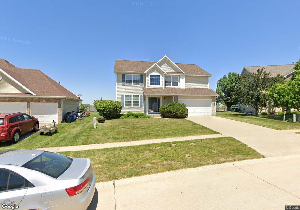
6706 Dean Rd SW Cedar Rapids, IA 52404
Estimated Value: $298,000 - $345,000
4
Beds
3
Baths
2,247
Sq Ft
$146/Sq Ft
Est. Value
About This Home
This home is located at 6706 Dean Rd SW, Cedar Rapids, IA 52404 and is currently estimated at $327,577, approximately $145 per square foot. 6706 Dean Rd SW is a home located in Linn County with nearby schools including Prairie Crest Elementary School, Prairie View Elementary School, and Prairie Ridge Elementary School.
Ownership History
Date
Name
Owned For
Owner Type
Purchase Details
Closed on
May 24, 2024
Sold by
Ostroff Michael D and Ostroff Marjorie A
Bought by
Ostroff Family Trust and Ostroff
Current Estimated Value
Purchase Details
Closed on
Dec 26, 2000
Sold by
Midland Homes Of Eastern Iowa Lc
Bought by
Ostroff Michael D and Ostroff Marjorie A
Home Financials for this Owner
Home Financials are based on the most recent Mortgage that was taken out on this home.
Original Mortgage
$165,500
Interest Rate
7.8%
Mortgage Type
Purchase Money Mortgage
Purchase Details
Closed on
Dec 20, 2000
Sold by
Stoney Point Heights Llc
Bought by
Midland Homes Of Eastern Iowa Lc
Home Financials for this Owner
Home Financials are based on the most recent Mortgage that was taken out on this home.
Original Mortgage
$165,500
Interest Rate
7.8%
Mortgage Type
Purchase Money Mortgage
Create a Home Valuation Report for This Property
The Home Valuation Report is an in-depth analysis detailing your home's value as well as a comparison with similar homes in the area
Home Values in the Area
Average Home Value in this Area
Purchase History
| Date | Buyer | Sale Price | Title Company |
|---|---|---|---|
| Ostroff Family Trust | -- | None Listed On Document | |
| Ostroff Michael D | $206,500 | -- | |
| Midland Homes Of Eastern Iowa Lc | $28,000 | -- |
Source: Public Records
Mortgage History
| Date | Status | Borrower | Loan Amount |
|---|---|---|---|
| Previous Owner | Ostroff Michael D | $165,500 |
Source: Public Records
Tax History Compared to Growth
Tax History
| Year | Tax Paid | Tax Assessment Tax Assessment Total Assessment is a certain percentage of the fair market value that is determined by local assessors to be the total taxable value of land and additions on the property. | Land | Improvement |
|---|---|---|---|---|
| 2025 | $5,746 | $310,400 | $65,500 | $244,900 |
| 2024 | $5,966 | $305,900 | $56,400 | $249,500 |
| 2023 | $5,966 | $303,200 | $56,400 | $246,800 |
| 2022 | $5,622 | $269,300 | $51,000 | $218,300 |
| 2021 | $6,050 | $258,700 | $47,300 | $211,400 |
| 2020 | $6,050 | $265,700 | $47,300 | $218,400 |
| 2019 | $5,208 | $244,800 | $36,400 | $208,400 |
| 2018 | $5,066 | $232,200 | $36,400 | $195,800 |
| 2017 | $5,178 | $230,100 | $36,400 | $193,700 |
| 2016 | $4,626 | $213,800 | $36,400 | $177,400 |
| 2015 | $4,788 | $222,492 | $36,414 | $186,078 |
| 2014 | $4,788 | $222,492 | $36,414 | $186,078 |
| 2013 | $4,550 | $222,492 | $36,414 | $186,078 |
Source: Public Records
Map
Nearby Homes
- 3600 Falcon View Rd SW
- 3555 Stoney Point Rd SW Unit 3555
- 7112 Water View Dr SW
- 7106 Water View Dr SW
- 7110 Waterview Dr SW
- 7104 Waterview Dr SW
- 3516 Stoneview Cir SW Unit 3516
- 3304 Stoneview Cir SW Unit 3304
- 3309 Stoneview Cir SW
- 3337 Stoneview Cir SW Unit 3337
- 3335 Stoneview Cir SW Unit 3335
- 4124 Lakeview Dr SW Unit 4124
- 4048 Lakeview Dr SW
- 3712 Stoneview Cir SW Unit 3712
- 3550 Stone Creek Cir SW Unit 313
- 3550 Stone Creek Cir SW Unit 105
- 5901 Williams Blvd SW
- 5705 Beverly Rd SW
- 5209 Dostal Dr SW
- 315 Highland Ct
- 6700 Dean Rd SW
- 6710 Dean Rd SW
- 6703 Pheasant Hollow Rd SW
- 3211 Falcon View Rd SW
- 6709 Pheasant Hollow Rd SW
- 6622 Dean Rd SW
- 6619 Pheasant Hollow Rd SW
- 6711 Dean Rd SW
- 3205 Falcon View Rd SW
- 6717 Dean Rd SW
- 6613 Pheasant Hollow Rd SW
- 6616 Dean Rd SW
- 6705 Dean Rd SW
- 3228 Falcon View Rd SW
- 3234 Falcon View Rd SW
- 3216 Falcon View Rd SW
- 6607 Pheasant Hollow Rd SW
- 3210 Falcon View Rd SW
- 3300 Falcon View Rd SW
- 3311 Falcon View Rd SW