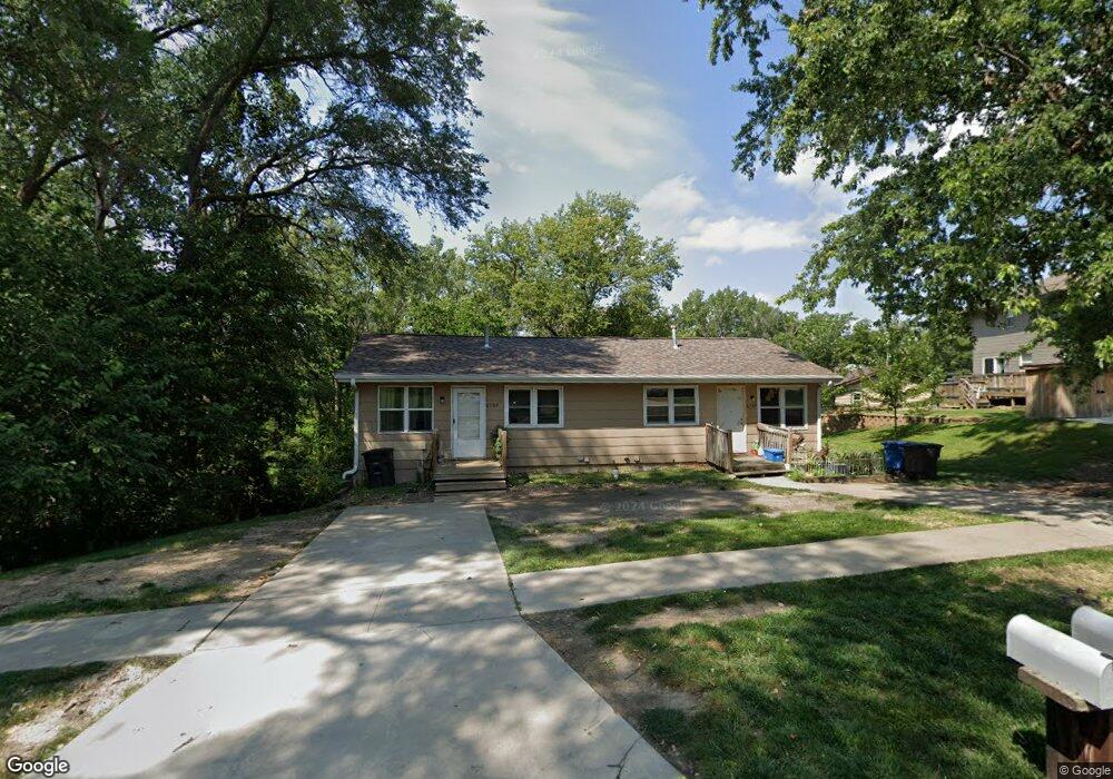
6707 Sherrick Ave Des Moines, IA 50322
Estimated Value: $226,000 - $285,000
4
Beds
4
Baths
1,248
Sq Ft
$199/Sq Ft
Est. Value
About This Home
This home is located at 6707 Sherrick Ave, Des Moines, IA 50322 and is currently estimated at $248,571, approximately $199 per square foot. 6707 Sherrick Ave is a home located in Polk County with nearby schools including Hillis Elementary School, Meredith Middle School, and Hoover High School.
Ownership History
Date
Name
Owned For
Owner Type
Purchase Details
Closed on
Jan 19, 2018
Sold by
Blaue Sharon K and Sharon K Blaue Revocable Trust
Bought by
Bloomfield Acres Llc
Current Estimated Value
Home Financials for this Owner
Home Financials are based on the most recent Mortgage that was taken out on this home.
Original Mortgage
$96,000
Outstanding Balance
$81,219
Interest Rate
4.04%
Mortgage Type
Future Advance Clause Open End Mortgage
Estimated Equity
$167,352
Purchase Details
Closed on
Jun 17, 2015
Sold by
Estate Of Stanley Wayne Blaue
Bought by
Sharon K Blauce Revocable Trust
Purchase Details
Closed on
Feb 2, 1998
Sold by
Reszel Andrew H and Reszel Constance A
Bought by
Blaue Stanley W
Home Financials for this Owner
Home Financials are based on the most recent Mortgage that was taken out on this home.
Original Mortgage
$55,900
Interest Rate
7.08%
Create a Home Valuation Report for This Property
The Home Valuation Report is an in-depth analysis detailing your home's value as well as a comparison with similar homes in the area
Home Values in the Area
Average Home Value in this Area
Purchase History
| Date | Buyer | Sale Price | Title Company |
|---|---|---|---|
| Bloomfield Acres Llc | $120,000 | None Available | |
| Blaue Sharon K | -- | None Available | |
| Sharon K Blauce Revocable Trust | -- | Attorney | |
| Blaue Stanley W | $79,500 | -- |
Source: Public Records
Mortgage History
| Date | Status | Borrower | Loan Amount |
|---|---|---|---|
| Open | Bloomfield Acres Llc | $96,000 | |
| Previous Owner | Blaue Stanley W | $55,900 |
Source: Public Records
Tax History Compared to Growth
Tax History
| Year | Tax Paid | Tax Assessment Tax Assessment Total Assessment is a certain percentage of the fair market value that is determined by local assessors to be the total taxable value of land and additions on the property. | Land | Improvement |
|---|---|---|---|---|
| 2025 | $4,396 | $240,600 | $43,300 | $197,300 |
| 2024 | $4,396 | $221,400 | $39,100 | $182,300 |
| 2023 | $4,376 | $221,400 | $39,100 | $182,300 |
| 2022 | $4,342 | $184,000 | $34,000 | $150,000 |
| 2021 | $4,230 | $184,000 | $34,000 | $150,000 |
| 2020 | $4,392 | $168,000 | $31,000 | $137,000 |
| 2019 | $4,118 | $168,000 | $31,000 | $137,000 |
| 2018 | $4,074 | $151,900 | $27,300 | $124,600 |
| 2017 | $3,694 | $151,900 | $27,300 | $124,600 |
| 2016 | $3,594 | $135,500 | $24,400 | $111,100 |
| 2015 | $3,594 | $135,500 | $24,400 | $111,100 |
| 2014 | $2,964 | $114,700 | $19,300 | $95,400 |
Source: Public Records
Map
Nearby Homes
- 6620 Boston Ave
- 2729 67th St
- 3206 68th St
- 2708 68th St
- 3233 68th St
- 6316 Clearview Cir
- 6700 Sheridan Ave
- 2610 Westover Blvd
- 7051 Oak Brook Dr
- 7005 Sheridan Cir
- 6717 Roseland Dr
- 2623 63rd St
- 6614 Oliver Smith Dr
- 3116 61st St
- 7004 Holcomb Ave
- 3611 68th St
- 3320 61st St
- 3673 67th St
- 7201 Maple Dr
- 3512 62nd St