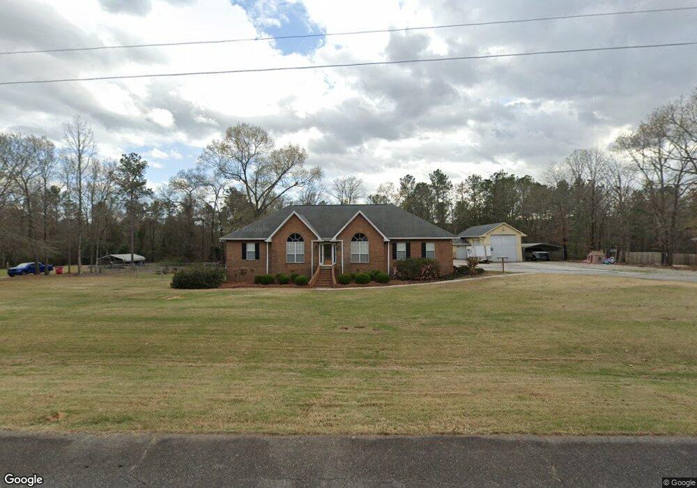
6708 Chriswood Dr Unit 165 Old Ridge Road Macon, GA 31216
Estimated Value: $310,000 - $377,000
4
Beds
2
Baths
2,290
Sq Ft
$149/Sq Ft
Est. Value
About This Home
This home is located at 6708 Chriswood Dr Unit 165 Old Ridge Road, Macon, GA 31216 and is currently estimated at $340,343, approximately $148 per square foot. 6708 Chriswood Dr Unit 165 Old Ridge Road is a home located in Bibb County with nearby schools including Heard Elementary School, Rutland Middle School, and Rutland High School.
Ownership History
Date
Name
Owned For
Owner Type
Purchase Details
Closed on
Jul 6, 2023
Sold by
Sisemore Vanessa N
Bought by
Hart Leon and Hart Carol S
Current Estimated Value
Purchase Details
Closed on
Mar 25, 2016
Sold by
Cameron Susan M
Bought by
Sisemore Vanessa N
Purchase Details
Closed on
Aug 29, 2014
Sold by
National Residential Nominee S
Bought by
Cameron Susan M and Cameron Kenneth G
Purchase Details
Closed on
Aug 16, 1995
Sold by
Cox Larry M and 1988 Sandra L
Bought by
Shouse Stephen S and Shouse Tammy L
Create a Home Valuation Report for This Property
The Home Valuation Report is an in-depth analysis detailing your home's value as well as a comparison with similar homes in the area
Home Values in the Area
Average Home Value in this Area
Purchase History
| Date | Buyer | Sale Price | Title Company |
|---|---|---|---|
| Hart Leon | $315,000 | None Listed On Document | |
| Sisemore Vanessa N | $198,000 | -- | |
| Cameron Susan M | $174,000 | -- | |
| Shouse Stephen S | $14,500 | -- |
Source: Public Records
Tax History Compared to Growth
Tax History
| Year | Tax Paid | Tax Assessment Tax Assessment Total Assessment is a certain percentage of the fair market value that is determined by local assessors to be the total taxable value of land and additions on the property. | Land | Improvement |
|---|---|---|---|---|
| 2025 | $2,991 | $121,724 | $19,373 | $102,351 |
| 2024 | $3,110 | $122,453 | $19,373 | $103,080 |
| 2023 | $2,161 | $110,085 | $19,373 | $90,712 |
| 2022 | $2,869 | $89,876 | $10,231 | $79,645 |
| 2021 | $3,149 | $89,876 | $10,231 | $79,645 |
| 2020 | $3,218 | $89,876 | $10,231 | $79,645 |
| 2019 | $3,021 | $84,164 | $9,744 | $74,420 |
| 2018 | $4,610 | $80,898 | $9,744 | $71,154 |
| 2017 | $2,705 | $85,596 | $9,744 | $75,852 |
| 2016 | $2,979 | $86,112 | $9,744 | $76,368 |
| 2015 | $3,878 | $86,112 | $9,744 | $76,368 |
| 2014 | $3,355 | $75,398 | $9,744 | $65,654 |
Source: Public Records
Map
Nearby Homes
- 4037 Liberty Estates Dr
- 4025 Liberty Estates Dr
- 0 Ponderosa Dr
- 116 Wynens Way
- 6530 Bevin Dr
- 261 Amanda Dr
- 3150 Holleman Dr
- 268 Amanda Dr
- 3160 Walden Rd
- 112 Alan Ct Unit 159
- 708 Coopers Lnd
- 0 Houston Rd Unit 10572705
- DUPONT Plan at Quail Ridge
- GARDNER Plan at Quail Ridge
- KINGSTON Plan at Quail Ridge
- ESSEX Plan at Quail Ridge
- 149 Lew Dr
- 2165 Griffin Rd
- 2960 Regina Dr
- 6708 Chriswood Dr
- 6706 Chriswood Dr
- 6710 Chriswood Dr
- 6711 Chriswood Dr Unit 400
- 6711 Chriswood Dr
- 6713 Chriswood Dr
- 6707 Chriswood Dr
- 6704 Chriswood Dr
- 6715 Chriswood Dr
- 6705 Chriswood Dr
- 6681 Chriswood Dr
- 6683 Christwood Dr
- 6683 Chriswood Dr
- 6679 Chriswood Dr
- 6685 Chriswood Dr
- 6703 Chriswood Dr
- 6714 Chriswood Dr
- 6677 Chriswood Dr
- 6702 Chriswood Dr
- 6687 Chriswood Dr