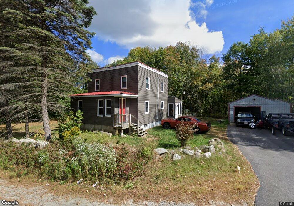
671 Lewiston Rd New Gloucester, ME 04260
Estimated Value: $302,000 - $446,000
3
Beds
2
Baths
1,100
Sq Ft
$334/Sq Ft
Est. Value
About This Home
This home is located at 671 Lewiston Rd, New Gloucester, ME 04260 and is currently estimated at $367,154, approximately $333 per square foot. 671 Lewiston Rd is a home located in Cumberland County with nearby schools including Gray-New Gloucester High School.
Ownership History
Date
Name
Owned For
Owner Type
Purchase Details
Closed on
Mar 9, 2009
Sold by
Colavecchio John P and Libby Susan R
Bought by
Moore Andrea J
Current Estimated Value
Home Financials for this Owner
Home Financials are based on the most recent Mortgage that was taken out on this home.
Original Mortgage
$124,643
Outstanding Balance
$78,616
Interest Rate
5.14%
Mortgage Type
FHA
Estimated Equity
$288,538
Create a Home Valuation Report for This Property
The Home Valuation Report is an in-depth analysis detailing your home's value as well as a comparison with similar homes in the area
Home Values in the Area
Average Home Value in this Area
Purchase History
| Date | Buyer | Sale Price | Title Company |
|---|---|---|---|
| Moore Andrea J | -- | -- |
Source: Public Records
Mortgage History
| Date | Status | Borrower | Loan Amount |
|---|---|---|---|
| Open | Moore Andrea J | $124,643 |
Source: Public Records
Tax History Compared to Growth
Tax History
| Year | Tax Paid | Tax Assessment Tax Assessment Total Assessment is a certain percentage of the fair market value that is determined by local assessors to be the total taxable value of land and additions on the property. | Land | Improvement |
|---|---|---|---|---|
| 2025 | $2,813 | $181,815 | $84,000 | $97,815 |
| 2024 | $2,707 | $181,815 | $84,000 | $97,815 |
| 2023 | $2,598 | $181,815 | $84,000 | $97,815 |
| 2022 | $2,509 | $181,815 | $84,000 | $97,815 |
| 2021 | $2,509 | $181,815 | $84,000 | $97,815 |
| 2020 | $2,482 | $181,815 | $84,000 | $97,815 |
| 2019 | $2,464 | $145,800 | $61,400 | $84,400 |
| 2018 | $1,988 | $145,800 | $61,400 | $84,400 |
| 2017 | $2,274 | $145,800 | $61,400 | $84,400 |
| 2016 | $2,143 | $145,800 | $61,400 | $84,400 |
| 2015 | $2,136 | $145,800 | $61,400 | $84,400 |
| 2014 | $2,114 | $145,800 | $61,400 | $84,400 |
| 2013 | $1,961 | $145,800 | $61,400 | $84,400 |
Source: Public Records
Map
Nearby Homes
- 164 Intervale Rd
- 10 Cobbs Bridge Rd
- 22 Shaw Rd
- 160 Gloucester Hill Rd
- 271 Bennett Rd
- 155 & 151 Gloucester Hill Rd
- 0018-C Gloucester Hill Rd
- 24 Swamp Rd
- TBD Targett Rd
- 29 Rockwood Dr
- 12 Country Charm Ln
- 200 Woodman Rd
- 14 Golden Way
- 10-56 C&E Bowdoin Way
- 423 Sabbathday Rd
- 65 Blueberry Ln
- 161 Beaver Dam Dr
- 343 Shaker Rd
- 0 Mayall
- 10 Spring Valley Ln