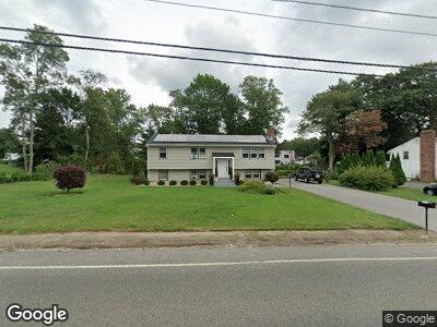
671 Turnpike St Stoughton, MA 02072
Estimated Value: $612,000 - $641,000
5
Beds
2
Baths
1,584
Sq Ft
$396/Sq Ft
Est. Value
About This Home
This home is located at 671 Turnpike St, Stoughton, MA 02072 and is currently estimated at $627,310, approximately $396 per square foot. 671 Turnpike St is a home located in Norfolk County with nearby schools including South Elementary School, O'Donnell Middle School, and Stoughton High School.
Ownership History
Date
Name
Owned For
Owner Type
Purchase Details
Closed on
May 31, 2007
Sold by
Houle Barry A and Houle Loraine F
Bought by
Rao John C and Demiranda-Rao Suzana T
Current Estimated Value
Home Financials for this Owner
Home Financials are based on the most recent Mortgage that was taken out on this home.
Original Mortgage
$243,600
Interest Rate
6.24%
Mortgage Type
Purchase Money Mortgage
Purchase Details
Closed on
Jul 1, 1994
Sold by
Cunningham James G and Cunningham Eileen M
Bought by
Houle Barry A and Houle Loraine F
Home Financials for this Owner
Home Financials are based on the most recent Mortgage that was taken out on this home.
Original Mortgage
$65,000
Interest Rate
8.55%
Mortgage Type
Purchase Money Mortgage
Create a Home Valuation Report for This Property
The Home Valuation Report is an in-depth analysis detailing your home's value as well as a comparison with similar homes in the area
Home Values in the Area
Average Home Value in this Area
Purchase History
| Date | Buyer | Sale Price | Title Company |
|---|---|---|---|
| Rao John C | $304,500 | -- | |
| Rao John C | $304,500 | -- | |
| Houle Barry A | $145,000 | -- | |
| Houle Barry A | $145,000 | -- |
Source: Public Records
Mortgage History
| Date | Status | Borrower | Loan Amount |
|---|---|---|---|
| Open | Rao John C | $320,000 | |
| Closed | Rao John C | $230,400 | |
| Closed | Rao John C | $243,600 | |
| Previous Owner | Houle Barry A | $20,000 | |
| Previous Owner | Ryan Stephen G | $260,000 | |
| Previous Owner | Houle Barry A | $107,000 | |
| Previous Owner | Houle Barry A | $105,000 | |
| Previous Owner | Houle Barry A | $64,000 | |
| Previous Owner | Houle Barry A | $65,000 |
Source: Public Records
Tax History Compared to Growth
Tax History
| Year | Tax Paid | Tax Assessment Tax Assessment Total Assessment is a certain percentage of the fair market value that is determined by local assessors to be the total taxable value of land and additions on the property. | Land | Improvement |
|---|---|---|---|---|
| 2025 | $6,403 | $517,200 | $229,600 | $287,600 |
| 2024 | $6,206 | $487,500 | $209,300 | $278,200 |
| 2023 | $6,019 | $444,200 | $194,400 | $249,800 |
| 2022 | $5,794 | $402,100 | $177,800 | $224,300 |
| 2021 | $5,585 | $369,900 | $161,100 | $208,800 |
| 2020 | $5,304 | $356,200 | $155,600 | $200,600 |
| 2019 | $5,352 | $348,900 | $155,600 | $193,300 |
| 2018 | $4,624 | $312,200 | $148,100 | $164,100 |
| 2017 | $4,348 | $300,100 | $140,700 | $159,400 |
| 2016 | $4,217 | $281,700 | $129,600 | $152,100 |
| 2015 | $4,150 | $274,300 | $122,200 | $152,100 |
| 2014 | $3,932 | $249,800 | $111,100 | $138,700 |
Source: Public Records
Map
Nearby Homes
- 111 E Vanston Rd
- 349 Central St
- 15 Harwich Ln Unit 15
- 15 Harwich Ln
- 60 Brewster Rd Unit 60
- 453 Turnpike St
- 53 Hollytree Rd
- 121 Bassick Cir
- 336 Lincoln St
- 393 Walnut St
- 192 Corbett Rd
- 0 Old Maple St
- 31 7th St
- 20 Walnut Ct
- 45 Old Maple St
- Lot 9 Lawler Ln
- 827 Park St
- 600-R Pleasant St
- 710 Central St
- 287 Walnut St
- 671 Turnpike St
- 659 Turnpike St
- 196 Central St
- 204 Central St
- 204 Central St Unit 1
- 184 Central St
- 88 Peters Dr
- 188 Central St Unit A
- 188 Central St Unit 1
- 188 Central St Unit I
- 188 Central St Unit G
- 188 Central St Unit E
- 666 Turnpike St
- 647 Turnpike St
- 172 Central St
- 652 Turnpike St
- 78 Peters Dr
- 9 Green Dr
- 637 Turnpike St
- 32 Green Dr