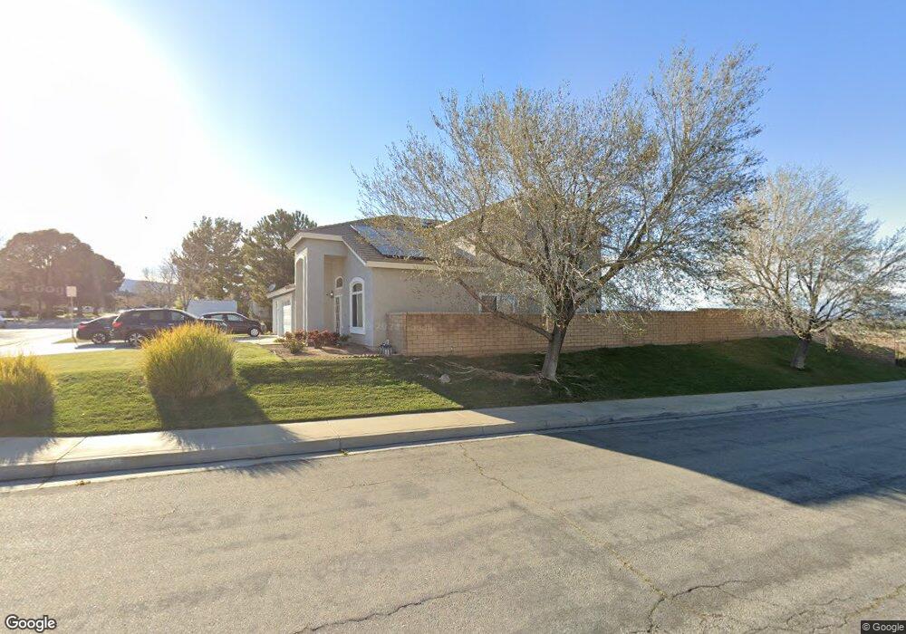
6711 Andover Ave Lancaster, CA 93536
West Lancaster NeighborhoodEstimated Value: $600,199 - $657,000
4
Beds
3
Baths
2,686
Sq Ft
$234/Sq Ft
Est. Value
About This Home
This home is located at 6711 Andover Ave, Lancaster, CA 93536 and is currently estimated at $628,050, approximately $233 per square foot. 6711 Andover Ave is a home located in Los Angeles County with nearby schools including Sundown Elementary School, Joe Walker Middle School, and Quartz Hill High School.
Ownership History
Date
Name
Owned For
Owner Type
Purchase Details
Closed on
Feb 20, 2023
Sold by
Tyson Larry and Tyson Lula Jane
Bought by
Larry And Lula Tyson 2023 Trust
Current Estimated Value
Purchase Details
Closed on
Aug 4, 1997
Sold by
Beazer Homes Holdings Corp
Bought by
Tyson Larry and Tyson Lula Jane
Home Financials for this Owner
Home Financials are based on the most recent Mortgage that was taken out on this home.
Original Mortgage
$172,573
Interest Rate
7.43%
Mortgage Type
VA
Purchase Details
Closed on
Sep 19, 1996
Sold by
West Coast Land Fund Lp
Bought by
Beazer Homes Holdings Corp
Purchase Details
Closed on
Dec 16, 1993
Sold by
Resolution Trust Corp
Bought by
West Coast Land Fund
Create a Home Valuation Report for This Property
The Home Valuation Report is an in-depth analysis detailing your home's value as well as a comparison with similar homes in the area
Home Values in the Area
Average Home Value in this Area
Purchase History
| Date | Buyer | Sale Price | Title Company |
|---|---|---|---|
| Larry And Lula Tyson 2023 Trust | -- | None Listed On Document | |
| Tyson Larry | $169,500 | Investors Title Company | |
| Beazer Homes Holdings Corp | -- | Commonwealth Land Title Co | |
| West Coast Land Fund | -- | -- |
Source: Public Records
Mortgage History
| Date | Status | Borrower | Loan Amount |
|---|---|---|---|
| Previous Owner | Tyson Larry | $172,573 |
Source: Public Records
Tax History
| Year | Tax Paid | Tax Assessment Tax Assessment Total Assessment is a certain percentage of the fair market value that is determined by local assessors to be the total taxable value of land and additions on the property. | Land | Improvement |
|---|---|---|---|---|
| 2025 | $8,069 | $275,569 | $55,072 | $220,497 |
| 2024 | $8,069 | $270,167 | $53,993 | $216,174 |
| 2023 | $6,076 | $264,871 | $52,935 | $211,936 |
| 2022 | $5,998 | $259,679 | $51,898 | $207,781 |
| 2021 | $2,354 | $254,588 | $50,881 | $203,707 |
| 2019 | $2,352 | $247,039 | $49,373 | $197,666 |
| 2018 | $2,347 | $242,196 | $48,405 | $193,791 |
| 2016 | $3,694 | $232,793 | $46,526 | $186,267 |
| 2015 | $2,954 | $229,298 | $45,828 | $183,470 |
| 2014 | $3,635 | $224,808 | $44,931 | $179,877 |
Source: Public Records
Map
Nearby Homes
- 42252 Blueflax Ave
- 6652 Lacolle Place
- 6608 Teasdale St
- 42344 Camden Way
- 42428 Camden Way
- 42328 71st St W
- 42323 Grandeur Way
- 42437 71st St W
- 42060 Jenny Ln
- 42041 Mohave Rose Dr
- 2000 Avenue L-4
- 6727 Miramar Ln
- 0 65th St W
- 0 Cor Ave L Pav 70th Stw Unit 22008217
- 7005 Hartford Ln
- 42419 62nd St W
- 41926 Bonita Dr
- 4858 W Avenue L-2
- 41858 Montana Dr
- 41843 Montana Dr
- 6719 Andover Ave
- 10 St. W and Ave E Sierra Hwy
- 85 St. W and Avenue F-12
- 86 St. W and Avenue F-9
- 86 St. W and Avenue F-10
- 88 St. W and Avenue F-8
- 4 St. E and Avenue F-14
- 85 St. W and Ave A
- 86 St. W and Ave A
- 126 St. W and Ave D
- 6727 Andover Ave
- 42338 Blueflax Ave
- 42330 Blueflax Ave
- 42317 Blueflax Ave
- 42322 Blueflax Ave
- 6735 Andover Ave
- 6726 Andover Ave
- 42309 Blueflax Ave
- 42331 Seville Cir
- 42325 Seville Cir
Your Personal Tour Guide
Ask me questions while you tour the home.