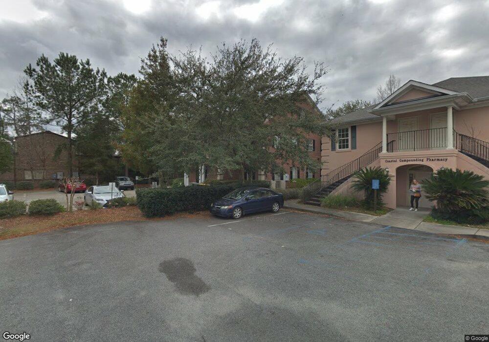
6711 Forest Park Dr Savannah, GA 31406
Oakdale NeighborhoodEstimated Value: $996,175
--
Bed
4
Baths
5,016
Sq Ft
$199/Sq Ft
Est. Value
About This Home
This home is located at 6711 Forest Park Dr, Savannah, GA 31406 and is currently estimated at $996,175, approximately $198 per square foot. 6711 Forest Park Dr is a home located in Chatham County with nearby schools including Heard Elementary School, Myers Middle School, and Jenkins High School.
Ownership History
Date
Name
Owned For
Owner Type
Purchase Details
Closed on
Jul 28, 2023
Sold by
Faithpromise Inc
Bought by
Seaport Property Group Llc
Current Estimated Value
Home Financials for this Owner
Home Financials are based on the most recent Mortgage that was taken out on this home.
Original Mortgage
$680,000
Outstanding Balance
$222,438
Interest Rate
6.71%
Mortgage Type
New Conventional
Estimated Equity
$773,737
Purchase Details
Closed on
Dec 4, 2012
Sold by
Southside Investment Manag
Bought by
Faithpromise Inc
Create a Home Valuation Report for This Property
The Home Valuation Report is an in-depth analysis detailing your home's value as well as a comparison with similar homes in the area
Home Values in the Area
Average Home Value in this Area
Purchase History
| Date | Buyer | Sale Price | Title Company |
|---|---|---|---|
| Seaport Property Group Llc | $850,000 | -- | |
| Faithpromise Inc | -- | -- | |
| Faithpromise Inc | -- | -- |
Source: Public Records
Mortgage History
| Date | Status | Borrower | Loan Amount |
|---|---|---|---|
| Open | Seaport Property Group Llc | $680,000 |
Source: Public Records
Tax History Compared to Growth
Tax History
| Year | Tax Paid | Tax Assessment Tax Assessment Total Assessment is a certain percentage of the fair market value that is determined by local assessors to be the total taxable value of land and additions on the property. | Land | Improvement |
|---|---|---|---|---|
| 2025 | $8,712 | $358,000 | $84,160 | $273,840 |
| 2024 | $8,712 | $340,000 | $80,080 | $259,920 |
| 2023 | $10,494 | $378,240 | $84,160 | $294,080 |
| 2022 | $9,729 | $350,600 | $84,160 | $266,440 |
| 2021 | $13,682 | $315,600 | $84,160 | $231,440 |
| 2020 | $9,796 | $312,320 | $84,160 | $228,160 |
| 2019 | $13,784 | $310,240 | $84,160 | $226,080 |
| 2018 | $9,644 | $305,440 | $84,160 | $221,280 |
| 2017 | $8,825 | $300,960 | $94,400 | $206,560 |
| 2016 | $8,780 | $300,960 | $94,400 | $206,560 |
| 2015 | $15,564 | $1,663 | $0 | $0 |
| 2014 | $16,695 | $300,960 | $0 | $0 |
Source: Public Records
Map
Nearby Homes
- 232 Stephenson Ave Unit 3E
- 232 Stephenson Ave Unit 4D
- 1 Jackson Ct
- 204 Wheeler St
- 503 Stuart Ct
- 25 Colony Park Dr
- 59 Colony Park Dr
- 66 Colony Park Dr
- 709 Beauregard St
- 305 Mclaws St
- 516 Early St
- 7750 Waters Ave
- 455 Mall Blvd Unit 83
- 712 Lee Blvd
- 459 Mall Blvd Unit 33
- 259 Kensington Dr
- 232 Groveland Cir
- 5603 La Salle St
- 1207 Bacon Park Dr
- 26 Arthur Cir
- 6711 Forest Park Dr Unit 4
- 6707 Forest Park Dr
- 211 Stephenson Ave
- 6803 Forest Park Dr
- 301 Rowland Rd
- 301 Rowland Ave
- 239 Stephenson Ave
- 231 Stephenson Ave
- 6811 Forest Park Dr
- 6811 Forest Park Dr Unit 105
- 6811 Forest Park Dr Unit 203
- 6811 Forest Park Dr Unit 104
- 6811 Forest Park Dr Unit 204
- 6811 Forest Park Dr Unit 202
- 6811 Forest Park Dr Unit 101
- 316 Benfield Dr
- 6740 Forest Park Dr
- 7044 Hodgson Memorial Dr
- 7044 Hodgson Memorial Dr Unit 7088
- 7044 Hodgson Memorial Dr Unit 7062
