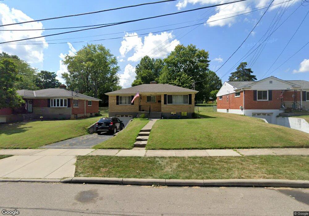
6711 Jamar Dr Cincinnati, OH 45224
Estimated Value: $185,272 - $241,000
3
Beds
2
Baths
1,129
Sq Ft
$197/Sq Ft
Est. Value
About This Home
This home is located at 6711 Jamar Dr, Cincinnati, OH 45224 and is currently estimated at $222,068, approximately $196 per square foot. 6711 Jamar Dr is a home located in Hamilton County with nearby schools including North College Hill Elementary School, North College Hill Middle School, and North College Hill High School.
Ownership History
Date
Name
Owned For
Owner Type
Purchase Details
Closed on
Aug 28, 1998
Sold by
Schrenk John Henry and Schrenk Mitzi Marie
Bought by
Reilman Sharon M
Current Estimated Value
Home Financials for this Owner
Home Financials are based on the most recent Mortgage that was taken out on this home.
Original Mortgage
$90,950
Outstanding Balance
$17,663
Interest Rate
7.03%
Mortgage Type
FHA
Estimated Equity
$204,405
Create a Home Valuation Report for This Property
The Home Valuation Report is an in-depth analysis detailing your home's value as well as a comparison with similar homes in the area
Home Values in the Area
Average Home Value in this Area
Purchase History
| Date | Buyer | Sale Price | Title Company |
|---|---|---|---|
| Reilman Sharon M | $91,000 | United Title Agency Of Cinci |
Source: Public Records
Mortgage History
| Date | Status | Borrower | Loan Amount |
|---|---|---|---|
| Open | Reilman Sharon M | $90,950 |
Source: Public Records
Tax History
| Year | Tax Paid | Tax Assessment Tax Assessment Total Assessment is a certain percentage of the fair market value that is determined by local assessors to be the total taxable value of land and additions on the property. | Land | Improvement |
|---|---|---|---|---|
| 2025 | $2,639 | $50,869 | $9,562 | $41,307 |
| 2023 | $2,596 | $50,869 | $9,562 | $41,307 |
| 2022 | $2,303 | $32,204 | $8,057 | $24,147 |
| 2021 | $2,254 | $32,204 | $8,057 | $24,147 |
| 2020 | $1,978 | $32,204 | $8,057 | $24,147 |
| 2019 | $1,940 | $28,249 | $7,067 | $21,182 |
| 2018 | $1,941 | $28,249 | $7,067 | $21,182 |
| 2017 | $1,835 | $28,249 | $7,067 | $21,182 |
| 2016 | $1,845 | $30,185 | $9,258 | $20,927 |
| 2015 | $1,850 | $30,185 | $9,258 | $20,927 |
| 2014 | $1,848 | $30,185 | $9,258 | $20,927 |
| 2013 | $1,810 | $30,489 | $9,352 | $21,137 |
Source: Public Records
Map
Nearby Homes
- 6765 Richard Ave
- 7929 Cherrywood Ct
- 1280 Brushwood Ave
- 7923 Bobolink Dr
- 7873 Bobolink Dr
- 1533 Corcoran Place
- 6531 Hamilton Ave
- 1202 Ashmore Ct
- 1701 Goodman Ave
- 6538 S Oak Knoll Dr
- 1148 Hollywood Ave
- 6666 Orleans Ct
- 1165 W Galbraith Rd
- 1476 Foxwood Dr
- 6669 Kirkland Dr
- 1541 Southridge Ln
- 6839 Greismer Ave
- 7909 Burgundy Ln
- 1552 Reid Ave
- 1714 Waltham Ave
- 6709 Jamar Dr
- 6713 Jamar Dr
- 6707 Jamar Dr
- 1323 Telford Ave
- 1321 Telford Ave
- 1325 Telford Ave
- 6705 Jamar Dr
- 6782 Richard Ave
- 6778 Richard Ave
- 6790 Richard Ave
- 6774 Richard Ave
- 6712 Jamar Dr
- 6710 Jamar Dr
- 6794 Richard Ave
- 6714 Jamar Dr
- 6703 Jamar Dr
- 6770 Richard Ave
- 6708 Jamar Dr
- 6716 Jamar Dr
- 6796 Richard Ave
Your Personal Tour Guide
Ask me questions while you tour the home.