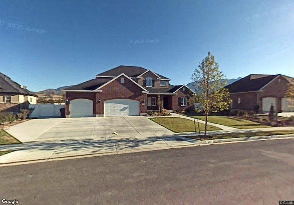
6712 Canterbury Dr Highland, UT 84003
Estimated Value: $926,639 - $1,009,000
5
Beds
3
Baths
2,298
Sq Ft
$420/Sq Ft
Est. Value
About This Home
This home is located at 6712 Canterbury Dr, Highland, UT 84003 and is currently estimated at $964,880, approximately $419 per square foot. 6712 Canterbury Dr is a home located in Utah County with nearby schools including Freedom Elementary School, Mountain Ridge Junior High School, and Lone Peak High School.
Ownership History
Date
Name
Owned For
Owner Type
Purchase Details
Closed on
Mar 25, 2005
Sold by
Steve Harris Construction Inc
Bought by
Child Eric D and Child Michele J
Current Estimated Value
Home Financials for this Owner
Home Financials are based on the most recent Mortgage that was taken out on this home.
Original Mortgage
$60,345
Interest Rate
5.7%
Mortgage Type
Stand Alone Second
Create a Home Valuation Report for This Property
The Home Valuation Report is an in-depth analysis detailing your home's value as well as a comparison with similar homes in the area
Home Values in the Area
Average Home Value in this Area
Purchase History
| Date | Buyer | Sale Price | Title Company |
|---|---|---|---|
| Child Eric D | -- | Brighton Title |
Source: Public Records
Mortgage History
| Date | Status | Borrower | Loan Amount |
|---|---|---|---|
| Closed | Child Eric D | $60,345 | |
| Open | Child Eric D | $321,840 |
Source: Public Records
Tax History
| Year | Tax Paid | Tax Assessment Tax Assessment Total Assessment is a certain percentage of the fair market value that is determined by local assessors to be the total taxable value of land and additions on the property. | Land | Improvement |
|---|---|---|---|---|
| 2025 | $3,294 | $440,440 | -- | -- |
| 2024 | $3,294 | $406,890 | $0 | $0 |
| 2023 | $3,122 | $415,965 | $0 | $0 |
| 2022 | $3,291 | $425,205 | $0 | $0 |
| 2021 | $3,232 | $621,900 | $228,500 | $393,400 |
| 2020 | $3,076 | $580,600 | $198,700 | $381,900 |
| 2019 | $2,898 | $572,100 | $198,700 | $373,400 |
| 2018 | $2,945 | $552,600 | $191,100 | $361,500 |
| 2017 | $2,824 | $282,810 | $0 | $0 |
| 2016 | $2,611 | $244,365 | $0 | $0 |
| 2015 | $2,561 | $227,205 | $0 | $0 |
| 2014 | $2,348 | $206,415 | $0 | $0 |
Source: Public Records
Map
Nearby Homes
- 1618 E Center Pointe Dr
- 1610 E Center Pointe Dr
- 1602 E Center Pointe Dr
- 10365 N 6960 W
- 975 E 2850 N
- 6756 W 10050 N
- 878 E 3050 N
- 6602 W Normandy Way
- 10801 N 6000 W
- 10818 N 6000 W
- 9967 N 6670 W
- 11248 Hawkstone Way Unit 109
- 6024 Hawkstone Way Unit 108
- 11228 Hawkstone Way Unit 110
- 3368 N 700 E
- 11124 N 6000 W
- 11572 N Maple Hollow Ct
- 11597 N Sunset Hills Dr
- 6337 Lone Rock Rd
- 3239 N 620 E
- 6712 W Canterbury Dr
- 6722 Canterbury Dr
- 6698 W Canterbury Dr
- 6722 W Canterbury Dr
- 6698 Canterbury Dr
- 6719 Canterbury Dr
- 6734 Canterbury Dr
- 10681 N Avery Ave
- 10681 Avery Ave
- 6686 W Canterbury Dr
- 6686 Canterbury Dr
- 10673 N Avery Ave
- 10673 Avery Ave
- 6737 Canterbury Dr
- 6748 Canterbury Dr
- 6673 W 10770 N
- 10663 N Avery Ave
- 10663 Avery Ave
- 6669 Canterbury Dr
- 6669 Canterbury Dr Unit 172
Your Personal Tour Guide
Ask me questions while you tour the home.