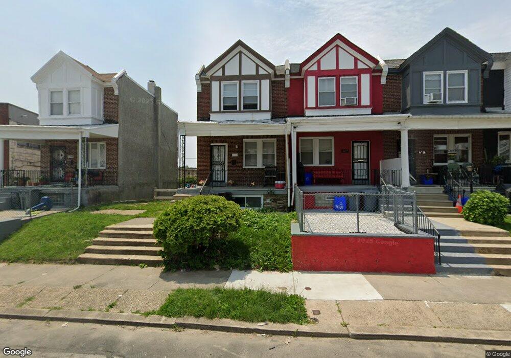
6712 Woolston Ave Philadelphia, PA 19138
West Oak Lane NeighborhoodEstimated Value: $134,911 - $203,000
3
Beds
1
Bath
1,136
Sq Ft
$149/Sq Ft
Est. Value
About This Home
This home is located at 6712 Woolston Ave, Philadelphia, PA 19138 and is currently estimated at $169,478, approximately $149 per square foot. 6712 Woolston Ave is a home located in Philadelphia County with nearby schools including William Rowen School, Gen. Louis Wagner Middle School, and Martin Luther King High School.
Ownership History
Date
Name
Owned For
Owner Type
Purchase Details
Closed on
Oct 12, 2015
Sold by
Noa Properties Inc
Bought by
Stephansky Llc
Current Estimated Value
Purchase Details
Closed on
Apr 15, 2014
Sold by
Mitchell Lonny and Mitchell Lonnie
Bought by
Noa Properties Inc
Purchase Details
Closed on
Jun 11, 2008
Sold by
Mitchell Lonny and Mitchell Lucias
Bought by
Mitchell Lonny
Create a Home Valuation Report for This Property
The Home Valuation Report is an in-depth analysis detailing your home's value as well as a comparison with similar homes in the area
Home Values in the Area
Average Home Value in this Area
Purchase History
| Date | Buyer | Sale Price | Title Company |
|---|---|---|---|
| Stephansky Llc | $30,000 | None Available | |
| Noa Properties Inc | $8,000 | None Available | |
| Mitchell Lonny | -- | None Available |
Source: Public Records
Tax History Compared to Growth
Tax History
| Year | Tax Paid | Tax Assessment Tax Assessment Total Assessment is a certain percentage of the fair market value that is determined by local assessors to be the total taxable value of land and additions on the property. | Land | Improvement |
|---|---|---|---|---|
| 2025 | $936 | $79,200 | $15,840 | $63,360 |
| 2024 | $936 | $79,200 | $15,840 | $63,360 |
| 2023 | $936 | $66,900 | $13,380 | $53,520 |
| 2022 | $678 | $66,900 | $13,380 | $53,520 |
| 2021 | $678 | $0 | $0 | $0 |
| 2020 | $678 | $0 | $0 | $0 |
| 2019 | $1,554 | $0 | $0 | $0 |
| 2018 | $1,345 | $0 | $0 | $0 |
| 2017 | $1,345 | $0 | $0 | $0 |
| 2016 | $1,345 | $0 | $0 | $0 |
| 2015 | $1,227 | $0 | $0 | $0 |
| 2014 | -- | $91,600 | $7,056 | $84,544 |
| 2012 | -- | $13,632 | $2,220 | $11,412 |
Source: Public Records
Map
Nearby Homes
- 2061 Independence St
- 6731 N Woodstock St
- 6733 N Woodstock St
- 6603 N 21st St
- 2056 Eastburn Ave
- 6558 Limekiln Pike
- 2070 E Haines St
- 6600 N Opal St
- 6824 Rodney St
- 6534 N Lambert St
- 2120 66th Ave
- 2022 66th Ave
- 2105 Stenton Ave
- 2115 Stenton Ave
- 2125 Stenton Ave
- 6531 N Beechwood St
- 6332 E Wister St
- 2152 Stenton Ave
- 1914 W 65th Ave
- 6436 N 20th St
- 6714 Woolston Ave
- 6710 Woolston Ave
- 6716 Woolston Ave
- 6708 Woolston Ave
- 6718 Woolston Ave
- 6720 Woolston Ave
- 6722 Woolston Ave
- 2096 Independence St
- 6724 Woolston Ave
- 2060 Independence St
- 2062 Independence St
- 2064 Independence St
- 2066 Independence St
- 6707 Woolston Ave
- 6709 Woolston Ave
- 6711 Woolston Ave
- 6705 Woolston Ave
- 6703 Woolston Ave
- 2068 Independence St
- 6713 Woolston Ave