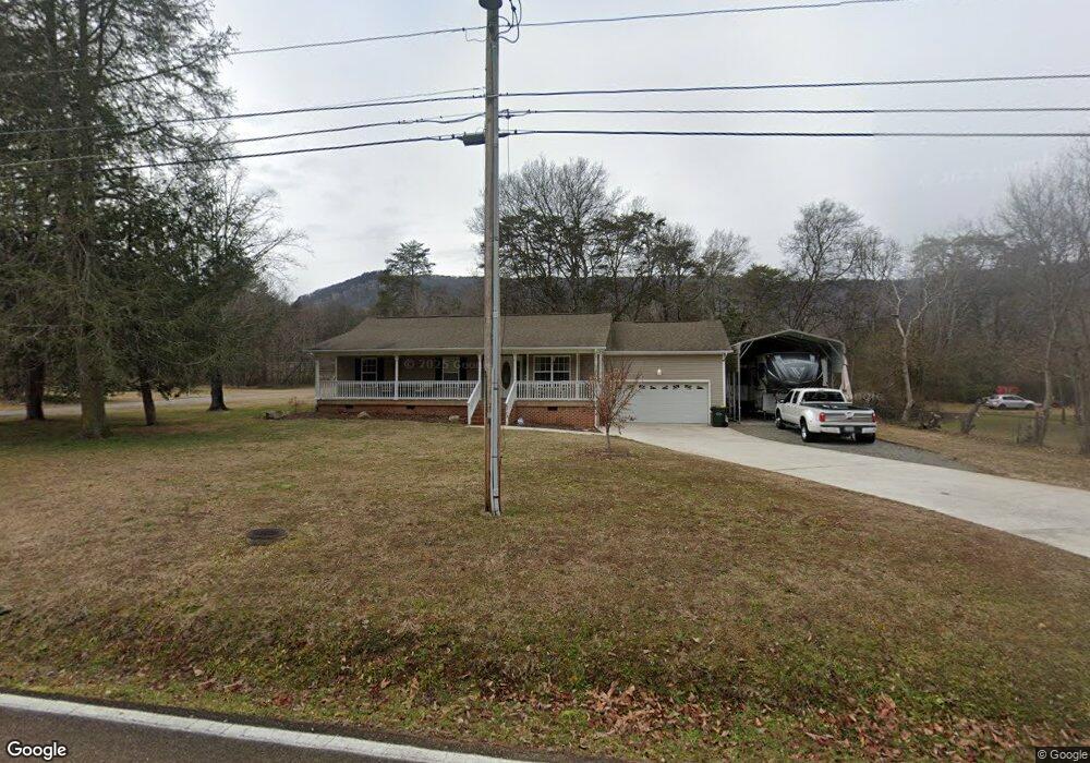
6713 Levi Rd Hixson, TN 37343
Falling Water NeighborhoodEstimated Value: $304,000 - $362,000
3
Beds
2
Baths
1,300
Sq Ft
$258/Sq Ft
Est. Value
About This Home
This home is located at 6713 Levi Rd, Hixson, TN 37343 and is currently estimated at $334,982, approximately $257 per square foot. 6713 Levi Rd is a home located in Hamilton County with nearby schools including Ganns Middle Valley Elementary School, Red Bank Middle School, and Red Bank High School.
Ownership History
Date
Name
Owned For
Owner Type
Purchase Details
Closed on
Apr 23, 2019
Sold by
Harbison James Gary and Harbison Janice L
Bought by
Harbison Linsay and Pettit Linsay
Current Estimated Value
Purchase Details
Closed on
Sep 24, 2004
Sold by
Stanford William R
Bought by
Harbison James Gary and Harbison Janice L
Home Financials for this Owner
Home Financials are based on the most recent Mortgage that was taken out on this home.
Original Mortgage
$135,000
Outstanding Balance
$66,904
Interest Rate
5.78%
Mortgage Type
Credit Line Revolving
Estimated Equity
$268,078
Purchase Details
Closed on
May 3, 2001
Sold by
Branam Billy Dewayne and Branam Sherry Lynn
Bought by
Stanford William R
Create a Home Valuation Report for This Property
The Home Valuation Report is an in-depth analysis detailing your home's value as well as a comparison with similar homes in the area
Home Values in the Area
Average Home Value in this Area
Purchase History
| Date | Buyer | Sale Price | Title Company |
|---|---|---|---|
| Harbison Linsay | -- | None Available | |
| Harbison James Gary | $135,000 | Realty Title & Escrow Servic | |
| Stanford William R | $10,800 | -- |
Source: Public Records
Mortgage History
| Date | Status | Borrower | Loan Amount |
|---|---|---|---|
| Open | Harbison James Gary | $135,000 |
Source: Public Records
Tax History Compared to Growth
Tax History
| Year | Tax Paid | Tax Assessment Tax Assessment Total Assessment is a certain percentage of the fair market value that is determined by local assessors to be the total taxable value of land and additions on the property. | Land | Improvement |
|---|---|---|---|---|
| 2024 | $1,170 | $52,300 | $0 | $0 |
| 2023 | $1,179 | $52,300 | $0 | $0 |
| 2022 | $1,179 | $52,300 | $0 | $0 |
| 2021 | $1,179 | $52,300 | $0 | $0 |
| 2020 | $1,187 | $42,600 | $0 | $0 |
| 2019 | $1,187 | $42,600 | $0 | $0 |
| 2018 | $1,187 | $42,600 | $0 | $0 |
| 2017 | $1,187 | $42,600 | $0 | $0 |
| 2016 | $1,190 | $0 | $0 | $0 |
| 2015 | $1,190 | $42,700 | $0 | $0 |
| 2014 | $1,190 | $0 | $0 | $0 |
Source: Public Records
Map
Nearby Homes
- 598 Blue Canyon Ln
- 5940 Sunset Canyon Dr
- 733 Ray Ln
- 805 Pickett Gulf Rd
- 595 Deer Valley Dr
- 792 Sawmill Trail
- 311 Roberts Mill Rd
- 1000 Sawyer Cemetery Rd
- 0 Rocky Ledge Rd Unit 1514267
- 855 Split Rock Trail
- 6016&6014 Browntown Rd
- 0 Dayton Blvd Unit RTC2802699
- 0 Dayton Blvd Unit 1508885
- 101 La Porte Dr
- 5977 Crestview Dr
- 311 Branch Dr
- 8545 Mountain Laurel Trail Unit 40
- 8545 Mountain Laurel Trail
- 935 Bluff Ledge Trail
- 7917 Mountain Laurel Trail Unit 85