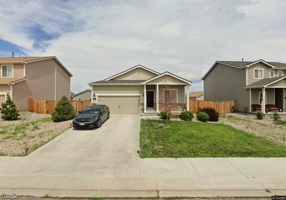
6719 Liberator Trail Colorado Springs, CO 80925
Widefield NeighborhoodEstimated Value: $377,293 - $414,000
3
Beds
2
Baths
1,469
Sq Ft
$272/Sq Ft
Est. Value
About This Home
This home is located at 6719 Liberator Trail, Colorado Springs, CO 80925 and is currently estimated at $399,823, approximately $272 per square foot. 6719 Liberator Trail is a home located in El Paso County with nearby schools including Grand Mountain School, Mesa Ridge High School, and Valley Christian Academy.
Ownership History
Date
Name
Owned For
Owner Type
Purchase Details
Closed on
Apr 29, 2022
Sold by
Ormsby Brenden
Bought by
Fkh Sfr Propco J Lp
Current Estimated Value
Purchase Details
Closed on
Jul 17, 2019
Sold by
Lgi Homes Colorado Llc
Bought by
Ormsby Brenden
Home Financials for this Owner
Home Financials are based on the most recent Mortgage that was taken out on this home.
Original Mortgage
$292,046
Interest Rate
3.82%
Mortgage Type
VA
Create a Home Valuation Report for This Property
The Home Valuation Report is an in-depth analysis detailing your home's value as well as a comparison with similar homes in the area
Home Values in the Area
Average Home Value in this Area
Purchase History
| Date | Buyer | Sale Price | Title Company |
|---|---|---|---|
| Fkh Sfr Propco J Lp | $425,000 | -- | |
| Ormsby Brenden | $285,900 | First American Title |
Source: Public Records
Mortgage History
| Date | Status | Borrower | Loan Amount |
|---|---|---|---|
| Previous Owner | Ormsby Brenden | $292,046 |
Source: Public Records
Tax History Compared to Growth
Tax History
| Year | Tax Paid | Tax Assessment Tax Assessment Total Assessment is a certain percentage of the fair market value that is determined by local assessors to be the total taxable value of land and additions on the property. | Land | Improvement |
|---|---|---|---|---|
| 2025 | $4,060 | $27,830 | -- | -- |
| 2024 | $4,006 | $28,970 | $6,040 | $22,930 |
| 2022 | $3,047 | $20,530 | $4,810 | $15,720 |
| 2021 | $3,172 | $21,130 | $4,950 | $16,180 |
| 2020 | $2,992 | $19,740 | $4,330 | $15,410 |
| 2019 | $2,983 | $19,740 | $4,330 | $15,410 |
| 2018 | $900 | $5,910 | $4,360 | $1,550 |
| 2017 | $1,286 | $8,280 | $8,280 | $0 |
| 2016 | $736 | $5,280 | $5,280 | $0 |
Source: Public Records
Map
Nearby Homes
- 6705 Liberator Trail
- 6755 Phantom Way
- 6672 Kearsarge Dr
- 10128 Castor Dr
- 10105 Castor Dr
- 6562 Phantom Way
- 6924 Winnicut Dr
- 9949 Castor Dr
- 9835 Rubicon Dr
- 10250 Intrepid Way
- 10179 Seawolf Dr
- 6577 Rubicon Heights
- 6565 Carriage Meadows Dr
- 6868 Alsea Dr
- 9889 Wando Dr
- 6650 Mandan Dr
- 10202 Abrams Dr
- 10208 Abrams Dr
- 6849 SiMcOe Dr
- 10868 Deer Meadow Cir
- 6747 Liberator Trail
- 6691 Liberator Trail
- 6728 Kearsarge Dr
- 6712 Kearsarge Dr
- 6744 Kearsarge Dr
- 6732 Liberator Trail
- 6718 Liberator Trail
- 6704 Liberator Trail
- 6761 Liberator Trail
- 6677 Liberator Trail
- 6760 Kearsarge Dr
- 6690 Liberator Trail
- 6746 Liberator Trail
- 6775 Liberator Trail
- 6680 Kearsarge Dr
- 6663 Liberator Trail
- 6776 Kearsarge Dr
- 6887 Phantom Way
- 6729 Kearsarge Dr
- 6662 Liberator Trail