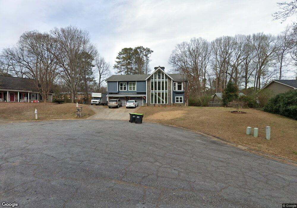
672 Benson Hurst Dr SW Mableton, GA 30126
Estimated Value: $401,000 - $449,000
4
Beds
3
Baths
2,048
Sq Ft
$204/Sq Ft
Est. Value
About This Home
This home is located at 672 Benson Hurst Dr SW, Mableton, GA 30126 and is currently estimated at $416,933, approximately $203 per square foot. 672 Benson Hurst Dr SW is a home located in Cobb County with nearby schools including Mableton Elementary School, Floyd Middle School, and Connection Pointe Christian Academy.
Ownership History
Date
Name
Owned For
Owner Type
Purchase Details
Closed on
Jul 14, 2003
Sold by
Mann Michael D and Mann Jean C
Bought by
Fox Richard G and Fox Carrie
Current Estimated Value
Home Financials for this Owner
Home Financials are based on the most recent Mortgage that was taken out on this home.
Original Mortgage
$188,900
Outstanding Balance
$79,076
Interest Rate
5.17%
Mortgage Type
New Conventional
Estimated Equity
$337,857
Create a Home Valuation Report for This Property
The Home Valuation Report is an in-depth analysis detailing your home's value as well as a comparison with similar homes in the area
Home Values in the Area
Average Home Value in this Area
Purchase History
| Date | Buyer | Sale Price | Title Company |
|---|---|---|---|
| Fox Richard G | $209,900 | -- |
Source: Public Records
Mortgage History
| Date | Status | Borrower | Loan Amount |
|---|---|---|---|
| Open | Fox Richard G | $188,900 |
Source: Public Records
Tax History Compared to Growth
Tax History
| Year | Tax Paid | Tax Assessment Tax Assessment Total Assessment is a certain percentage of the fair market value that is determined by local assessors to be the total taxable value of land and additions on the property. | Land | Improvement |
|---|---|---|---|---|
| 2025 | $4,522 | $189,100 | $30,000 | $159,100 |
| 2024 | $3,927 | $161,488 | $24,000 | $137,488 |
| 2023 | $3,384 | $161,488 | $24,000 | $137,488 |
| 2022 | $3,509 | $141,016 | $20,000 | $121,016 |
| 2021 | $2,914 | $113,816 | $20,000 | $93,816 |
| 2020 | $2,914 | $113,816 | $20,000 | $93,816 |
| 2019 | $2,831 | $110,044 | $20,000 | $90,044 |
| 2018 | $2,487 | $94,304 | $20,000 | $74,304 |
| 2017 | $2,373 | $94,304 | $20,000 | $74,304 |
| 2016 | $2,375 | $94,304 | $20,000 | $74,304 |
| 2015 | $2,446 | $94,932 | $18,000 | $76,932 |
| 2014 | $2,304 | $87,732 | $0 | $0 |
Source: Public Records
Map
Nearby Homes
- 4672 Vernon Dr SW
- 637 Carlouetta Rd SW
- 768 Ironhorse Ln SW
- Jasper-Townhome Plan at Park View Reserve - Hometown Series
- Madeline-Townhome Plan at Park View Reserve - Hometown Series
- 684 Sundial Ln
- 680 Sundial Ln
- 639 Concord Rd SW
- 4487 S Springwood Dr SW
- 4561 Moray Dr
- 4557 Moray Dr
- 4822 Floydwood Ln
- 4553 Moray Dr
- 4565 Moray Dr
- 4569 Moray Dr
- Kaufman Plan at Wilkins Walk
- Bryson Plan at Wilkins Walk
- Brooks Plan at Wilkins Walk
- 4167 Waratah Way
- 450 Dorset Way SW
- 678 Benson Hurst Dr SW
- 662 Benson Hurst Dr SW
- 658 Benson Hurst Dr SW
- 663 Benson Hurst Dr SW
- 707 Carlouetta Rd SW
- 717 Carlouetta Rd SW
- 695 Carlouetta Rd SW
- 679 Benson Hurst Dr SW Unit 2
- 729 Carlouetta Rd SW
- 652 Benson Hurst Dr SW
- 683 Carlouetta Rd SW
- 739 Carlouetta Rd SW
- 644 Benson Hurst Dr SW
- 0 NE Rogers Dr SW
- 706 Carlouetta Rd SW
- 643 Benson Hurst Dr SW
- 4671 Vernon Dr SW Unit 2
- 688 Carlouetta Rd SW
- 4651 Vernon Dr SW
- 738 Carlouetta Rd SW